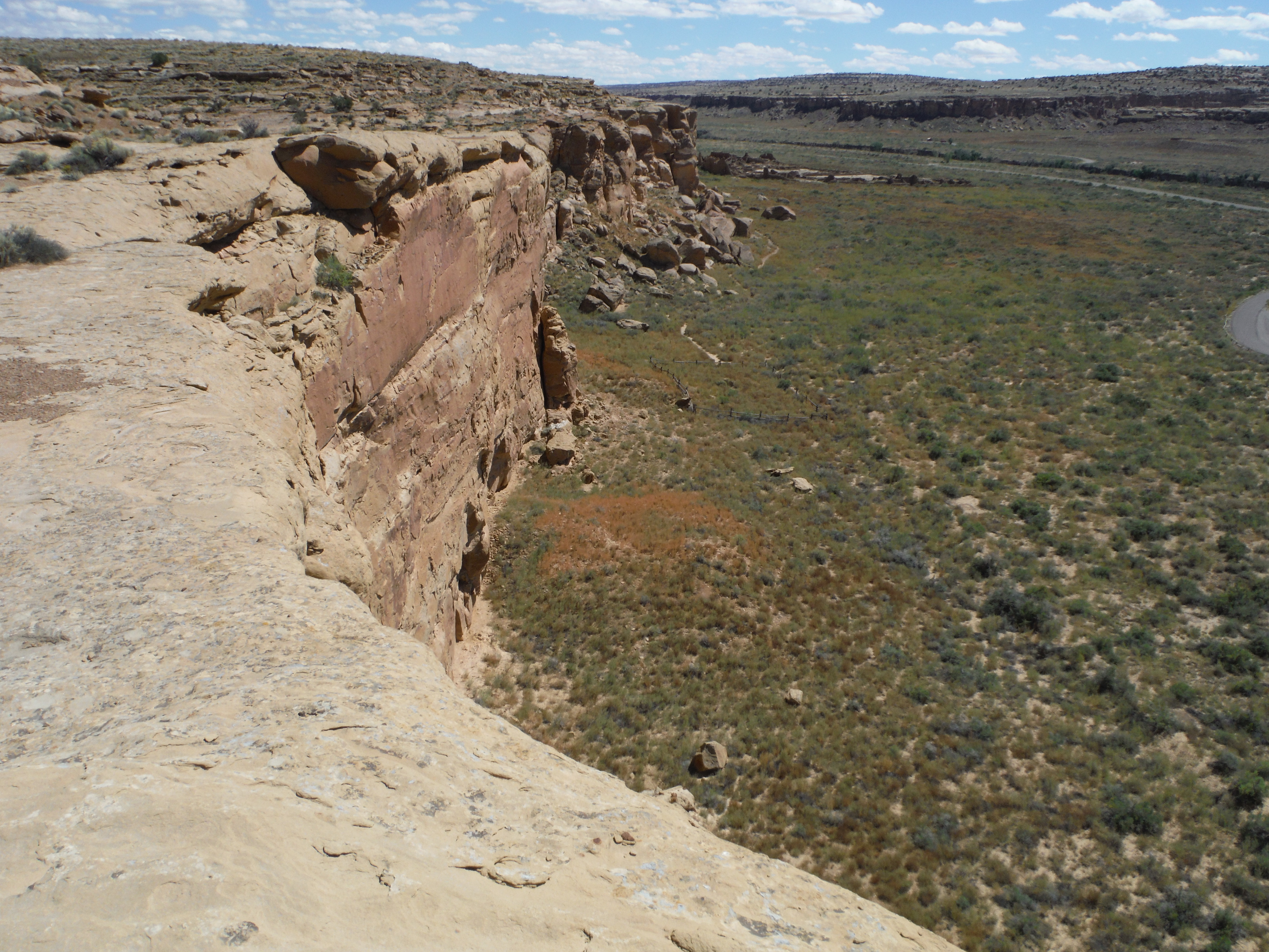
A view from the trail on the canyon rim!
Chaco Canyon is definitely the most significant example of ancient civilization in New Mexico, and probably the entire Southwest. I was uber excited to witness it! A United Nations World Heritage site, it is 11 miles long and 5 miles wide, and contains dozens of citadels each containing up to 800 rooms with up to 20 Kivas, or religious ceremonial centers. It’s also a nationally registered Dark Skies site. In Chaco, the stars seem an arms length away.
Ancient Puebo peoples from numerous tribes congregated at Chaco for seasonal and spiritual celebrations. None of these cultures had written language, so what we know is from oral traditions, stories, passed down to their ancestors – today’s Hopi, Navajo, etc. Anthropologists tell that Chaco was not a residential city. Although some people did live there temporarily to work on the buildings, they would eventually return to their villages many miles distant. Today’s SW Indian people see Chaco as an important waypoint on their tribal spiritual migration treks.

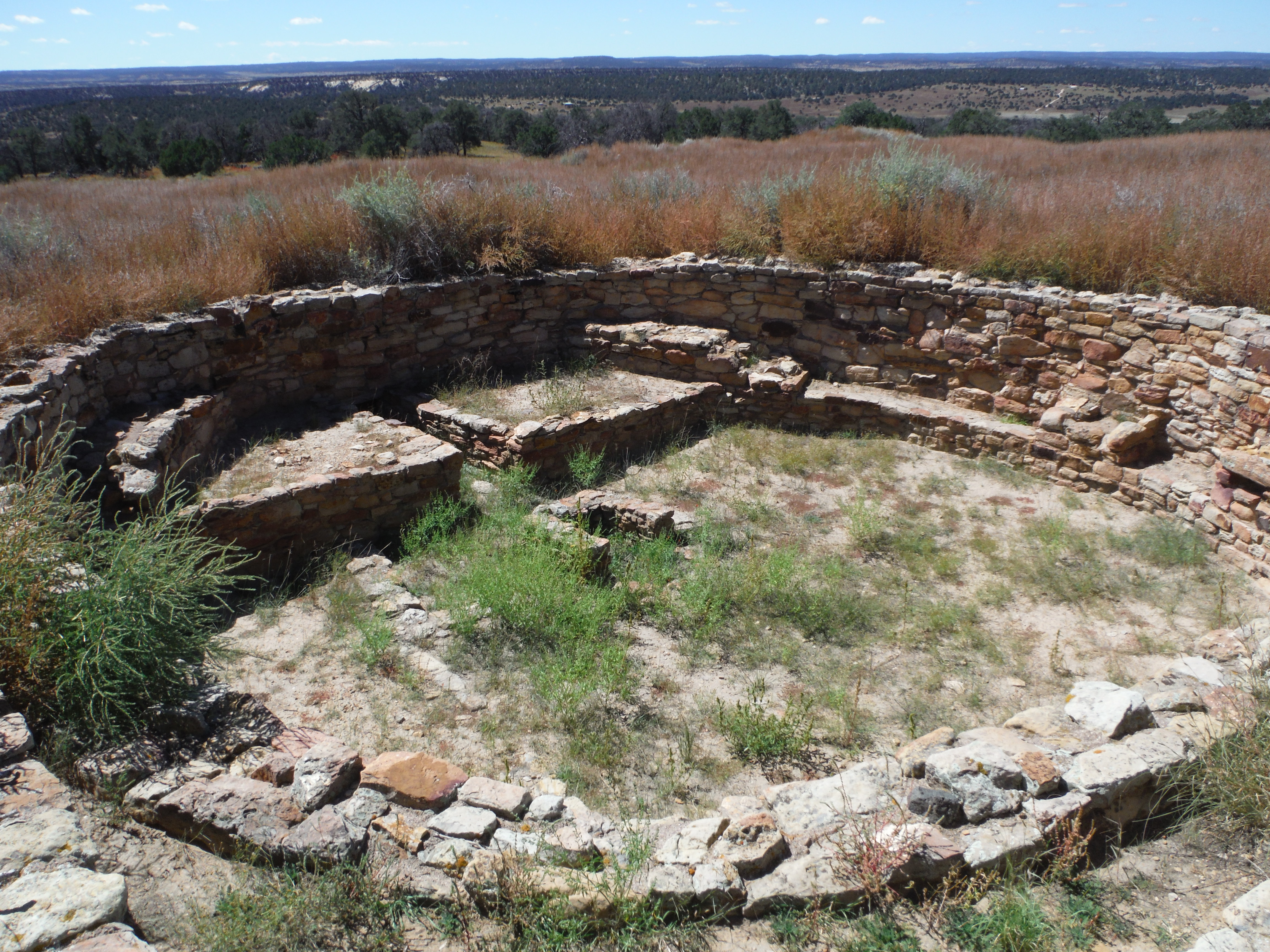
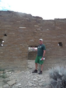
At Pueblo Bonito there are hundreds of rooms
Getting to Chaco is not for the faint of heart. While the site is a Federally managed area, with paved roads, the way there is fraught with challenges. The route passes through county, Federal, and tribal lands. It is 33 miles of paved, “maintained dirt,” and “unmaintained” road. It passes over dry river beds. While Chaco has campgrounds, there isn’t water within the park, except at the visitor center. Be prepared.
Chaco is a network of citadels, known as Great Houses, aligned along auspicious astronomical and directional lines. Buildings may constructed to align with the solstice, and Kivas may be aligned north-south, for example. These were built on the valley floor but also up high on ridges. Signal fires were lit to communicate important information up and down the valley. Incredibly, geological features enabled voice communication across the valley!
Building in Chaco is thought to have begun around A.D. 800, with the peak of construction about 1150. By 1050 Chaco was the center of influence in spiritual, economic and administrative matters for an area comprising SE Utah, SW Colorado, eastern Arizona and New Mexico. Advances in building technology is evident in the ruins.

The trail above, with stunning view, winds along, then climbs to Pueblo Alto Complex, another ancient town
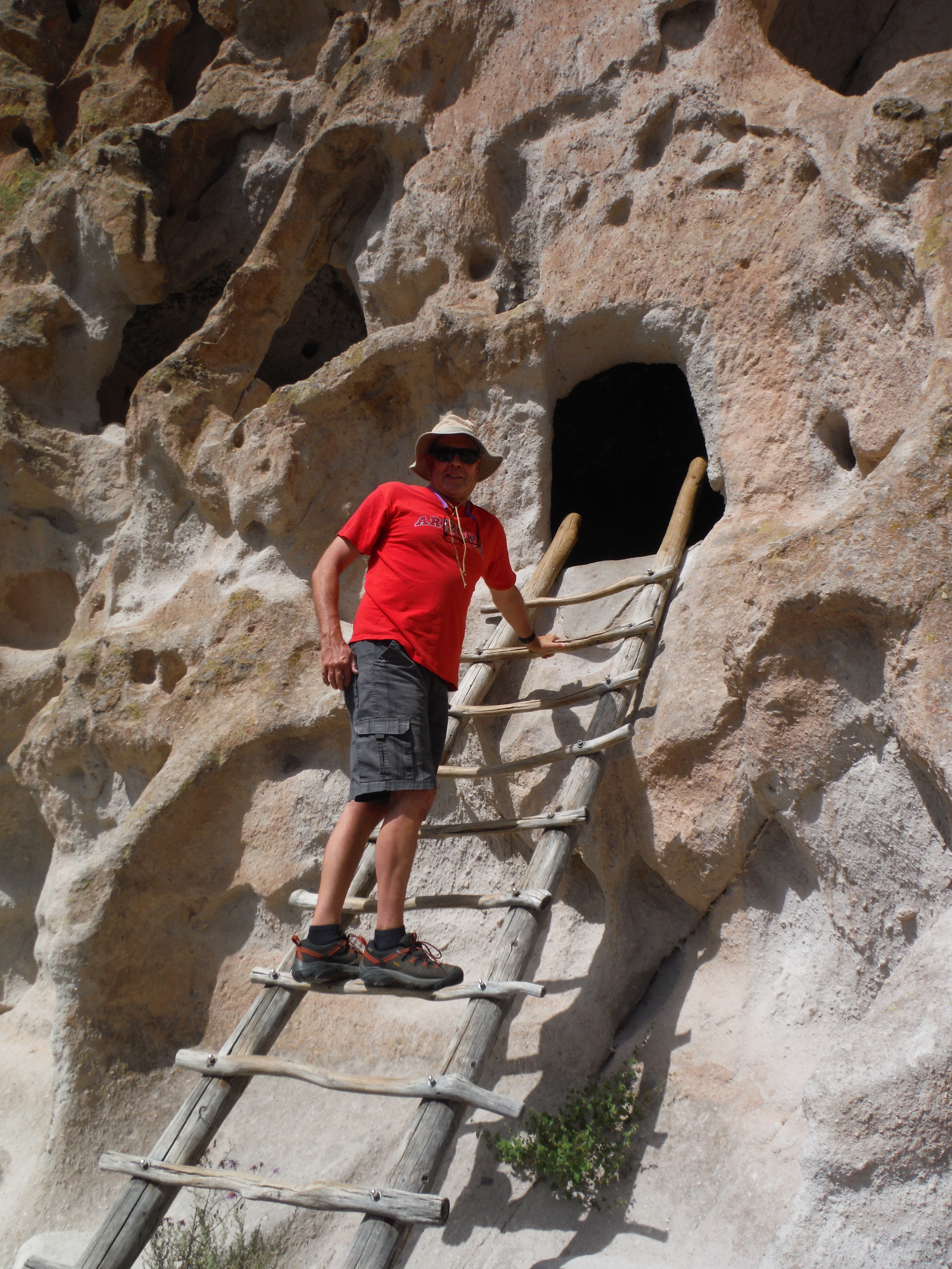
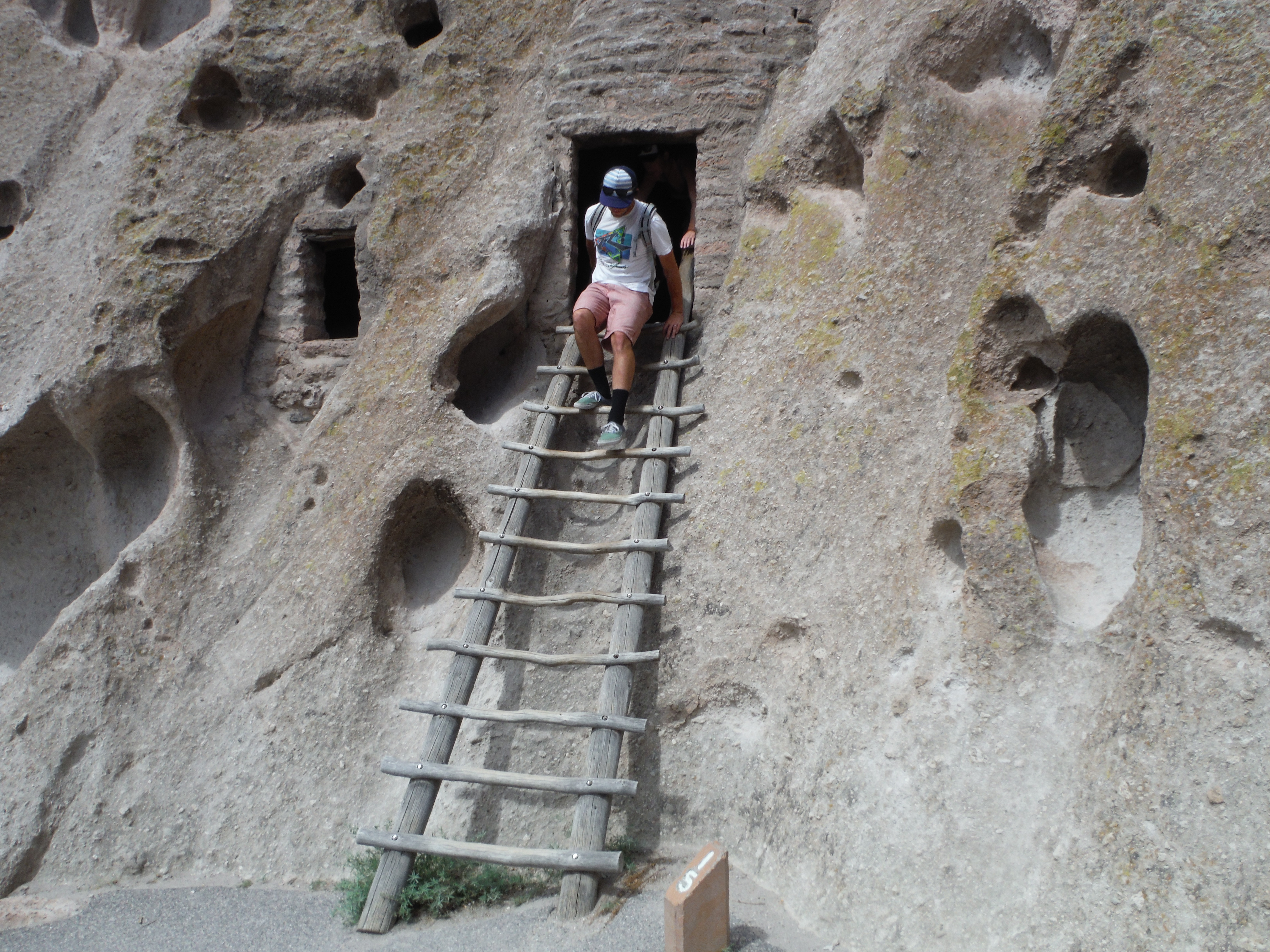
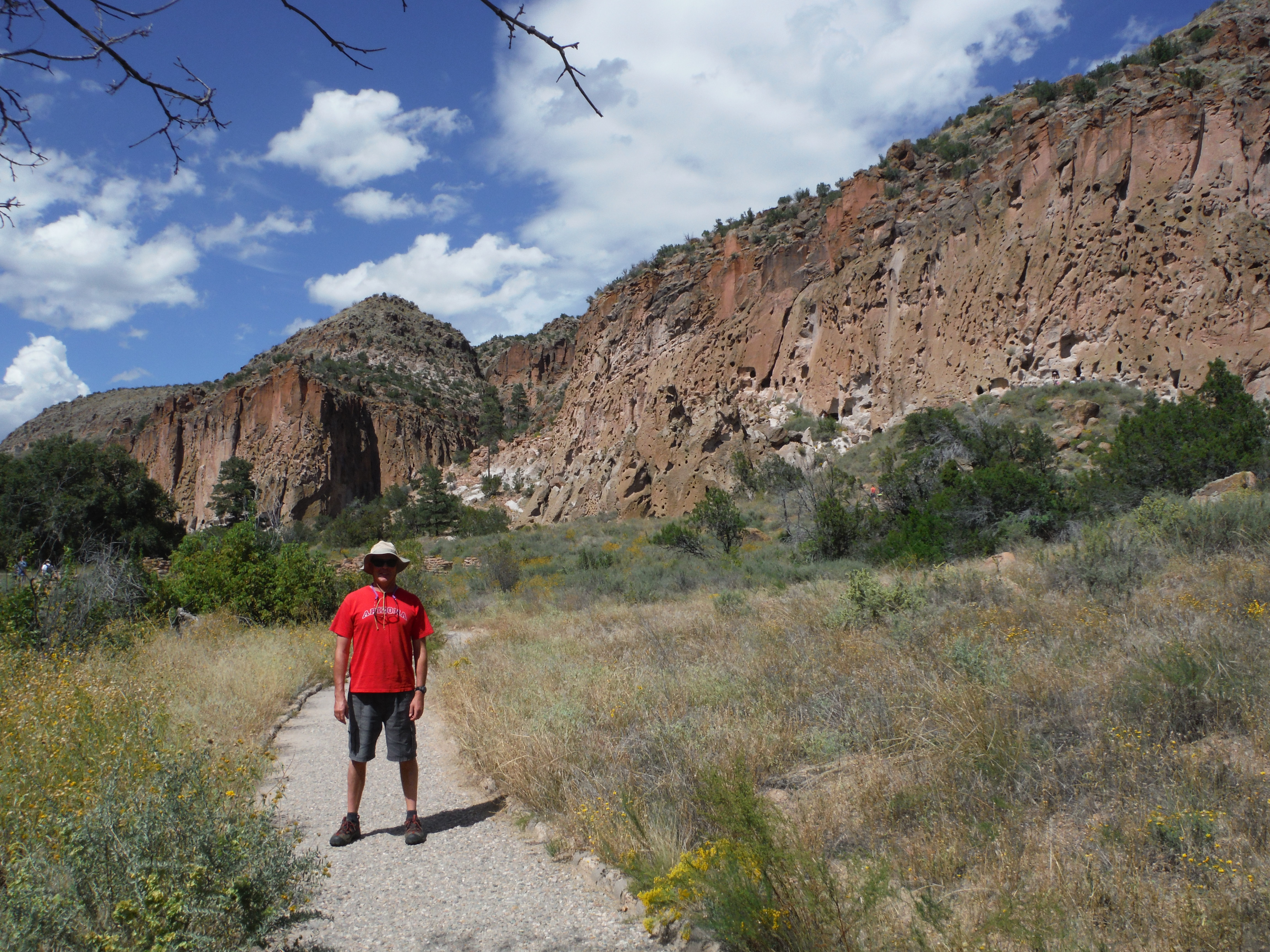
One of my favorite things to do in Chaco is taking a hike. Some of the hikes climb the canyon walls, leading to more trails and citadels up above! The view is incredible. But then you come across a ruin!
We heard about the hike to Pueblo Alto, which is a complex on the canyon summit above. But how could we see it? The Ranger told us there is a trail leading up there.
We drove out to Pueblo del Arroyo, where there is parking and a trailhead. A self-issue back country permit must be completed.
We started the hike. Along the way, there are stakes indicating “trail.” Some of them are in unexpected places, like in rocks 10 or 15 feet above where I stood. So we just scrambled up to get to them.
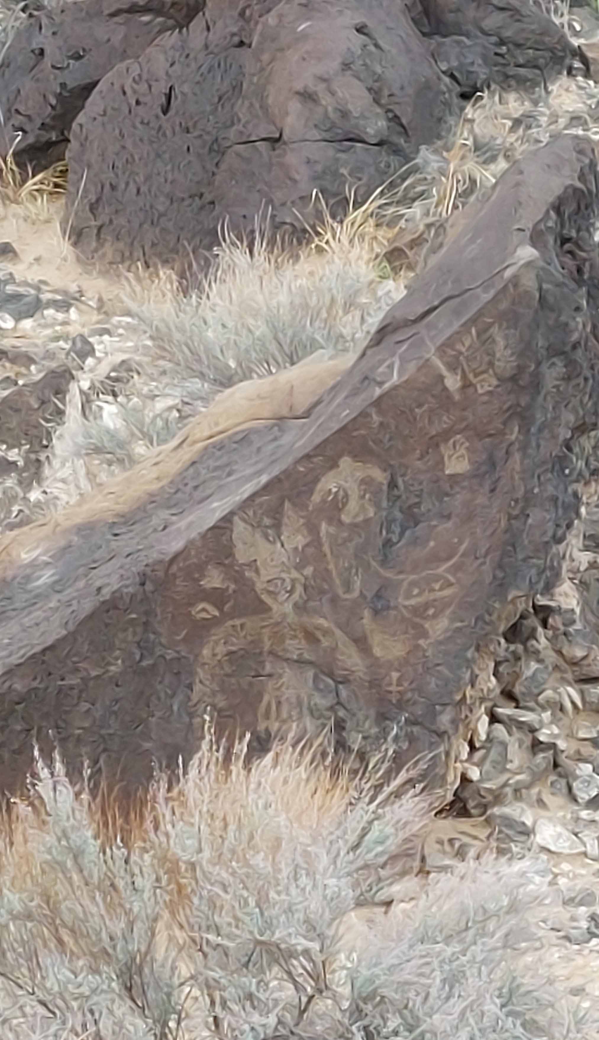
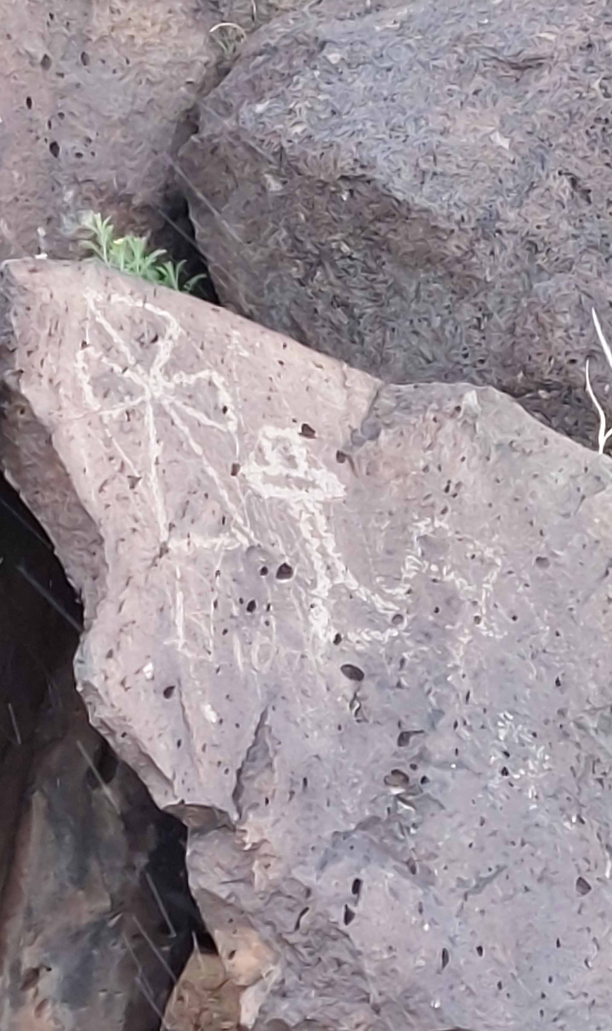
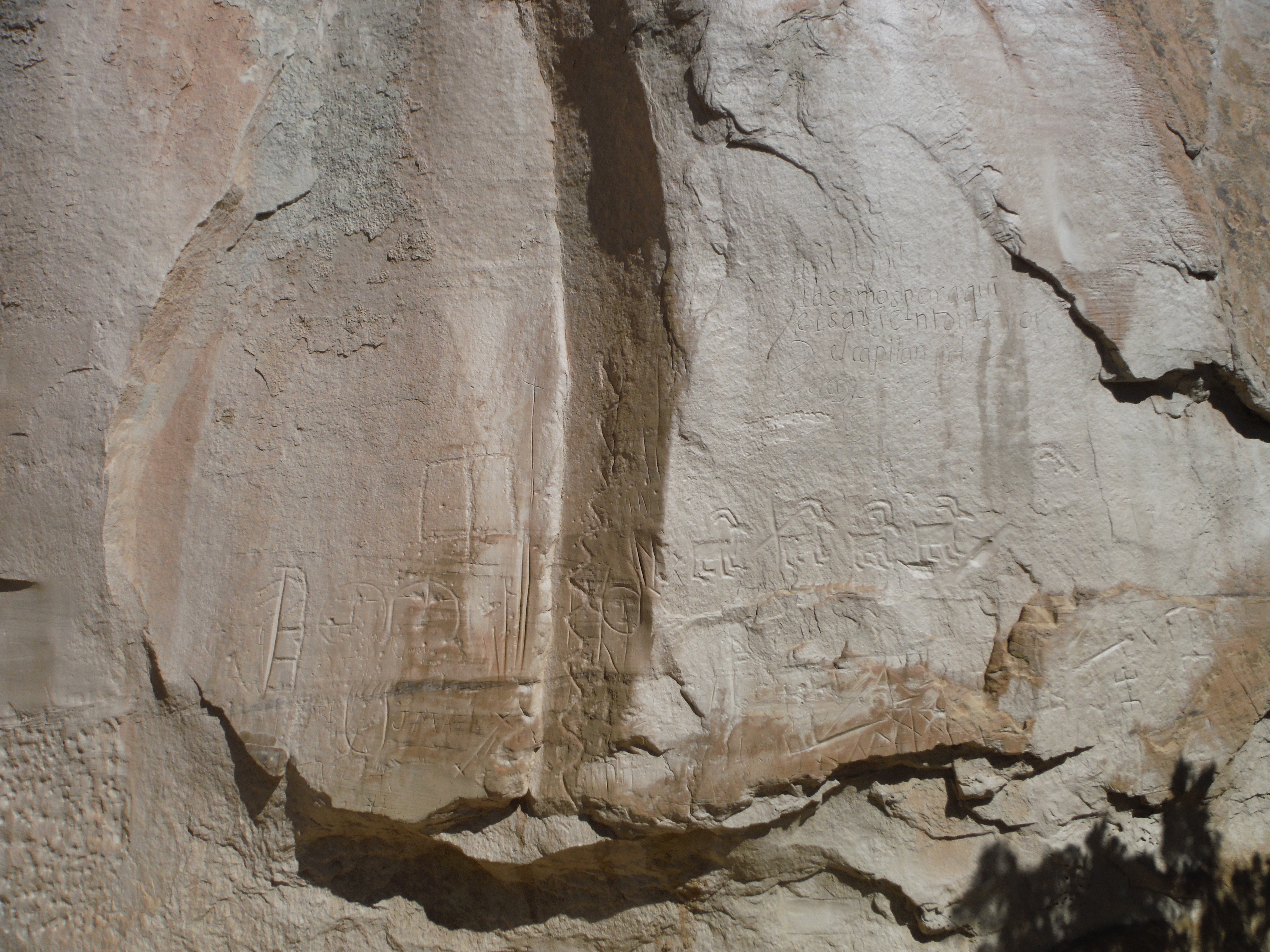
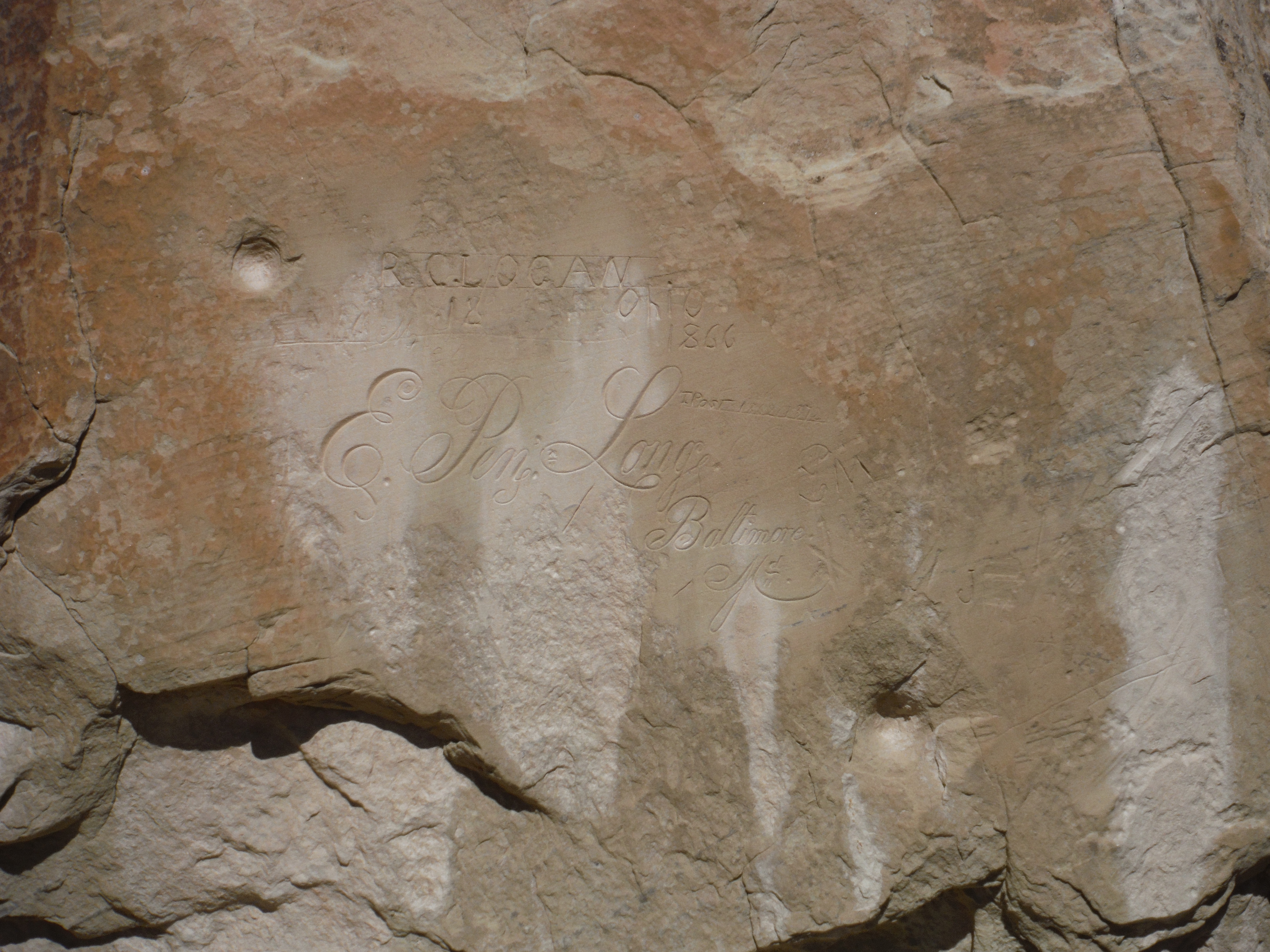
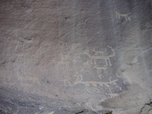
Along the scramble, we glimpsed a number of petroglyphs etched into the canyon walls. One can see many things illustrated. Like familiar creatures such as snakes, spiders, or elk. But other creatures gone from the canyon are depicted, like bighorn sheep. And spiritual entities are pictured.

 By far my highlight of the day was taking this hike above the valley floor.
The trail wound its way amongst boulders.
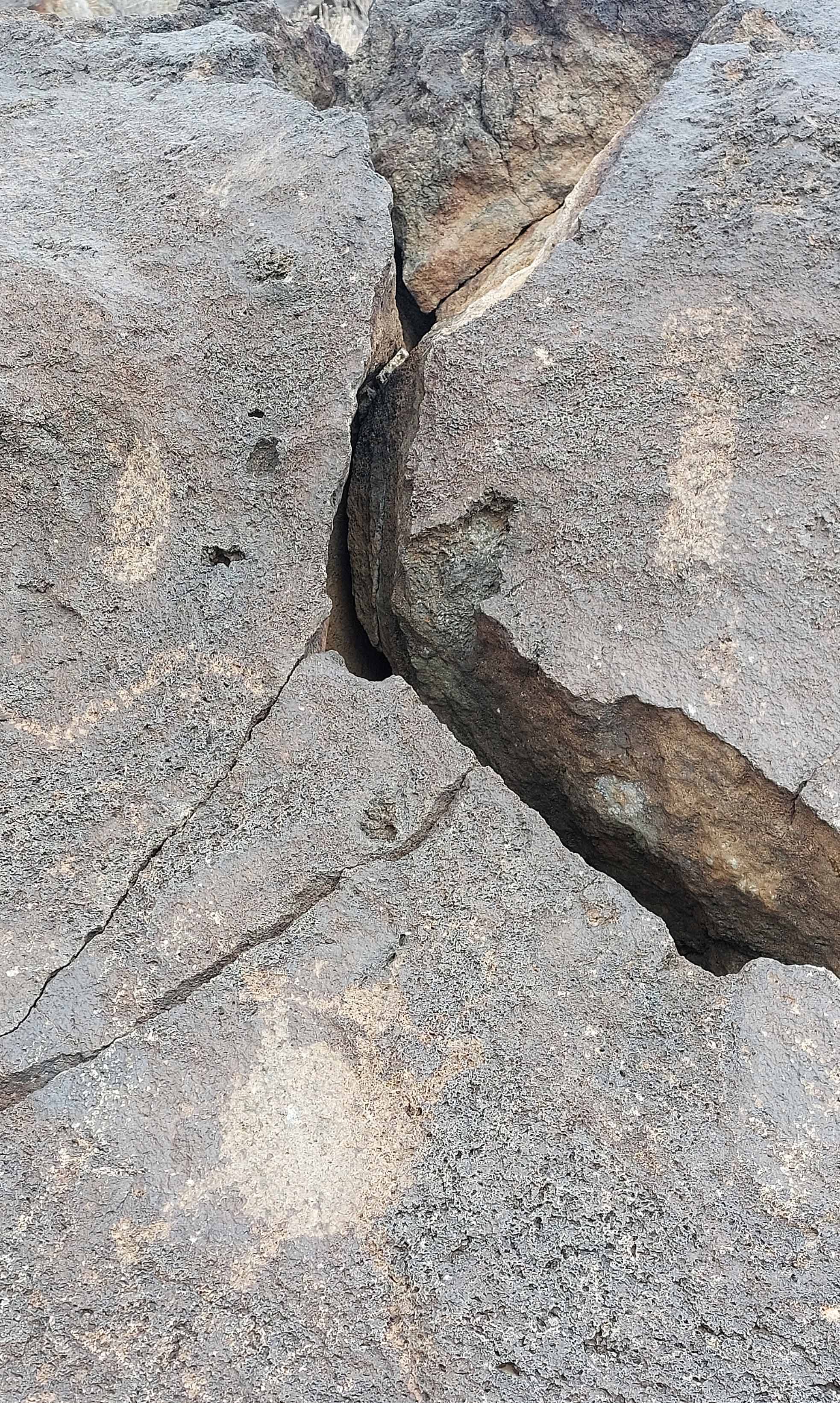
Then, the next “trail” stake was at the wall. I climbed up to it, and then, looking to my right, this “trail” seemed to climb up a crack in the valley wall to somewhere above.
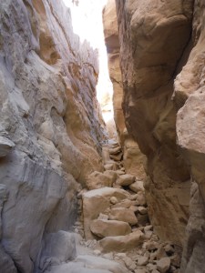
Scrambling up this slot leads to the top of the canyon, with a freaky beautiful trail up there!
I was in the lead, with Tully behind. I thought, “Well, what the heck!” What I didn’t know was what awaited above.
A careful stepping up the rocks led to the top of the canyon, where a relatively flat hike awaited – with an unlimited view!
One up there my emotions went from nervous to ecstatic. There is a whole world up there, which ancients walked for a thousand years. It is no wonder they held Chaco Canyon in spiritual reverence.
Chaco has Rangers that give informational talks, and we took advantage.
 The ranger explained what is known about the Chaco culture, the geology, architecture. He took us amongst the ruins. We looked at Kivas and even wound our way through the multi storied “apartments!”
We spent one and a half days in Chaco. We stayed near Cuba, a town outside the entrance to the area.
My recommendation is to camp in Chaco, if you are up for that. Spend two nights there. That way, you can walk the trails up to the high citadels. The base is 6,200ft. Take full advantage of the night skies opportunities. The Visitor Center has Dark Skies presentations – it has an observatory!

xx
xx