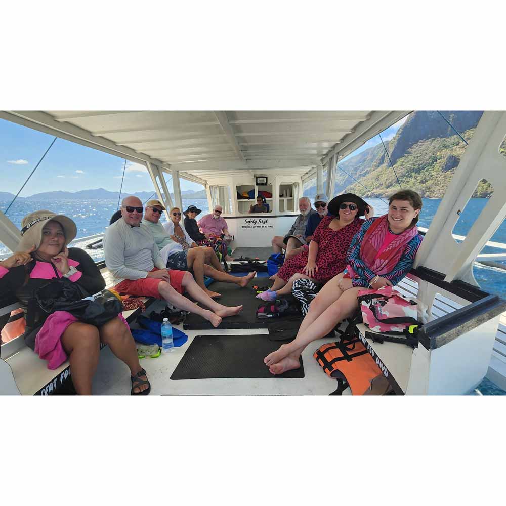
El Nido‘s Bacuit Archipelago is full of mysterious, vertically cliffed limestone islands – much like Vietnam’s Halong Bay. The similarity stops there. Here, it’s not only more beautiful, but there is so much more to do! And it’s much less polluted. At Halong Bay, hundreds of smoke-belching multi-level hotel-ships take tourists out for views, a meal and an overnight. But other than look at the islands, there isn’t much else to do. There are one or two beaches and hikes, and some paddling. The Bacuit Archipelago has the same islands, but they have hidden white sand beaches, palm treed islands, crystal clear lagoons, darn good snorkeling, and some world class blue green water for swimming! There are no cruise ships here. Outrigger boats head out from El Nido town early in the morning and take guests on tours to the islands. A full day includes a seafood lunch.
Sailing through these islands definitely reminded me of Halong Bay!
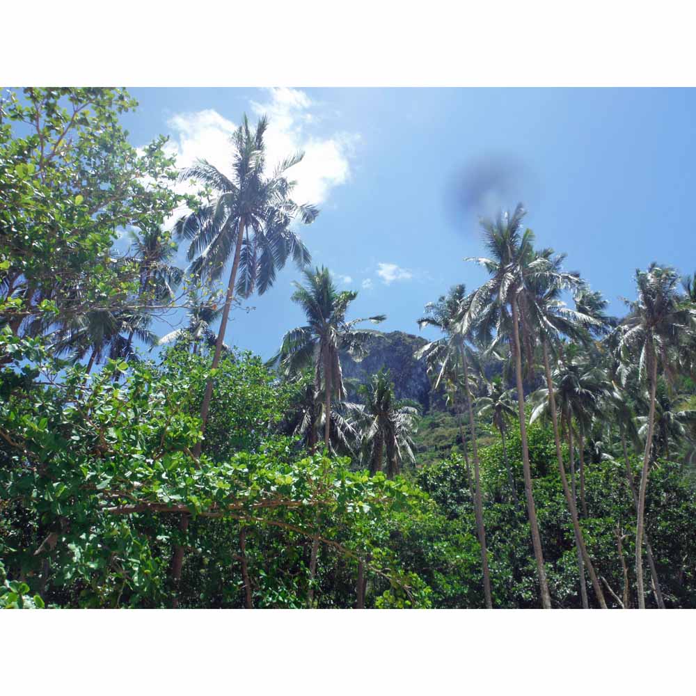
These islands have heavily eroded limestone faces – many very vertical. They are tree-covered. Passing through, you suddenly come across hidden “pocket beaches” lined with to-die-for palm trees. Some have openings to hidden lagoons behind. We stopped at one of these and kayaked into the lagoon. In there, the water was crystal clear and warm.
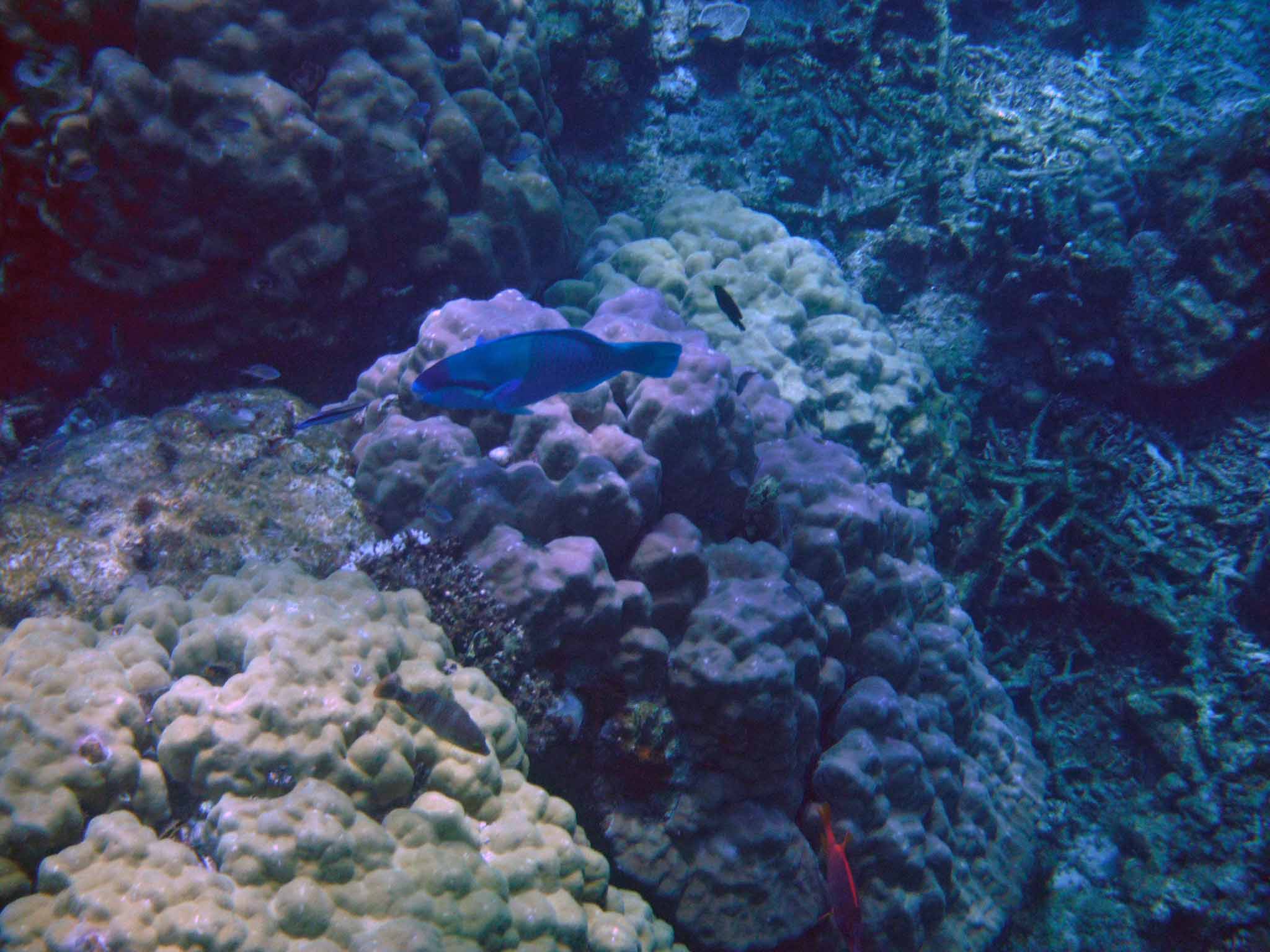
We did some snorkeling. I know the Palawan region has some of the most beautiful scuba diving in the world, such as the World Heritage awarded Tubbataha Reefs Natural Park. Unfortunately the snorkeling I experienced was pretty disappointing – as I’m an experienced snorkeler. When I was snorkeling off Belize on Lighthouse Reef, it was spectacular. And one of my peers, a marine biologist, told me Pacific snorkeling is on a whole higher dimension than Belize. Well, that is not what I experienced. I was frustrated that there was such snorkeling in the area but not where I was. I guess I have to go back! Where we snorkeled, in two separate places, it was pretty deserted and there was a lot of bleached coral. Don’t get me wrong, I did see fish, but not what I was expecting! I did see sea turtles. One, which I didn’t photograph, was as big as a coffee table. I saw clown fish, parrot fish, angel fish, and a clown fish being cleaned at at a “cleaning station.”
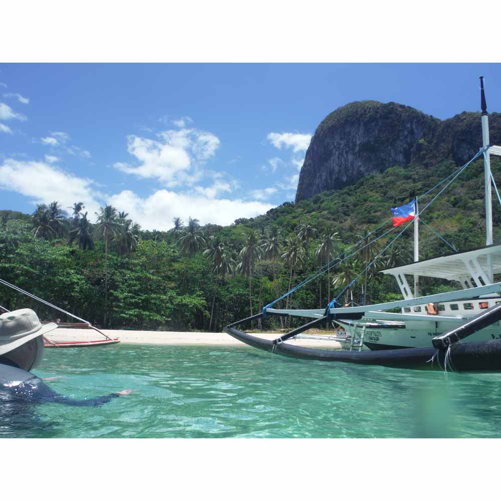
For me, the most amazing lifetime memory was our lunch spot! We stopped at Paradise Beach, on Cadlao Island. This place was just like Gilligan’s Island! With only two other boats, we had it to ourselves. The water is like NONE other. Let me tell you Halong Bay in Vietnam has NO such place. It is worth coming back. It truly is the beach of dreams. In fact, one of our tourist-mates has lived in Hawaii and has sailed from New Zealand to Hawaii – he said that this beach was the most beautiful he’d ever experienced!
I have to say I had no idea until I jumped off the boat into the water. There, I suddenly realized I had just splashed into the REAL DEAL! This really was the waters / beach people dream about and I was experiencing it!
This is it. I know, some love Cancun whilst others crave the Mediterranean beaches of France. But for me, those places, with thousands of people lined up shoulder to shoulder don’t do it. For me, this, this quiet, palm treed beach with no hotels or cruise ships in sight is the place to be!!!
In summary, would I recommend heading to the Philippines for vacation? Definitely! Friendly, English speaking locals. Terrific, home cooked meals. Inexpensive. Would I return? Absolutely. One could spend months simply hopping ferries to far flung islands and discovering paradise! It’s still out there. The unspoiled is there, amongst the 7,000+ islands.
First night’s happy hour! As you can see adult beverages on the left AND right!
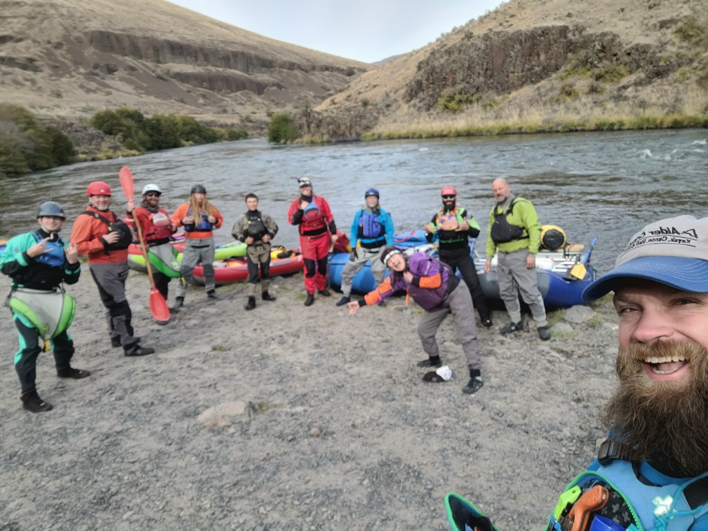
The Covid years of 2020 and 2021 have been the most challenging – and rewarding – to all of us Alder Creek Kayak and Canoe. Each of us has worked our hearts out – practically reinventing the business in the process – slaloming through countless challenges posed by mask mandates, reinvention of rental and instruction procedures, chronic product uncertainties, and skyrocketing pandemic-driven consumer demand. We’ve succeeded. The business is stronger than ever, and we still command exceptionally high customer satisfaction. Congratulations everybody! So in early October, our bosses Dave and Suzi, as a celebration and thank-you, closed the store for two days and took the staff on a two-day trip on 42.4 miles of the Lower Deschutes River.
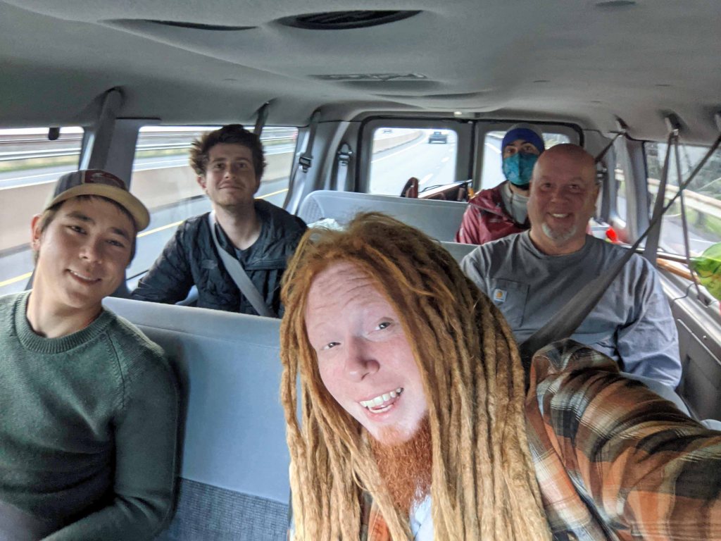
Meloy, Matt, Alex, Ethan, Byron and I loaded up the van with our gear and a couple of whitewater kayaks. Dave and Suzi earlier headed out with a trailer full of rafts and inflatable kayaks. Road trip!
We arrived within 30 minutes of each other. With daylight slipping away we wasted no time setting up tents and the all-important kitchen and “campfire.” At the departure date, wood campfires were prohibited. We ordered a propane-fueled campfire set up but it hadn’t showed up the day before, causing anxieties. But it showed up two hours before departure, and it was totally a hit!
Suzi did a bang up job coordinating the food and beverages for this trip. There was NO shortage of anything especially the adult beverages, which included wine, tequila, mud slides and mimosas! Our first night’s meal featured pulled pork burritos with this amazing salsa for the toppings. For dessert, she served my suggestion of brownies topped with whipped cream. The night was pretty cold! I sleep pretty warm. I brought my Mountain Hardware Phantom 32 bag plus a packable down comforter. It’s a hydrophobic down bag. I was so comfy I never even zipped the bag. We all had frost on our tents upon awakening.
Wakey wakey was about 7 a.m. with piping hot coffee. We had a nice assortment of Suzi’s home baked pumpkin muffins, yogurt, cereal, and fruit. The idea was to eat quickly and get on the river!
Once packed up we headed down to Buckhollow. Even though it was chilly, it was pretty physical work putting the boats together, and before long, we were wondering, once we put our dry suits on, if we’d soon be de-layering! Setting up involves sorting out gear, inflating rafts and inflatable kayaks, strapping things down, river feature discussion, etc. I was having trepidations about the dry suit I chose – I suspected it might leak. So I wore thick polypropylene pants and neoprene socks. That turned out to be a wise choice!
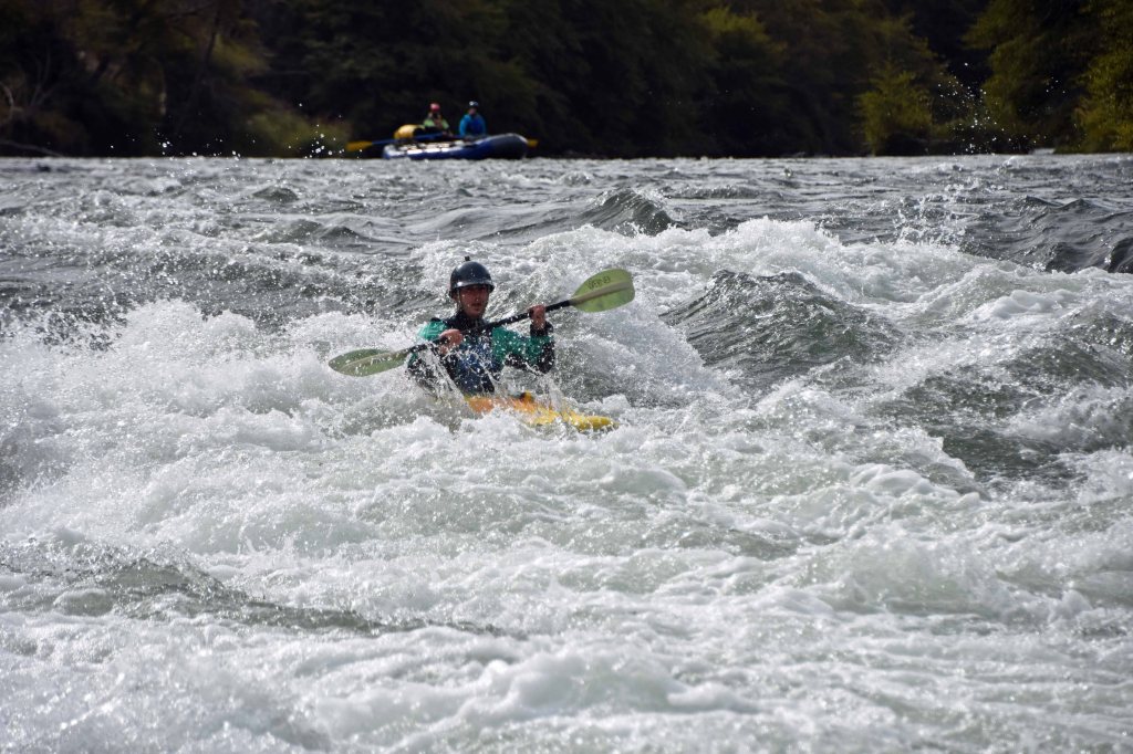
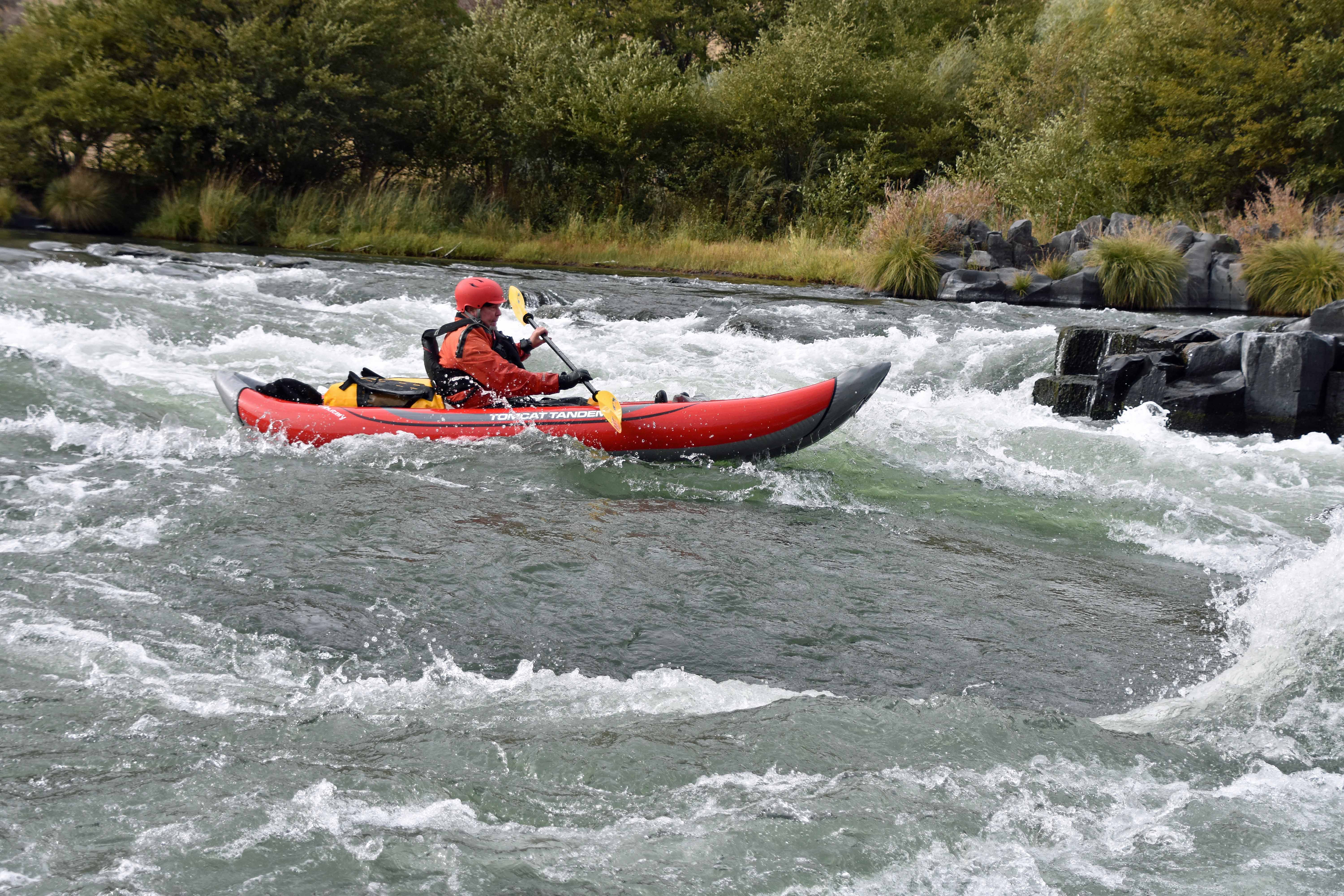
Off we went! This river section has a couple of Class II and a Class III (sometimes III+) rapid called Wreck Rapid. Turns out the name Wreck Rapid wasn’t referring to wrecking boats. It was the site of a 1949 railroad crash! As it’d been 10 years since I last whitewater boated, I chose an inflatable kayak. It was an Aire Tomcat. Inflatable whitewater kayaks are kind of two-faced. On the one hand, they are very forgiving, pretty much riding over eddies and opposing currents, rather than being thrown around by them. On the other hand, trying to make any sort of quick move just doesn’t happen. They are barge-like. I found the best way to approach a rapid or wave train is to just point it right at the waves and go. The main thing to avoid is being sideways to a wave. What is amazing is how fast they drain! Many times the kayak would seem to completely swamped, only to drain instantly. I brought along my bomber waterproof duffel by Ortlieb. It’d taken me on the Cordillera Huayhuash Trek in Peru, and the Annapurna Sanctuary Trek, in Nepal. But it hadn’t been subjected to constant thrashing on a river trip! This tough as nails bag came though completely dry on the inside. My drysuit, however, was as problematic as I’d feared. The right leg was very damp and foot wet. Yes, after the trip, on inspection, it had some kind of abrasion inside the leg, it had delamination, and the icing on the cake, a hole in the sock.
Andrew and Jen
Ethan in his solo raft
Today’s objective was to get to a few miles past Mack’s Canyon. If we managed that, we’d have a shorter paddle tomorrow. The river passes through beautiful Central Oregon canyon country. The canyon walls are lined with spectacular columnar basalt formations. Flora is mostly sage brush and juniper. We are on the lookout for Rocky Mountain Big Horn sheep! We glimpse countless Blue Heron, Osprey, and Kingfisher. The Cliff Swallow nests are visible, but the inhabitants have migrated away for the winter. The character of the paddle itself is moving flatwater punctuated by pool-drop rapids.
Meloy takes a splash
I paddle on through
Tyler dials it in
We chose to go further than Mack’s Canyon, the initial destination. We paddled approximately 3.5 miles further, to a campsite called Homestead. This offered us plenty of space to set up a kitchen with plenty of dispersed tent sites. But our late arrival made for hasty tent pitching and set up before dark! Alex set up a long length of line to hang out gear which we availed ourselves of tout suite! Soon, we found ourselves setting out food and drink, and the fire pit was going. This night we’d enjoy Suzi’s home made pasta sauce over noodles. Prior, as appetizers, we scarfed down crackers, cheeses, plates of sliced carrot, green pepper, cherry tomatoes, and more.
The dashing and daring kitchen crew!
Man what would we do without that fire pit?
Dinner done, it was time to hang out by the fire. It wasn’t long, after a few quaffs of adult beverages, that calls came out for the “Squim” game. Uh oh. This is a game where quarters are carried to a kettle and aimed and dropped in. HOW, do you ask, does one drop them in? By holding the quarter between the butt cheeks! Not all are skilled in this endeavor. But Suzi has buns of steel and is very adroit at this game. Andrew tried it too, and his new found strut made me just about cough up my beverage in laughter.
Suzi nails it!
I announced I was retiring, and went to my tent. But before, I ensured I had everything inside, including my drysuit. This turned out to be super wise, as it started to rain just as I zipped up the tent fly. My MSR Hubba Hubba NX tent was not the tent it used to be. The tent fly did not leak thank God. But the inside tent’s seam tape had completely disintegrated, and the floor became sticky like some kind of tape. Anyway eventually I got up to check and OMG there were little pools forming at the edges. The foot of my sleeping bag was wet. But inside the sleeping bag it was still dry. Lucky it’s hydrophobic. And if I just stayed on my Thermarest pad I was dry. It was hard to sleep, as I dreaded a drip drip drip falling on me from the fly! I prayed PLEASE rain stop. Which it did. I think it rained 90 minutes. About 2 a.m. I got up to relieve myself, looked up and glimpsed a 100% clear, sparkly starry sky! So the rain was a desert passing shower.
Once again, wakey wakey about 7 a.m. And first things first, the morning Constitutional demanded attention. OH, I ought to mention! On this river trip, this situation was practically a crisis! Only myself and Suzi brought toilet paper, and I only had 1 roll. For like 10 people? Damn. I will leave it up to your imagination. Oh come on, we are supposed to be professional outdoors people, right? I only know in my case I never depend on the campground or whatever for TP, I always bring it just in case! Anyway, here I was early in the morning, my body making demands. Dave had set up the ‘stool’ some ways away from camp. Only upon making the hike did I find the spot more than a place to perform the duty. It was a place of contemplation! Let’s just say, it was a unique spot to complete one’s daily dump.
The Throne of Contemplation!
In my case, my thoughts were occupied with the final few Class II, Class III and maybe Class III+ rapids I’d need to navigate in my leaky drysuit. Dave and Suzi, and Ethan told me repeatedly these were straightforward and not that big of a deal. But I didn’t know for myself, right? Oh well. Just forge ahead, right?
Our Chef’s duties called for my group to cook this morning’s breakfast. The pressure was on myself, Tyler and Ethan. The menu called for hash browns, bacon, and scrambled eggs, with melted cheese if we could manage that. And OF COURSE lots of coffee! The hash browns were of a kind I can’t seem to find at my local Fred Meyers. They come in a cardboard container. Just open, pour into the skillet and cook! The bacon was a snap. Suzi had pre cooked the bacon before the trip. Essentially all that was needed was a nice hot pre-heat. The eggs I did in my own simple way, which is to crack them open right on the skillet and add the other ingredients (milk and in this case cheese), scramble right on the skillet. All went well! The paddlers were satisfied! The funny thing about this trip was that many of us had never camped together before, yet it certainly seemed like we’d been camping together for years.
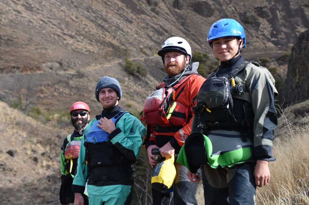
OK. After clean up of kitchen, packing away wet tents and other gear, topping off inflatable kayaks and rafts, strapping down of duffel bags, camp chairs, kitchen tables and propane tanks, it was time to head off! Today’s journey called for much flat water river journeying, viewing of canyon walls, hiking to petrogplyphs, and 4 Class III and III+ rapids at the end of the float. I was definitely nervous about the end, but it turned out to be more fun than fear!
Yes, once we began, Day 2 was sparklly bright and clear. There would be no rain. Wind was our primary challenge on Day 2, especially toward the end! On this day, we had plenty of fast moving flat water. But lay ahead were rapids with names like Washout, Rattlesnake, Colorado, and Gordon Ridge Rapid (where one of our Wenonah Canoe sales representatives dumped).
Some of switched boats, but myself, Meloy and Byron stuck to their original craft. For Matt, it was his first time piloting a raft, and he performed like a seasoned raft paddler. One thing I learned is that as a kayak paddler on a trip like this, you do NOT want to be behind a raft entering a rapid. As a kayak paddler, if you are behind a raft, the raft blocks your view, and secondly, the raft may, without warning, suddenly change direction, leaving you, the kayak paddler, without time to change position for an upcoming river feature like a hole.
I found that my favorite rapid was the Gordon Ridge Rapid. It seemed unanimous that all of us liked this rapid best! It featured numerous small islets which the river wended around, creating innumerable opportunities to paddle the kayak back and forth to meet the demands of the river. And, it was longer than the other rapids, making more fun! At one point, we were so ‘trafficked,’ that we bumped into each other.
We finished the storied Colorado Rapids, which were followed by Rattlesnake. Funny thing was, I paddled through Rattlesnake and did not even know it. Maybe it was the river level, I don’t know. But I just followed, at a distance, Dave and Suzi’s raft, and it was no big deal.
Then the wind roared. How does this happen? So, in the Summer, the Columbia Gorge gets hot, and even on warm Fall days, and the hot air rises. Something has to displace the air rising. And what would that be? It is air from the Pacific Ocean, and it begins to replace the rising air about noon. This every-day phenomenon starts a race-track all the way from Astoria to beyond The Dalles in the Columbia Gorge. And, it also flows up the Columbia Gorge side canyons like the John Day River and the Deschutes River. On our final miles to our take-out, we were experiencing gusts up to 35 mph. So what to do? PADDLE HARD! It constantly forced my inflatable kayak to turn right. To counter, I had to paddle hard to left, which at some point eventually led to a blister on my right wrist. Alex had a First Aid Kit with a gauze self-adhering bandage which I applied. That kept the damage at bay.
In the end, we all paddled against the wind to the take out. It was annoying but not too bad!
We had a terrific trip! We’re looking forward to a great 2022!
Despite the twilight monsoon-ish downpour, sleeping at Doban was fine. There were only a few light pitter-pattery showers overnight, and the river’s music lulled me to sleep. No nightmares this time.
Doban lay in a steep, waterfall-laden, forested, tightly wound valley. Morning broke clear. As always, snowy Machupachare watched over us.
Today we’d hike along the Modi Khola River, up and down with an eventual attainment of 3,576 feet by evening, arriving at 12,204 ft Machapuchare Base Camp! From there, it’s another 1,231 feet to Annapurna South Base Camp – the Annapurna Sanctuary itself.
Ecosystems Galore
This is the bit. Yes it is a TON of climbing and descending to finally arrive at Base Camp.
But the thing is, the ascending and descending north and south facing slopes of this incredible canyon reveals incredibly diverse biospheres at each elevation or direction. South facing slopes have produced incredibly dense forests with bamboo or rhododendron, whilst the north facing slopes have flora resembling a high desert plateau.
We Were at the Whims of the Himalaya
And as we continued climbing, we were increasingly in close proximity to mountains 23,000 – 27,000 ft, and the weather was changing accordingly. Up here, things change quickly. Expectations of a full day of sun were dashed, and in their place we experienced chillier, damper, and sometimes foggy weather. However, it could just as easily clear up for a couple of hours and become warm!
Packs at lunch
Some of lunch
A porter taking a break.
Sedimentary layers create gorgeous waterfalls!
So I donned what clothes I thought best, and stashed extras in my day pack, including the pack cover for an unexpected shower. After a multi course breakfast, we set off. And our dedicated kitchen staff, porters, and guides worked for us. The “stepped trail” pretty much followed the left side of the river, climbing up and down along the way. It was very beautiful, as the rainy downpours created incredible 500+ foot waterfalls coursing down the valley on both sides.
Peak Experience
It was on this day that the moment happened when I knew that I got the experience I was looking for on this trek. It just happened in an unexpected way. Sometime in the morning, our hikers split into a lead and a following group. And I found myself in the lead group.
Trekking Nirvana Comes Upon Me Without Warning
All during this trek, and for that matter, on any trek, there are some ‘concentrations,’ or ‘distractions,’ well, I don’t know know exactly how to describe them, or perhaps they can be described as the “snow globe of thoughts that must be addressed,” but they are there. I am not passing judgment on these things, but they are simply part of any trek. Such things are sentiments about keeping up with other trekkers, breathing the oxygen necessary to get legs over the next pass, performing the best “rest steps,” or talking with other trekkers, or waiting for other trekkers, well, I don’t know. And, as these things are natural, there is nothing wrong with these sentiments/duties or ordinary aspects of hiking with others and on challenging terrain. But the thing is, they distract from experiencing the natural environment in which one treks. Like static blocking out the beauty. I’d been talking with other trekkers, or de-layering to be comfortable, not even thinking I was missing something essential. So on this day one of us passed me playing some kind of pop music on their cell phone. I was so totally turned off. I just wanted to experience the Himalaya – leave that stuff back home. So I slowed my pace so that I allowed the front group to get ahead so that the noise died away. Before long, I only heard my boots on the trail , birds overhead, my own thoughts and lullaby of the Modi Khola river nearby.
I found myself alone, in between the front group and the following group of trekkers. And everything about trekking fell into place. My footsteps, the river burbling, the birds soaring, Machupachare seemingly watching, I don’t know, it all just came together and I guess the serotonin in my brain started pumping. I was lifted up into some kind of nirvana-like state which I wanted to go on forever! This just went on and I felt absolutely nothing about walking up and down that trail until lunch. Nothing but pure pleasure worth every penny of going on this trek. I just couldn’t believe how it seemed to require withdrawing from other people. But it was there nonetheless. Maybe it just required withdrawing from the snow globe of requiring to respond to others and then to just focus 100% on THE PRESENT. I just don’t know. But it was there. It was 100% palpable and incredible. Such simplicity, Such whole-ness.
Here is a sweet video of one of our rest stops on this day.
During our delicious multi-course lunch, a sinister cold-moist breath reached our break spot. It was the Himalayan cloud pattern, which reversed the sunny warmth and in its place laid a moist, cold foggy layer. Yikes! It was so palpable I was taken aback. But it required an after lunch re-set of layers once again.
The trek up to Machapuchare Base Camp was varied. At certain points it opened up above tree line, where we could see where we were going, but then again, the fog would close in, so we really didn’t know what was coming up. At one point the trail seemed to open up and become more level, but then again the fog rolled in, the steps steepened, and I had to stop and re-layer. The lead group forged on, and MingMa stayed with me as I layered for the final push. This last part of this leg, for me, was super annoying. Reading the trip description I thought this section was more level, but OH NO. In fact it was steps ascending relentless to the camp. This was confirmed on the way back down, it was a whole heck of a lot of steep, high, steps. I give MingMa a ton of credit for going with me on this last stretch.
Once we arrived at ‘MBC,” it turned out to be a complex with multiple lodges, tea houses, and camp sites. It was so foggy MingMa had to figure out where our group was camped. It took Oh, 10 minutes to find our group.
This time, I’d had it. I was finally out of dry clothes and with the cool fog, no way to dry anything. I pretty much gave in to the idea of just staying around camp the next day, maybe taking a 30-minute each way hike, try to dry things out. However, our plans changed. The original plan was to spend two nights at MBC. But that would mean two very very long days before we get down to the end of the trek. So, it was decided that we’d hike out of MBC for a couple of hours, and spend the night. That way, it’d shorten one of the days hiking out.
No pictures of arrival at MBC, too foggy. But I can show you our dinner! In the kitchen tent. Our cooks were super. They made pumpkin pie, apple pie, two types of cake, and even some kind of fruit basket made of hard candy! They made a lot of local specialties like Momo, and a type of “potato chip,” lots of vegetable dishes, a type of tempura, but I cannot remember the names of the others!
Speaking of food, they introduced me to SPAM! I don’t eat ham. But I tried spam at breakfast, and while I wouldn’t eat it daily, on a trek it was perfect.
Next morning dawn was gorgeous and bright. The stars before dawn were unforgettable.
Made famous by Jacques Cousteau, The Great Blue Hole lies in Lighthouse Reef, 55 miles off the Belize mainland. He said it’s one of his top 10 dive sites in the world. Physically it’s 1,000 feet wide and 400 feet deep – whereas the rest of Lighthouse Reef is 22 miles long and 8 – 10 feet deep. The outer ring of the blue hole is an amazing forest of coral just below the surface. Click here for a wonderful time snorkeling amongst the corals!
The Blue Hole wasn’t always a hole. Turning the pages of time way back to the Ice Age, Lighthouse Reef was an island several hundred feet above sea level. At that time, the Blue Hole was above sea level and it was a cave. It was a great cathedral with side caverns filled with growing stalactites and stalagmites.
A female Stoplight Parrotfish pauses at a “cleaning station”
Then the earth warmed, the Ice Age ended, and as glaciers melted, the sea level rose. The island was submerged under water and became Lighthouse Reef. The roof of the cave collapsed, and sea water entered, creating what we see today.
Our Island Expedition guides shuttled us out to the Blue Hole as it’s pretty far from Half Moon Caye.
Once there, we slip on our flippers, don the dive masks, and somersault into another world. Once I adjust my mask and focus, a wave of excitement washes over me! This spectacularly preserved ecosystem is but a few feet below the surface, and I can swim right through it.
This is the healthy reef system I was longing for – everything I wanted to see. It is the ultimate snorkeling experience. Snorkeling the ring surrounding the Great Blue Hole, you witness healthy brain coral, staghorn coral, sea fans, barrel sponges, great barracuda, reef sharks, midnight parrotfish, grunts, blue tang, hawksbill turtles, angelfish, fairy basslets, eagle rays, and much much more!
Wrasse and a sea fan
We spent three hours at The Great Blue Hole, but I could have explored a full day there. I knew that down below snorkeling level, there are great predators. Great Hammerhead Sharks, Bull Sharks, Lemon Sharks, and more spend time at depths in the Blue Hole. But the examples of these species are juveniles – they come to this spot for protection from predation by the full grown members of their own kind out on the ocean side of the reef.
Brain Coral, on the right
For this snorkeling trip, I purchased an underwater camera capable of video. It is the Fujifilm XP60. Like most point and shoot cameras these days, it only has a video screen. I am far sighted. So it was difficult to know, looking at the blurry screen in front of me, if I was definitely in focus, or even had the subject correctly framed! Add to that my body bouncing on the surface, or down under, holding my breath. Further, fish don’t just pose for pictures. They are always moving. I learned to listen to the beeping sound for focus.
Another factor I learned about is that underwater, the further you are away from your subject, the more blue-tinged the photo shall be. The closer I took the photo, the more the real colors showed up. Andy, one of our group, knew how to free dive. He could go down 20 feet and just hang out down there and got the most incredible close up photos of fish.
Another factor in getting good photos of fish is their behavior. Fish tend to retreat into their hideouts when you approach. But if you linger a bit, they come back out. Lingering underwater with lungs full of air is pretty hard because your body tries to float up. Andy’s trick is to hold onto something like a rock.
He gave me some tips on staying down longer. Instead of using your air/energy do go down by kicking hard with your flippers, get completely vertical with your head down and legs straight above and let the weight push you down. When you are feeling pressure, pinch your nose and blow out to equalize the pressure. Now that you are down, and equalized, you have more time to stay down…and you can grab a rock to keep you from floating up too fast.
I tried this and many times, I got so comfortable down there I lost track of how far I had to go up to catch a breath! It was fun, and a new thing for me.
The Blue Hole was certainly well worth visiting! But it’s far offshore. So I recommend spending a few nights on one of the islands out on the reef. You can always book with Island Expeditions! They’ll take good care of you.
I chose this trip because I had learned Belize has some of the Atlantic’s only coral atolls – and that their reefs are super healthy. It was all true. Snorkeling just off Half Moon Caye Belize is super easy. Simply slip your mask, snorkel, and flippers on, and a mere 50 yards from shore amazing underwater wildlife thrives.
Queen Triggerfish
This blog post covers some simple snorkeling just off the island. On the west side of the island, Lighthouse Reef’s 8-10 foot lagoon sports countless coral heads, which are home to dozens of species of fish, turtles, lobster, and squid.
Blue Chromis
Yellow Grunt
On the east side of the island, it connects with the reef ringing 22-mile Lighthouse Reef. Our first snorkel took place out there. Right off, I was rewarded, witnessing so many brightly colored reef fish living out their lives in this protected reserve.
Lots of grunts on the reef!
Some of the most common fish on the reef are grunts. There are different variants, but a frequently seen grunt is the Blue-Striped Grunt.
Blue Striped Grunt
Another fish I saw lots of is the Blue Tang.
The Blue Tang – ubiquitous reef inhabitants
A pair of Spotfin Butterflyfish
Rarely seen are the Spotfin Butterflylfish.
There were sharks, too. And rays. And Parrotfish, and Barracuda. And Squid.
I swam right over this Nurse Shark – I almost didn’t notice it!
I brought an underwater camera along for this trip. I was learning to use it as the trip progressed, and I was able to get some video of underwater wildlife.
If you have seen “Gilligan’s Island,” then you might have imagined Island Expedition’s small operation on Half-Moon Caye. It is a true slice of paradise! No more than a mile long, coconut palm forested Half-Moon Caye sits in the southeast edge of Lighthouse Reef.
Just off its eastern edge, the water drops to 12,000 feet deep. But inside the 22-mile long lagoon, the water is no more than 10 feet deep. This creates some interesting explosions of sea life, which we’ll explore in later posts.
Half-Moon Caye and several square miles around it are a World Heritage Site. The caye hosts a colony of rare red-footed booby birds.
These birds are amazing acrobatic aerial fishermen. Every day hundreds issue forth to forage in the ocean.
They bring back food for their young, but they are never alone.
Red-Footed Boobie
Red Footed Boobies are symbiotically connected to Frigatebirds, which steal the food for themselves.
Like an F-15 the Frigatebird wheels to steal some food.
Frigatebirds are even better fliers than boobies. But they have absolutely no fishing skills. They are completely dependent on stealing food from the boobies. So much so, that frigatebirds defend the entire colony from other scavenger species such as sea gulls or petrels. Oddly, the boobies seem OK with surrendering food.
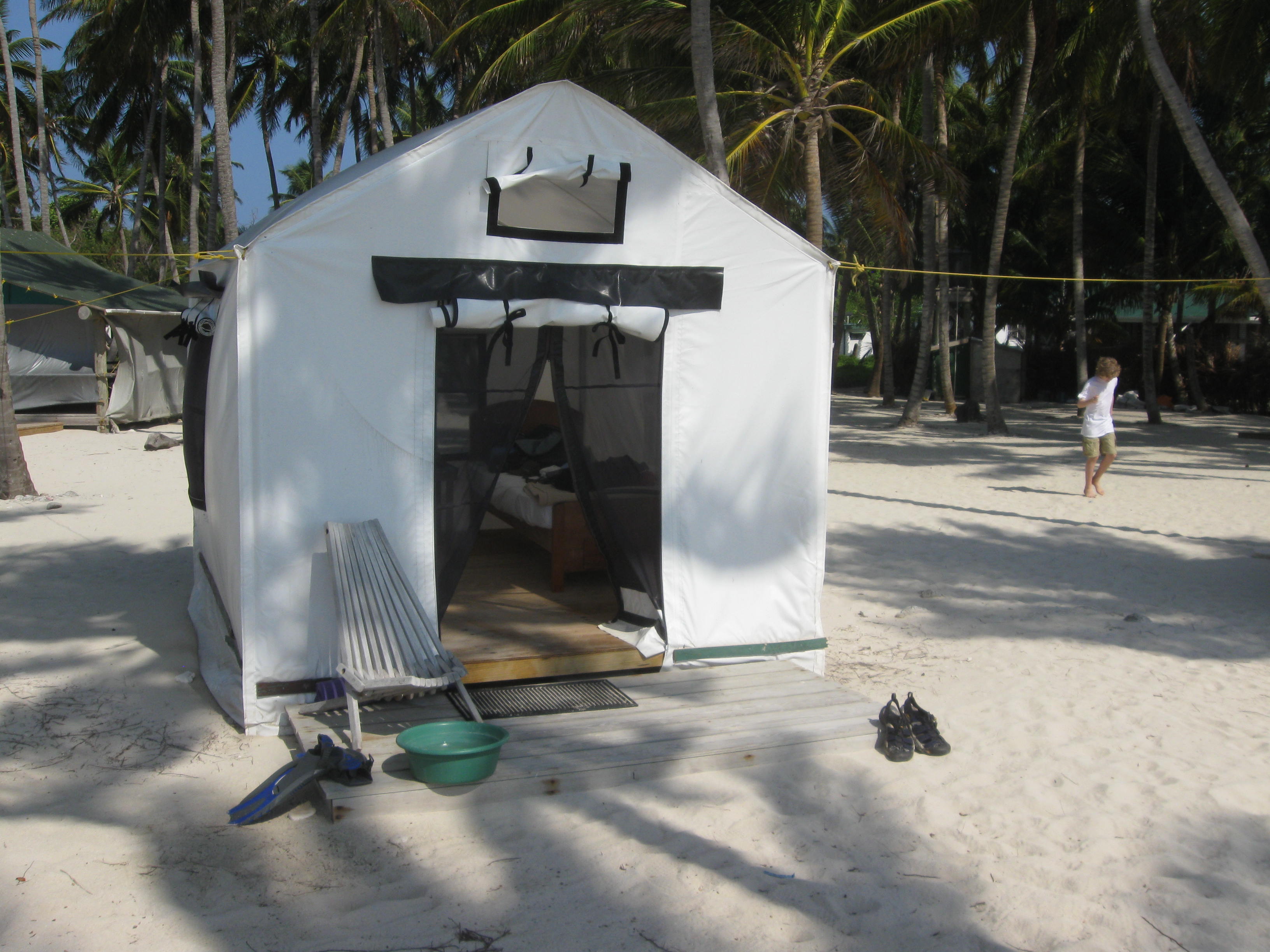
Island Expeditions had about 12 platform tents arranged along the east side of the island, facing the ocean. Just beautiful, with coconut palms overhead.
I certainly enjoyed my tent, which had two twin beds inside. It was simple yet thoughtfully laid out. It had strong pipes for a frame. It had a nightstand, a table, a laundry line, a hanging “dresser,” and an anti vermin cannister just in case. It stood up to the 24mph winds one night.
One job all of us had was keeping sand out of the tents!
Lodging is a misleading term, because we “lodged” in platform tents – each with beds. No super resorts here: exactly what I wanted. There were 12 tents lined up along the shore. Island Expeditions runs a sustainable operation – with water from rain collectors, a well, and composting toilets. Electricity was on four hours per day, just enough to charge your camera batteries. So, we were far from luxury yet far from roughing it. The kitchen served up three sumptuous meals daily.
Dishes included Creole fair (lots of bbq), plus conch soup, coconut pie, pineapple and mango, and when we caught fish, catch of the day.
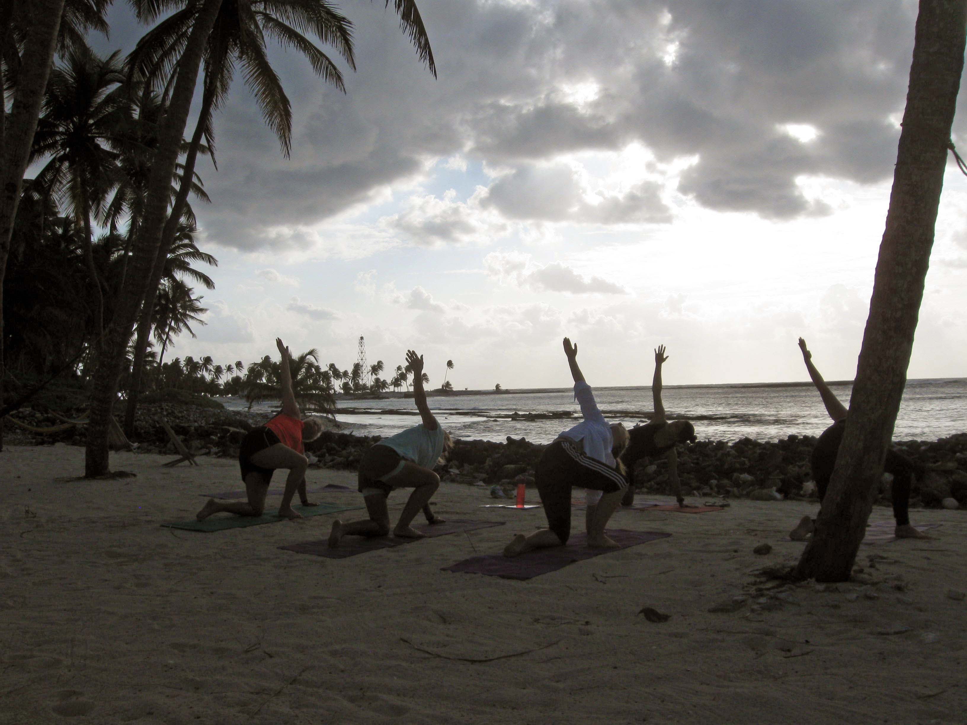
Rise and shine! 6:30 a.m. yoga.
We were fortunate to have Tisha, a yoga instructor from British Columbia, on hand. Each morning she’d lead us in stretching and moves to open up the day.
In the evenings, we all gathered in the dining tent for discussions of the days adventures and misadventures.
With island life taken care of, we had much off shore activities to pursue. So the next series of posts will explore kayaking, fishing and snorkeling in Lighthouse Reef, and the Great Blue Hole!