Hiking Zew Zealand’s Abel Tasman Coast Track

28 02 2013

IMG_3449
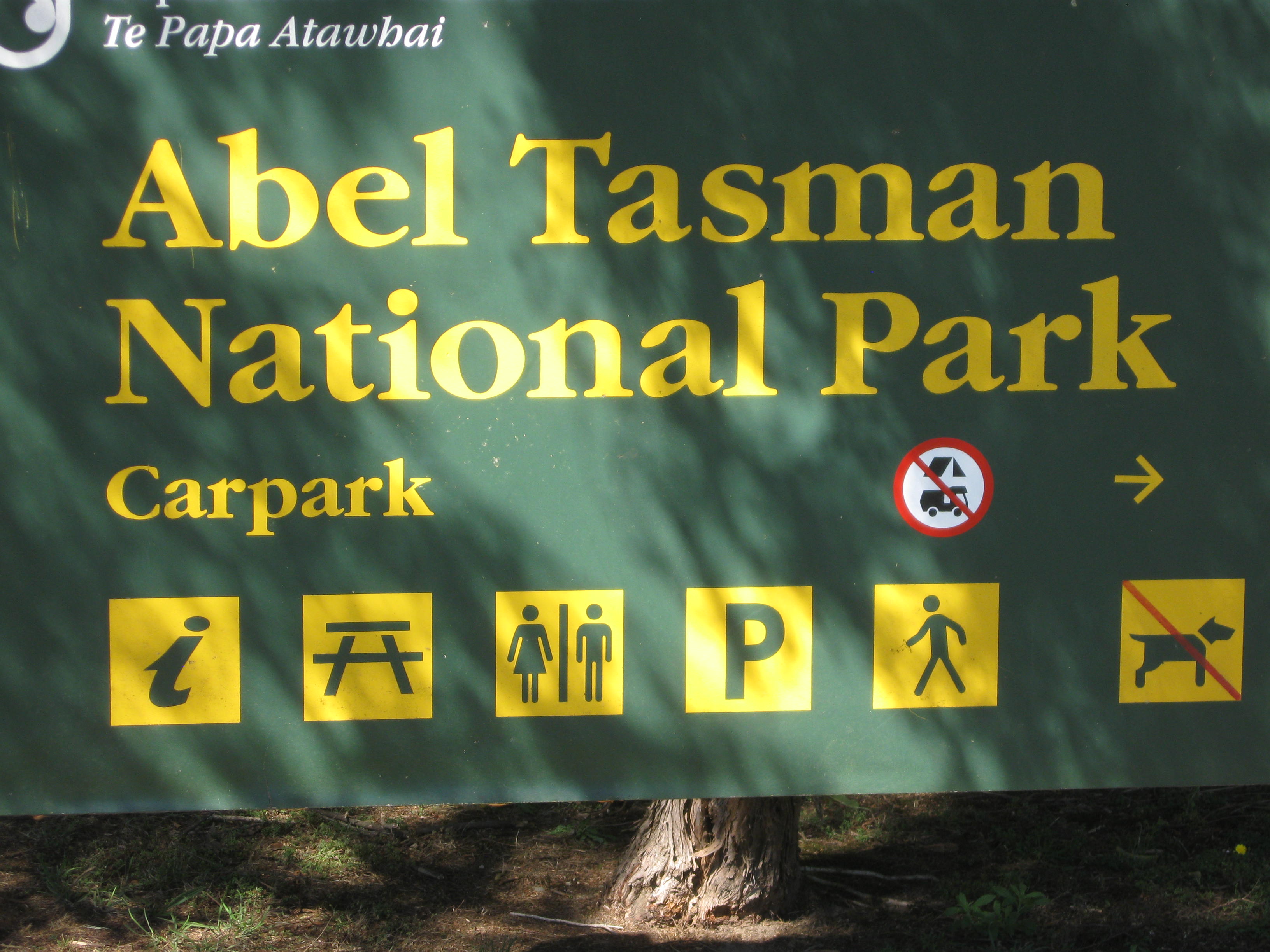
Abel Tasman National Park, at the northwest tip of New Zealand’s South Island, is a warm weather lover’s paradise! It belongs on your Kiwi bucket list. Endowed with lush peninsulas and private bays with golden beaches and turquoise seas, it irresistibly attracts outdoorsy types. The Abel Tasman Coast Track, one of New Zealand’s Great Walks, allows hikers to experience the park’s wonder, passing along beaches, through Jurassic Park-like forest, before climbing to jaw-dropping views. It is also renowned for sea kayaking and kayak camping. Abel Tasman National Park is a sure bet to deliver soul-cleansing pleasure. Open your ears, breathe deeply and let your eyes feast on the views. Then grab a paddle and immerse yourself kayaking in the sea!

There are many ways to enjoy the park. Backpacking (or “tramping” in Kiwi) its 54 km coastal track, hiking, swimming, kayaking and kayak camping are but a few. We chose to spend two days there, and experience the park by foot one day and by kayak the next.IMG_0166

One of Abel Tasman National Park’s to-die-for experiences is sea kayaking. So we called ahead to Marahau Sea Kayaks to reserve kayaks for the second day. This outfitter in Marahau was amenable to my request for a single kayak – most rentals in New Zealand are tandems. I’d lead Elwin and Angelique, who’d be in a tandem. I’m a kayak instructor – so I’d give them some first-timer lessons!

IMG_3447

3 Kayaks down there! Click and zoom to see them…

But today’s adventure called for hiking. There are many choices. We wanted to do a thorough hike on the coastal track. There are no roundabout trails – it’s only out and back. However, you can take a water taxi to a trailhead and hike back to your vehicle – so we picked that idea. We set off from the Nikau Apartments in Nelson, and arrived in Marahau at 8:00 a.m. It would be an all-day adventure!

And what a day it was! We met our water taxi at Marahau, and it would drop us off on the beach at Bark Bay. From there, it’d be a five to six- hour hike back to Marahau.

Bark Bay is a pretty golden sand beach with a tent campground set behind the trees. Behind lay a peaceful lagoon. Here our day long hike begins!

IMG_0169

Here the coastal track follows the bays tucked in the many peninsulas along the headlands. At first, I’m hiking close to the water’s edge but in the forest. It is about 80 degrees. There are no mosquitoes nor biting flies. Just cicadas buzzing. I hear Bell Birds and the occasional Fan Tail alights nearby to check me out. It is dry-very little wind. This perfection is totally intoxicating and I become lost in the moment…the low level forest is full of giant black tree ferns…maybe I am in Jurassic Park!

This is truly incredible since it’s early January – my winter but summer in the southern hemisphere!

If you are an avid American hiker or backpacker – or kayak camper living in the American West, you might expect a solitary/private experience in Abel Tasman. If that is what you want, you’ll be disappointed. This track is very popular. So much so that you won’t be able to just set up a tent in the woods. Rather, due to volumes of visitors, there are huts, or designated tent campgrounds. You’ll also meet sailboat cruisers and some powerboaters who’ve anchored offshore. At least you’ll meet fellow outdoor lovers from all over Planet Earth. The two girls from Finland I met came the furthest.

I stop to take some pictures, and lose track of Elwin and Angelique. After 45 minutes trying to catch them in vain, I just set my own pace, enjoying every step of the way. There are a good number of backpackers – I hear French and German spoken.

I walk across a couple of suspension bridges, on either side ferns, with a clear pool underneath. Then I begin to climb away from the shore, up to the bluffs above. There, the forest becomes less jungle-like and more dry.

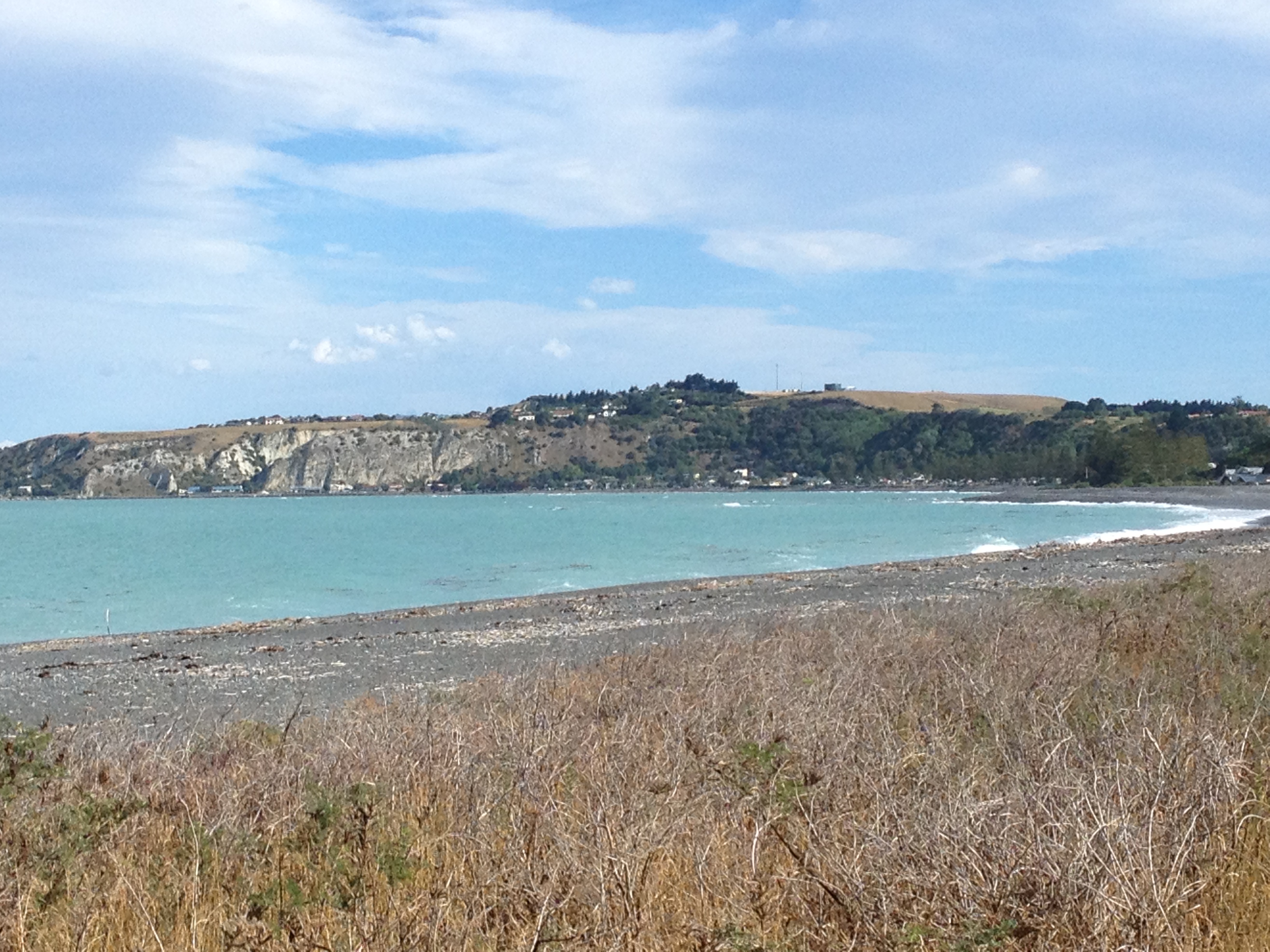
In many places it opens for periods of walking with views of islands, kayakers, and across the Cook Strait toward the North Island.

IMG_0173There are so many cool bays and inlets. There are lots of possibilities for tomorrow’s kayaking!

All along the Abel Tasman Coast Track there are opportunities to take side trails to secluded beaches, peninsula lookouts and lagoons.

IMG_0186

A sweet picnic beach

I keep track of the time and my progress. At Anchorage one of the stops, I begin to realize if I spend too much time on a side adventure it’d be after 5:00 when I return! So, with that in mind, I limit myself. But there are so many opportunities to pause, and drink in the view. I take one of these and sit down, watch the kayakers below, and eat my lunch.

Somewhere along the way I entertain myself by turbocharging my pace. I hear hikers coming from behind, some kids amongst them, and I imagine they’re Lord of the Rings Orcs hunting for me. No matter how hard I go they keep dogging me! But at some point I pass another side trail leading to a beach and after that I don’t hear from them anymore. From a high bluff I look out and realize it is freaking January! How can this be?

Finally, I descend to the end stretch, a flat section eventually terminating at Marahau. I hear “Rod!” from behind. It’s Elwin, with Angelique behind. Somehow I managed to lead them this whole time. Or, maybe they took a long side adventure. Either way we will wind up at the end together. My feet and Angelique’s legs are both hurting! I’m glad it’s not any further.

IMG_0191

Back in Marahau I check in at Marahau Sea Kayaks and they have dozens of boats ready for departure. A group shall be going out! But they’ve allowed us to go out privately since I’m a BCU certified coach. Looking forward to sea kayaking tomorrow!

We head back to Nelson, to catch the movie The Hobbit…


A Day in Sunny Kaikoura New Zealand – An Unplanned Treat!

24 02 2013

IMG_0146Our spirits, soaked with sadness on having to forgo driving up the west coast of New Zealand’s South Island because of the storm, were completely lifted upon reaching the sunny east coast near Kaikoura! There, we experienced incredibly calm turquoise seas, warm temperatures, ocean wildlife, and peace.

On the way we reserved a room at the Sunrise Lodge Hostel. We really lucked out as our room was right across from the beach! With that in mind, I brought out a chair and watched the sunset. Almost immediately a school of dolphins approached, jumping all over.

IMG_0145

It was so relaxing after the disappointments we’d had. This was quite a nice reward! I prepared dinner at the kitchenette in our hostel apartment, and then Elwin returned – we decided to make a bonfire out on the beach.

This was great fun. The stars came out, and it was so clear that we could pick out the Southern Cross, and the Magellanic Clouds. Two local Kiwis taking a stroll noticed our fire and took part in collecting more wood.

IMG_0144

To the north lay the mountainsIMG_0142.

And looking south the Kaikoura Peninsula. Beautiful!

Right in Kaikoura there is a worthwhile hike – on the Kaikoura Peninsula. So that would be next day’s plan.

Another beauty of a day dawned, and we packed our backpacks with lunches and headed out for a hike.

The Kaikoura Peninsula Walkway is a four-hour loop hike taking you out into the Pacific.

IMG_3428

A Southern Sea Lion takes in the UV rays.

IMG_3426

It meanders along the water’s edge, past sea lion colonies, red-billed gull colonies, nesting shearwaters, and coves where snorkelers were harvesting rock lobsters, known locally as crayfish.

IMG_0153

Angelique, Elwin and I spent hours meandering amongst the many bays created by the fingers of land reaching into the sea. The water is perfectly clear, and you can watch the sea swells ebbing into the bays. There, bull kelp sways to and fro with the water’s motion.

Then the trail climbs the bluffs, and you can see forever in each direction. Up top, of course someone’s farm with cows comes right up to the trail. But the unlimited views are spectacular.

IMG_0154

There is a lot of beautiful pampas grass which flows like flags in the wind.

IMG_3434After our rigorous hike and refreshing air and views, it’s time to head up north – we’ll be staying in Nelson, our staging point for a few days hiking and kayaking in Abel Tasman National Park.


Stuck in Wanaka, New Zealand: Mother Nature’s Wrath Alters Our Plan

22 02 2013

Weighing on our minds the past few days was a series of Antarctic storms. These had smashed the western coast of the New Zealand’s South Island every few days since I arrived. And now our plans called for driving up that coast. It is beautiful and has the world renowned low elevation Fox Glacier and Franz Josef Glaciers. But to get there, we’d have to cross the mountains. What would Mother Nature have in store for us?

Today we drive from Te Anau to Wanaka. Plans called for playing in Wanaka and then making an epic crossing of the Southern Alps via the Haast Pass to the coast. There are only two roads across the Southern Alps between here and Christchurch. The other is Arthur’s Pass. A recent storm had already closed the coastal highway but it had been repaired due to heroic efforts from New Zealand highway crews.

Now another storm approached, and upon our arrival in Wanaka, it unleashed its fury. It was pouring and due to continue for 12 hours. Our hostess at the Matterhorn South tried her best to find things for us to do, but other than movie theaters, there really wasn’t a lot to do other than walking the shopping area. The typically fantastic view of Lake Wanaka was completely obscured. Our room at the Matterhorn South needed some serious cleaning and updated bedding. At least the hostel was in downtown and had an upstairs with a library, fireplace and wide screen TV.  We spoke at length with a woman from Perth, Australia who was to climb Mount Aspiring. And a gentleman from Christchurch who had vivid descriptions of the earthquakes.

All we could do was make dinner in the kitchen and wait. Next morning, I checked via my iPhone and learned that the Haast Pass route was closed. In New Zealand, rain causes rivers and lakes to rise rapidly. Part of the road was built right next to Lake Wanaka – and the lake flooded out the road and was still rising. Worse, the other route across, further north, Arthur’s Pass, was also closed! Forecast was that maybe the lake would recede…but later in the day. Could we wait? No, because we had reservations in Abel Tasman National Park, on the northern tip of the island, in just 48 hours.

Disappointed, frustrated and in denial that something we’d looked forward to witnessing for months was slipping away, we pulled ourselves together and researched alternatives. I’d already experienced how the eastern side of the island can have much drier, warmer weather so I looked at the IMG_0137map and suggested we aim for Kaikoura. It’s a couple hours north of Christchurch, it’s on the beach, and has a peninsula worth hiking.

With that we headed to Kaikoura, and just like magic, on the eastern coast it was summer again! This lifted our spirits so much. We found a hostel and a room steps from the beach.

So, it was time for some late afternoon beach combing and then supper!


Lake Te Anau and the Kepler Track

19 02 2013

IMG_3423 The next day broke sunny with a little chill in the air. We wanted to get out into it, hike, breathe, check out the sights. Get our bodies moving. Our hotel manager suggested the Kepler Track because it is so close to town.

We were only planning on a three hour hike. That seemed to fit the bill. The Kepler Track is one of the many Great Walks of New Zealand. Most famous of these is the Milford Track. Also in the area is the Routeburn Track.

New Zealand’s “Great Walks” is a developed hiking and camping trail system designed so that the thousands of “trampers,” as they call them, can hike and spend the night on the trail with minimal impact on the environment. This means that many trails are much more maintained and developed that we might be accustomed to in America. And most times hikers or kayakers are required to either camp in designated campgrounds, or spend the night in a “trail hut.” These huts are reservation-based, and contain kitchen facilities. This means your “wildIMG_3425erness experience” will likely include nights shared with gregarious trampers from the world over. It’s just part of the Kiwi experience. The Great Walks, and lesser tracks, are found all over New Zealand and explore everything from glaciated mountains, lush semi tropical forests to warm coastal bays and inlets.

Want to see what this is all about: Get ready and watch this video!

See the Kepler Track in action!


IMG_0131The Kepler Track begins on Lake Te Anau, following a forested path near the water. Birds like the Tui or Bellbird call all during the hike cicadas also hum.

To hear the bell bird, listen to this video:

Another call is the Tui, in this video:

IMG_0133

All along the trail there are southern beeches, and the unique black tree ferns. These tree ferns grow upwards of 25 feet and can also be found in Tasmania. They’re really cool!

When you go for a multi-day hike on New Zealand’s Great Walks system you are engaging in what Kiwis call tramping. Tramping in New Zealand is not the sort of slutty activity we might think of in The States. Rather, tramping is something of a combination of “trekking” and “camping.” You can stay in either designated campsites or huts. Huts have bunks, mattresses, heating, toilets, and cold running water. Even the campsites have toilets, sinks and a water supply. These are not first come-first-served-you need to book a space in advance! Fancy, glossy brochures on these famous hikes are available for free at information centers throughout New Zealand.

We did not make it above the forest on the Kepler Track. That will be another trip! Still a lovely day we had. Next we head for action packed Wanaka and the west coast of the South Island.


New Zealand’s Fiordland National Park and Doubtful Sound

18 02 2013

We spend the better part of a day driving the South Island between Twizel and Te Anau, which is the gateway to Fiordland National Park and Doubtful Sound, and Milford Sound. We will be visiting three of the South Island’s largest lakes, Lake Wakatipu (New Zealand’s longest at 50 miles), Lake Te Anau (New Zealand’s largest lake by volume), and Lake Manapouri. We’re bypassing outdoor tourism hotspot Queenstown.

IMG_0122

Lake Wakapitu

For a good portion of today’s journey we pass along Lake Wakatipu – which twists with the mountains. The area near Queenstown has lots of sailboats plying the waters nearby, and the mountains rise up straight out of the lake.

In mid afternoon we arrive in Te Anau and check in at the Red Tussock Motel. We’ve got an apartment – two bedrooms, kitchen, bath, and living room. It’s quite nice. Once more Angelique gets the queen and Elwin and I get the two twin beds in the other bedroom. On arrival it’s about 80 degrees with fair weather clouds. The Red Tussock Motel is 10 minutes walk from the shore of Lake Te Anau and the downtown area. It’s a very walkable town – and seems pretty much tourism dependent from what we can see. Paul Lepper and other Kiwis we’d met insisted that the best fiord to visit isn’t the famous Milford Sound, but rather the 10 times larger and less busy Doubtful Sound. To see Doubtful Sound, though, one cannot go alone. This is because one must cross Lake Manapouri, then take a lengthy road down to the sound. You can’t just walk or drive to it, like Milford Sound. We were set on seeing Doubtful Sound and booked a trip for the following day. There are two ways to see doubtful sound. You can book a trip with Real Journeys or you can book a sea kayak trip.

These are two entirely different ways of experiencing Doubtful Sound. We were 100% set on kayaking in New Zealand. Either way to see the Sound is expensive, $200-$300 a day. But we could kayak up north, either in Abel Tasman National Park, or/and in the Bay of Islands, where it is W-A-R-M and down here it’s guaranteed to be chilly and rainy part of the time. The Real Journeys trip isn’t private and of course noisier with a motorized craft. The choice was to be moot, because all the kayak tours were booked up. So Real Journeys it was to be. It was an ultra modern multi deck motor catamaran, and as such it could get around and cover most of Doubtful Sound in a few hours. Kayaking would be quiet – but you’d only explore one of the Sound’s fiords in a day.

So, Doubtful Sound Day Dawns. It’s going to be an all-day affair! The weather is sun/rain/cloud/sun all day, and that is exactly what we’ve been told it’s like in the fiords most of the year. It rains 236 inches a year in the fiords!

IMG_0127Since we stayed primarily in kitchen-equipped apartments, a typical day began with coffee or tea and then either muesli and fruit topped with yogurt, or sometimes eggs and toast. And we often made sack lunches which we ate during the day.

We take a boat across Lake Manapouri. Looking across this giant lake from the top deck, I’m reminded of my trip on Argentina’s Lago Nahuel Huapi in Argentina. It is rimmed with gorgeous peaks, many draped in fresh snow.

Once ashore we board a coach which climbs its way through the lush forest to a 700-ft high pass before steeply descending to Doubtful Sound’s Deep Cove, our embarkation point. The forest is super lush with waterfalls urgently relieving the mountainsides of their liquid burden.

View down to Deep Cove

Taking a trip with Real Journeys, I’m reminded of traveling with an airline. It’s a family-run company founded decades ago taking tourists to Doubtful Sound. In those days, guests walked 11 grueling hours all the way from Lake Manapouri to Deep Cove. Today, we ride a coach. The company has grown, and seems to have a near-monopoly on tourism in Fiordland. Uniformed staff sell you tickets at their terminals, and the boats are absolutely 21st century craft. It’s a far cry from some of the 3rd world adventure of on-your-own arranging to see an area. Still, as New Zealand is a magnet for throngs of visitors, I can understand – there is a need to manage the crowds! For example, the famous Milford Track sees 14,000 visitors a year! The Milford Sound itself sees 400,000!

IMG_3412

Fiordland National Park’s seven fiords are all drowned glacial valleys. In past ice ages, ice thousands of feet thick moved off the mountains, carving these fiords to the west, and the steeply sloped arms of the lakes to the east. The underlying rock sits not far below the roots of the forests – the soil is not nutrient rich, nor thick. The plants, such as the famous 20-foot high black tree fern, have adapted to make use of the huge amount of rainfall.

IMG_0129Captain Cook, the British Global Explorer, named the place Doubtful Harbor because he did not think it would be possible to sail inside. Later Whalers gave it the present name.

It has a fascinatingly eery feeling with all the mists billowing off the impossibly steep valley walls.IMG_3414

Part of the Real Journeys itinerary was to visit the Manapouri Hydroelectric Power Station. It is frequently cited as New Zealand’s greatest engineering achievement. It is a completely underground power station – they dug giant tunnels connecting Lake Manapouri to Doubtful Sound. Water runs through turning turbines. It is the largest hydroelectric plan in the country.

Ironically, the reason it was built may cease to exist. The project was commenced to provide electricity to an aluminum smelter – but that smelter may be closed due to cheaper aluminum from China. We were told the power station can supply enough power for the entire South Island, if necessary. The other irony is that while the production of electricity from Manapouri does not produce greenhouse gases, the Tiwai Point aluminum smelter at the other end is one of the worst polluters in New Zealand.


Mount Cook and Twizel, New Zealand

14 02 2013
IMG_3385

Stupendous view from Lake Pukaki, near Twizel!

Elwin, Angelique and I departed Christchurch for our exploration of New Zealand’s Southern Alps, lakes and fiords. We were looking forward to stunning views, sapphire lakes, hikes, and glaciers. Our first stop would be Twizel, which is the little gateway town for Mount Cook, at 12,316 ft the highest peak in Australasia.

Now, New Zealand is beautiful. You may have heard. But it is the compactness of the country, and variety of climates, that makes it so different than any other in the world. On the road to Twizel we drove through plains, mountain passes, through an infinity of multicolored lupine fields, from the palms of the semi tropical coast to majestic glaciated peaks – in a matter of hours! What you may not know, is that so much of it has been cleared for agriculture. We were surprised that sometimes it seems every scrap of land not part of a reserve seems to be converted to agriculture. Even the forests covering the mountains are often all second generation pines grown for wood production. The Kiwis are acutely aware and have ramped up preservation on land and in coastal marine reserves as well.

We arrive in Twizel. Twizel, population 1,065, is definitely ground zero for Mt. Cook exploration. This town was originally founded entirely as housing for construction workers for the hydroelectric projects on the dams nearby. Today, the remaining houses and “dorms” serve as places for the outdoors crowd. Still small, Twizel has a limited lodging landscape, and I made reservations only a few days ahead. As such I had to make do with a hostel room for all three of us at High Country Lodge & Backpackers, shared unisex bath down the hall. And parking? Outside your window – literally – on the lawn. We did make friends with some other travelers. But, the place was dirty, the beds lumpy, and it was generally noisy both at night and in the morning. If you can imagine beer drinking buddies, showering backpackers, a woman voicing her orgasms behind the wall, and people outside your window unpacking their SUV all at the same time, that describes a night at this place! And at 5:30 a.m.? Cars loading up for a day on Mt Cook, engines running and doors opening and slamming. At least we made do watching “The Lord of the Rings, The Two Towers” during all of this. So, if you plan on staying in Twizel, I recommend reserving your lodgings earlier and don’t stay at the backpackers hostel! You can, however, stay at their “lodge,” and have a real room and small porch / bathroom to yourself – IF you book further ahead.

Aside from our lodgings, Twizel is perfectly fine. It has a few restaurants, it’s quiet, there are two grocery stores, it’s walkable, and generally OK.

Left sided driving to Mt Cook...

Left sided driving to Mt Cook…

The plan is to hike some of the valleys near Mt. Cook. Unfortunately Elwin comes down sick, and decides to sleep it off. So, Angelique and I head up in 100% blue bird perfect weather to hike the Hooker Glacier area near Mt Cook, and hopefully the Tasman Glacier, too.

Like the glaciers in Patagonian Argentina we saw last year, these too create miles long sky blue lakes to the east. What we saw in Patagonia, by comparison, is almost unimaginable. Lake Argentina is 1,466 sq km, and Lake Pukaki is 179 sq km.  Still, these are impressive-and beautiful.

So we head out. The trail to the Hooker Glacier is really close to the tourist center in the valley, including the Hermitage Hotel, so there are lots of folks on the way. But that doesn’t matter. It’s really gorgeous.

IMG_0115

It is so pretty. It’s really HOT, and we seek shelter from the sun in a little hut. There are “rivers” literally spouting from the sides of the mountains. That tells me that the rock is porous, allowing underground streams to form from the melt-water from the glaciers above.

We meet lots of Australians – something that would be repeated over and over during my month in New Zealand. And they’d always tell me that, though Australia is beautiful too, it’s so expensive that they fly to New Zealand for their holidays.

IMG_0117

Across suspension bridges, up and up Angelique and I go, with the Hooker Glacier the goal. The trail has been re-worked a few times, and there’s an old suspension bridge, plus a to-be suspension bridge we pass as we go.

Down under the area closer to The Hermitage, there is a lake with ice bergs melting from the glaciers. It’s nowhere near the size of the Patagonia lakes – but it’s still cool!

IMG_3394

Rod and Angelique

I wish Elwin were here because it’s really spectacular. He and Angelique spent the last month in Australia, and there’s nothing like this there. Well, he’s going to just have to see the pictures I guess.

The Hooker Glacier, at the terminus, is not spectacular. It is small (relative to the massive glaciers in Patagonia we saw) and covered in an insulating blanket of rocks. But it’s still a glacier!

So Mt Cook did not disappoint. If you head to New Zealand’s South Islands, definitely check it out.

IMG_3388Angelique and I also headed to the Tasman Glacier Terminus. On the way I realized O-M-G we are smack in the middle of The Lord of the Rings Battle for Gondor! There is NO question. I looked it up and verified. I don’t have pictures. But wow! They did film those scenes right there.

IMG_3395

Spectacular Mt. Cook, and the Hooker Glacier (covered in rocks) underneath.

When we reach the trailhead I realize just how much of a magnet Mt. Cook is in January! The parking area is completely filled up and people are competing for spots. I actually got angry and left in a huff. I didn’t go on vacation to engage in an urban combat situation. Perhaps I should have been more patient! But I’d read that the Tasman Glacier’s terminus, like Hooker’s, is also gray and less-than-spectacular…that was my only consolation.

Back in Twizel, Elwin was improving! He’s a super hiker and I knew h0w hard it was for him to miss today’s hike!

Next up – road trip past Queenstown, New Zealand, to Te Anau and Fiordland National Park!