John Day River Glamping at Service Creek, Oregon

25 10 2021

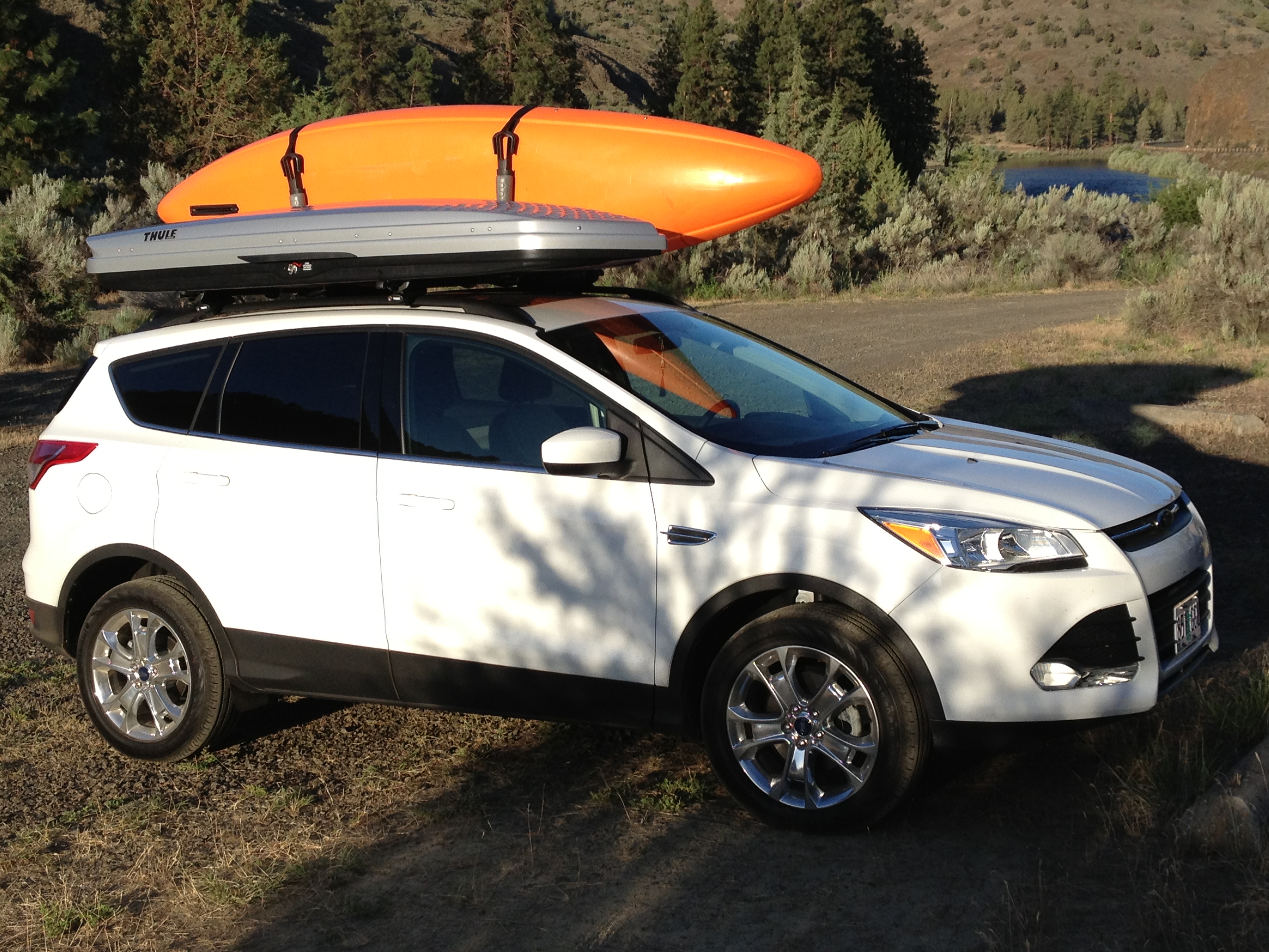
In April 2021 I had a couple of mid-week days off, and a great weather forecast. I also had a newly minted fishing license and was anxious to go angling! The John Day River is a beautiful, snow-melt fed river originating in the Elkhorn Mountains of northeast Oregon. Its flows are most favorable for fishing and rafting in the late spring to early summer. After that, as the snow melts, its levels drop. I hadn’t been out there in some years, but I remembered a riverside business at Service Creek. It’s called Service Creek Resort. looked at their website, and discovered they were launching a glamping (luxurious camping) area! I called, and they told me to come on out. I would be their first and only customer, being so early in the season. It’s a 4-hour drive through the beautiful Columbia River Gorge and into the rolling farms filled with rows and rows of wind generators.

Service Creek Resort is a multi-service operation. They rent river rafting gear, have a shuttle service, a small bed and breakfast, a restaurant, and the new glamping area. It is in a field behind the bed & breakfast. In old-school style, a staffer was waiting for me at the B&B and came out to greet me. I parked at the B&B, we boarded an ATV and she took me to my glamping tent.

The B&B has several rooms to rent. Glamping is behind, across the creek!

The glamping area has several tents of different configurations in a field. There is a common area with a fireplace, propane grills, and games like foosball.

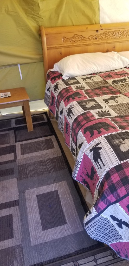
My tent was set up on a platform. It had a porch with chairs. On the inside, an area carpet, king size bed, nightstand, and sofa. Very comfy! $65 a night.
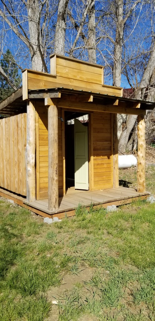
The staff was great! As I work in the paddling business, and we rent rafts and other gear, I was instantly brought into their family. We heartily shared stories about customers and renting gear. I felt right at home.

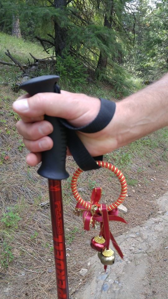
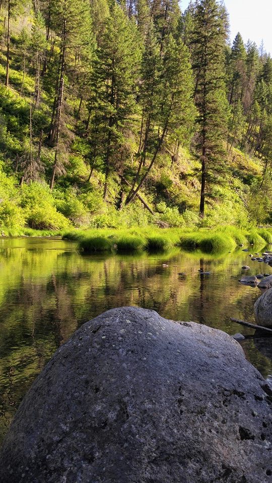
I took my fishing gear down to the river and tried my luck. A number of fishermen floated by on rafts, in inflatable kayaks, or drift boats. VERY beautiful. It is canyon country, and in springtime the canyon walls can become green.

I picked a spot easily accessible by foot, with a deep pool I hoped held fish. After some time, and trying different lures, a strike! The John Day River is a warm river, and holds lots of Smallmouth Bass. The fight was on! But this one got off. Oh well, try again. After a few minutes another hit! This one I brought home. It flip flopped around and got all dirty but I snapped a photo.

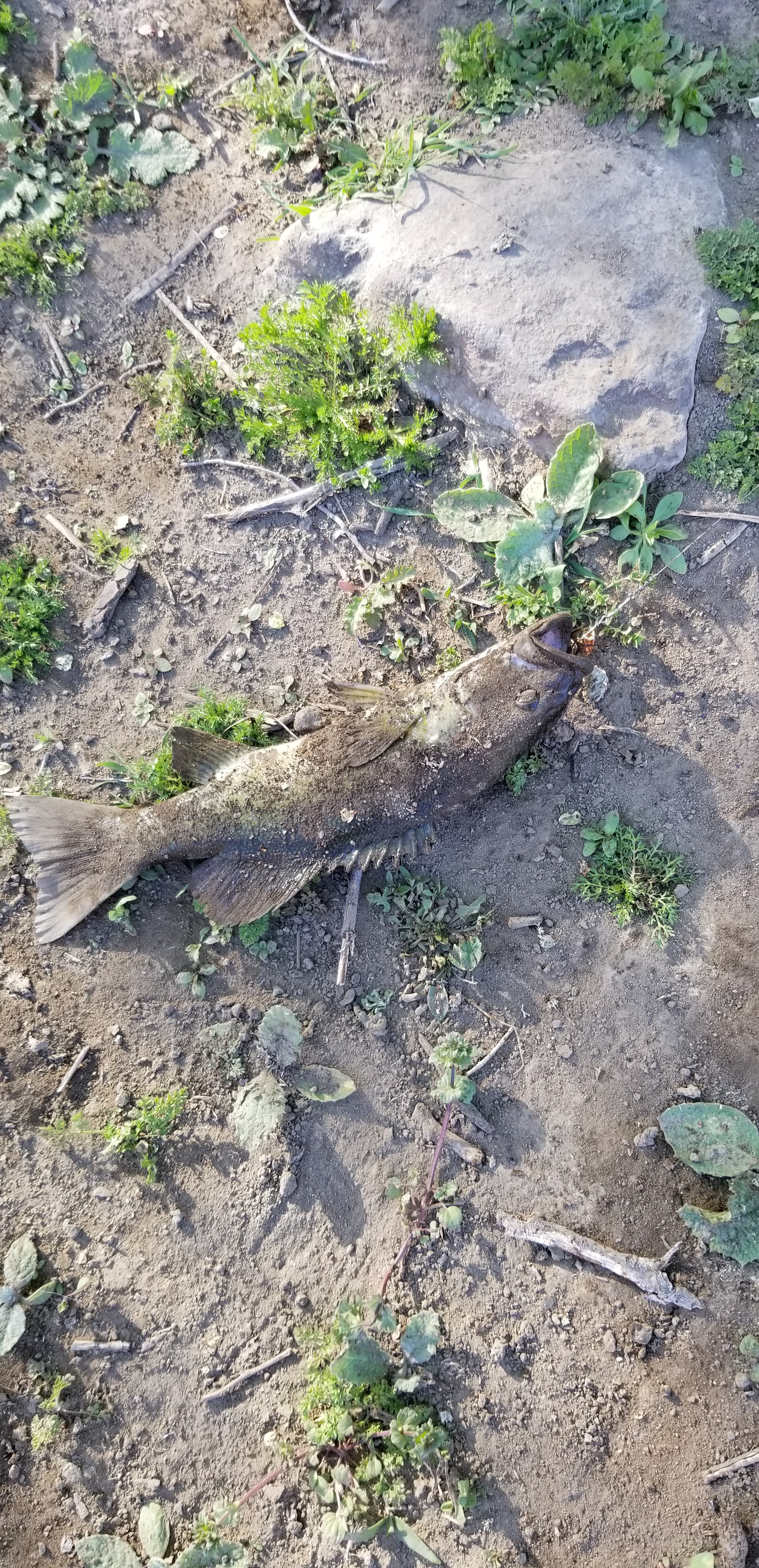
That made my day! When I showed the photo back at the restaurant the waitress said it was a good one. I quickly took out the hook and let it go back into the river.

I had dinner at the restaurant, and enjoyed sharing stories with the staff. The waitresses on this night were high school girls, and this was their first night of the season. So I was their training guinea pig! It was super fun.

Sleeping in the tent was very comfortable. The bed was sumptuous. I left the mosquito netting at the front zipped, but left the canvas open. Later in the night, a breeze kicked up and I closed it up. It warmed up quickly without the breeze. It was so nice I would definitely do it again! Glamping is glorious!


North Fork John Day River Backpack

26 08 2016

River Evening Peaceful

The peaceful nirvana of early evening at the Oriental Springs Campground

In July, Laura and I planned to backpack a 10-mile section of the North Fork John Day River in central eastern Oregon’s Blue Mountains. The entire river is a nationally designated wild and scenic river, so we were very excited! I had hiked the eastern portion back in 2014. This time, the plan was to try hiking from the western end. The whole trail, some 50 miles, is steeped in gold-rush history. Back in the 1870’s gold was struck in the area, and thousands braved the wilds to strike it rich. Today, although the big mines are mostly gone, there are still active mining claims with people panning for gold! I’ll post a blog about that next. But for now, it’s about the backpacking.

This hard-to-reach trailhead and backpack had been on my list for many years. It took about 5 hours from Portland. Even when you get off the state road, the dirt road/4WD track to the last campground and trailhead is many miles. Due to the long drive, we just planned to car camp the first night at Oriental Springs Campground. Arriving about 5:00 p.m., the heat of the day had passed. The river sits in a tight valley, and the shadows were already beginning to lengthen.

Oriental Campground 
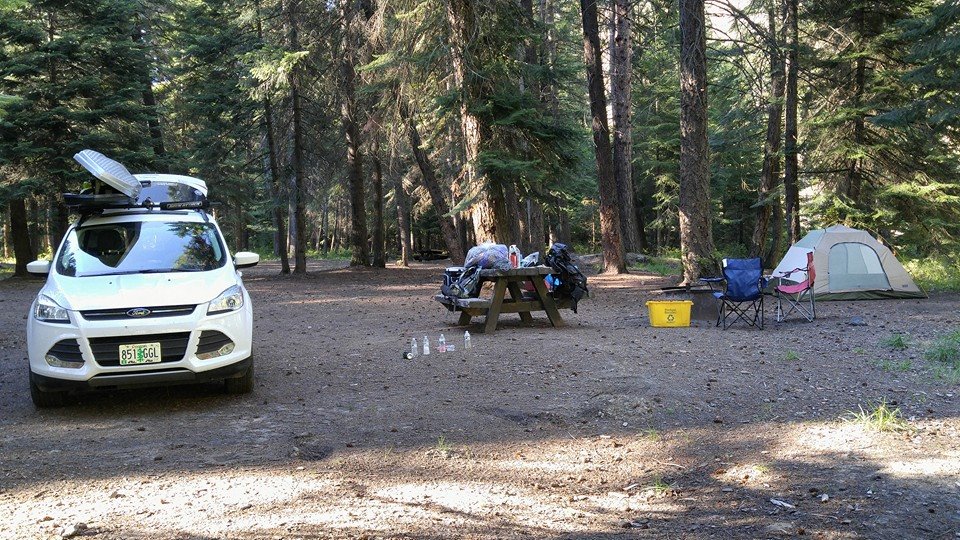
We had the whole place to ourselves. There were lots of puddles on the road – and blow down. There must have been a recent thunderstorm. Though most of the area was dry and dusty, the evidence of rain was there. Despite the standing water, there were no mosquitoes. Lucky us.

Laura found the campfire to her liking! Laura Fire Oriental Campground

In the morning, we sipped coffee, ate breakfast and packed up.

It was a moderately cool morning. Very pleasant!

Not in a hurry, we didn’t plan on hitting the trail until maybe 11:00. Big mistake.

Laura packed for backpack

Packed up and ready!

With the car locked and packs filled, we hit the trail. My research revealed that this is bear and cougar country. So, we both wore jingle bells on our wrists and used trekking poles, which made us very noisy to any hungry or motherly creatures out there! And merry makers to others.

Bear Bells

Bear bells highly suggested!

The trail lies on the northern (i.e. sunniest) side of the river. The forest here is amber-colored bark Ponderosa pine. If you’ve never been in a Ponderosa pine forest – I need to describe. Instead of tightly laced tree branches typical of Douglas fir forests – which are shady and therefore offer a cooling effect, Ponderosa pines are spread farther apart, with not nearly as many branches between trees touching. Hikes in Pondersoa forests are more vulnerable to hot sun. This one is no exception.

The valley slopes reached skyward immediately from the northern side of the trail. Soon,  the place became a convection oven! We had no relief from the sun or the broiler-like hillside next to us. But there was more. There was winter blowdown. Packs on, we climbed over or slithered under fallen trees.

It didn’t take long for signs of large wildlife to appear. The recent rain and puddles left some flat, muddy areas. Anything walking over would leave footprints, betraying its presence. We noticed deer, elk, and then – bear and cougar prints!

Bear Track

No doubt about what left these prints!

Not long after, and right smack in the middle of the trail, we saw a pile of poop. Not just any pile of poop. Because whatever this creature ate it was full of seeds! Bear scat. Between the trail and the river at this particular point is an area full of blackberries. No doubt this bear was feasting.

Heat aside, it’s a very beautiful river. It winds lazily along, and except for some deeper pools, it’s about 2-3 feet deep. But the heat quickly got to us. We found an open place for lunch and discovered it was a camping spot. It didn’t look like it had been used recently because growth was starting to cover the fire ring. As hard as it was to accept, we actually decided to base camp here. It was a place that offered shade!


Feeling guilty and pretty annoyed about the heat and the fact that we’d only covered 2.5 miles, we decided to hike further up the river. What we discovered unexpectedly justified stopping to camp were we did.

We didn’t find anywhere suitable to camp. And grass plus brush had assertively grown across the trail, about knee high. We wore shorts. And I’d heard stories about lots of ticks from other hikers recently. So we pressed on, but were constantly checking our legs for critters.

Eventually we’d had enough and, frustrated, we started back. Just when we began to get cranky, I saw a possible wading spot. We walked down there and waded out into the river. This was the respite we needed. More, we realized, this what this day was all about. Sitting in the river, with it flowing over our overheated souls, we cooled down enough and it became almost meditative. Impossible to get out.

Laura on rock in river

We spent time here, and then back at camp, spent more time just enjoying the water! Well, what to do with the rest of our time out here? We decided to get on the trail early the next day, before the heat picked up, hike out, and then drive over to Anthony Lakes and car camp.

Laura on Anthony Lake

An end-of-day happy hour at Anthony Lakes!

Anthony Lakes is a year-round recreational area. In summer there is camping, hiking, boating, and fishing. And even some sailing. It’s elevation is over 7,000 feet, so it’s got dry powder snow in the winter. The Anthony Lakes Ski Area is popular with locals all winter long. Plus, there are lovely Cross-Country trails all around. The stars were really spectacular. All together, we had a nice trip!


Oregon’s Ochoco Mountains and John Day River Picture Gorge: Journey Thru Time Oregon Scenic Byway

30 08 2013

Journey Thru Time Car

Uh Oh! Am I going back in time?

Planning my trip was a bit of an effort. The route I wanted to see in inner NE Oregon wasn’t all that clear – I had no less than four maps and guides. Some showed route numbers, and some just gray lines on the map. Others showed possible ghost towns, like “Greenhorn,” “Granite,” “Sumpter,” or “Susanville.”  And others still showed tent icons where one might camp along the way. So, I pieced together a route from all these sources. Looking at it in total, I decided the most rewarding way to head out there was to use Oregon’s highway 26. That would take me past Mount Hood, into Central Oregon, through Prineville, and up and into the Ochoco Mountains.

From there, the road would meander along the John Day River and the Journey Thru Time Oregon Scenic Byway. What better way to get to inner NE Oregon? The other way would take me via I-84 which I have seen so many times. Highway 26 meanders through farms, ranches, and small towns such as Mitchell, Dayville and Prairie City, all the way to its connection with the Elkhorn Oregon Scenic Byway.

I’d need to get an early start. So the night before, I packed the 2013 Ford Escape SE. The weather forecast looked great. I would be on the road by 8:00 a.m. And what a day it was. Sunny and bright. I’d just had the car’s first oil change, so it was ready. Packed up, iPhone 4S plugged in with 1,840 songs, ready to go!  No kayaking this trip so I removed the roof rack to get max mileage. I’ll have grilled pork chops tonight with mashed potatoes and salad. But I dunno where I’ll be camping. Just figure it out. See how it goes.

On my way. Up and over the Oregon Cascades, through Blue Box Pass, about 4,400ft. Then into the Central Oregon Plateau past Madras. From here, I can see Mount Bachelor (9,068 ft), the Three Sisters (10,358 ft),  Broken Top, Mount Washington (7,800 ft) Three Fingered Jack, Mount Jefferson (10,450 ft) Olallie Butte, Mount Hood (11,241 ft) and even Mount Adams (12,280 ft)!

I climb the Ochocos. These are high dry mountains. It’s pretty up here. Ponderosa pines are everywhere.

OchocoDescending toward the John Day River Valley, the view is unlimited, the sky crystal clear.

The road eventually drops into a crack in the earth – the Picture Gorge. In the Picture Gorge, the John Day River has followed a fault line for millions of years. That is right.

And it has flowed here for so long that it is older than the mountains themselves. When the flood basalts erupted and flowed all over eastern Oregon millions of years ago, the John Day River kept on cutting through on its way to the Columbia. Thousands of feet of basalt layer caked one upon another but the John Day continued cutting.

Today, the John Day river flows north right through the ascending basalt layers, even as the highway descends in the opposite direction. There are few places on Planet Earth where a river seems to flow INTO a mountain, rather than out of it. This is one such place. I saw another in New Zealand, when I was there in January 2013.

Not long after the Picture Gorge, highway 26 opens up into a beautiful valley filled with farms and ranches.

It is here one finds the entrance to the John Day Fossil Beds National Monument and Oregon’s Painted Hills. I’m not here to see these treasures, my quarry lies beyond.

But I am enjoying the view, and by noon getting hungry. The town of Mitchell comes within striking distance, so I decide to Stop in Mitchell, Oregon and grab a bite for lunch. Mitchell1

Like a lot of eastern Oregon towns, Mitchell has seen better days. Yet, it has enough character to hold up all its own. Townsfolk lazily walk the street, stopping to seek shelter and converse under a shady porch or tree.

Mitchell2Nobody is in a hurry in Mitchell!

My lunch spot today is to be the Little Pine Cafe, right on main street.

Its customers this lunch are myself, a family from Portland, and a mother with toddler. Mom and toddler regularly go behind the counter to pick up condiments or change the station playing on cable TV.Mitchell3

I pick the Mushroom Swiss burger and a side of macaroni & cheese. Turns out to be fine and dandy!

Adorning the walls are pictures of John Wayne, Clint Eastwood, Gene Autry, plus locals over the years. There are a lot of dollar bills with various scribbles thumb-tacked to the walls. One says, “Brought my boyfriend from CA up here. He says, this explains a lot!”

I can only imagine. I depart feeling satisfied, planning to return on my next pass through.

Today’s drive will take me through the towns of John Day, Prairie City, and into the Elkhorns, into Sumpter and Granite.

Check back on the next blog post for Elkhorn Mountain trip journal entries!


A Scenic Road Trip through NE Oregon – Journey Thru Time Oregon Scenic Byway, Elkhorn Oregon Scenic Byway, and Blue Mountain Oregon Scenic Byway

30 08 2013

Journey Thru Time BywayFor years, inner NE Oregon has been on my bucket list! I have seen the areas around it, but never been in the thick of it. I have been to Halfway, Oregon. I have been to Hells Canyon. I have hiked the Wallowa Mountains. I have backpacked the Strawberry Mountain Wilderness. Three of Oregon’s Scenic Byways lie there: Journey Thru Time Oregon Scenic Byway, Elkhorn Oregon Scenic Byway, and Blue Mountain Oregon Scenic Byway.

I have always been curious about the less renowned Blue Mountains, and the Elkhorn Mountains. The Central Cascades and Wallowas get all the attention. In the Blue Mountains and Elkhorn Mountains lie the headwaters of the John Day River – the North Fork and Middle Fork.

Elkhorn Byway

And 19th Century history lies here. Gold Rush ghost towns, abandoned mines, mine tailings left behind by Chinese prospectors.


Blue Mtn Byway

The John Day River cuts through a swath this region – made famous by the John Day Fossil Beds, where huge discoveries of Ice Age fossils were made. It meanders lazily in the valley underneath the Strawberry Mountains, where cowboys tend cattle and farmers raise grain. In the Elkhorn Mountains, the road passes gold mines before climbing to over 7,300 ft. then descending to the jewel of Anthony Lake.

Oregon’s Blue Mountains are high altitude rolling hills and vast meadows with limitless views of the Columbia Plateau and John Day River. There, one can simply camp on a horizon-to-horizon meadow, with not a care about neighbors whatsoever

This area is full of beauty and history. But not crowds. By comparison, Central Oregon seems downright urban! It has its own beauty, which is not overwhelmed with volcanoes dominating the view. My next few blogs will cover this beautiful, often overlooked, region.


John Day River Oregon: A Day Running the River!

9 07 2013

IMG_0587Fraternity brother Tully Alford and I spend some “bro time” every summer camping. This year, for our first camp-out we returned to the John Day River. It’s in dry central north Oregon, an area way below the radar of many outdoor enthusiasts, yet if offers tremendous opportunities for those venturing there! Imagine floating down a canyon-walled river. With every turn, a new world unfolds. Not a house or road to be seen. Eagles and hawks float above, bass swim below. Yet only two and a half hours from Portland!

This year we decided to float the river – camping and the using a river shuttle service to pick us up and deliver us to our car at the end of the run. The John Day River is famous for long, flat stretches of running river with rapids connecting them. And for beautiful canyons with layered rocks overhead.

IMG_0579We packed up my new 2013 Ford Escape with Jackson Kayaks Rogue 9 and Rogue 10 kayaks. These kayaks are perfect for this trip, because they are good for the whitewater stretches, but also have a rear hatch – good for storing gear and food – and a skeg for the flat sections so they can be paddled straight.

IMG_0582

Tully getting ready at the put in!

As Tully had no experience in whitewater I gave him a tutorial on entering and exiting the main current into eddies. And, I explained that in rapids there are these things called “holes,” though I couldn’t really explain what they do. So you know, a hole is a backwash behind a boulder. If your boat gets stuck in one, it can be difficult to get out. Your boat gets “sucked in” by the hole.

Running the John Day River is characterized by long stretches of flat water separated by rapids. The plan was for me to run the rapid ahead and Tully follow me through. This worked great until the very end of the day.

I was very impressed! Tully made it through everything and found it fun!

IMG_0586

Tully chills out after a rapid…

Tully began the day in a wetsuit but as the temperature rose, he felt heat-distressed and at lunch took it off. The Jackson Rogue 9’s hatch took the wetsuit with lots of spare room. Lunch was sumptuous. We found a shaded peninsula and made sandwiches of mayonnaise, Dijon mustard, turkey, lettuce, cheddar cheese and tomato. Plus fresh oranges for dessert.IMG_0588

Back on the water. The river and canyons unfolded one after the other. We heard, but could not see, Bighorn Sheep in the hills above. We saw bald eagles. The occasional Smallmouth bass swam below.

The run was from Spray to Service Creek, about 17 river miles. We were told it would take all day. I never believed it, but it was true. We set off at 10:00 a.m. and took out at 4:00 and we were pretty tired. It was a great day. The John Day River took its prize in the last rapid, the hardest of the day. As we approached, I could only see the horizon line and nothing of the features below. We had agreed we did not want to bother scouting, because none of the other rapids were all that hard. As first paddler I went in. Immediately I noticed three holes and lined up my kayak to pass by each one. However, on the second hole, there turned out to be another right behind it, invisible from above. After scooting by the 2nd hole, I darted across and paddled hard past the surprise hole. Tully was not able to do that, and got stuck in that hole. I did not know this until I had made it completely past the rapid and into the pool beyond. Then I looked back and saw carnage! Tully holding on to his boat, but the paddle, spray skirt, his glasses, etc. were floating by and sinking. He looked pretty shaken up and I towed his boat to the shore and he grabbed on.

We kayaked the last stretch and hauled out. No matter, we had a GREAT day on the John Day River!

The evening meal was grilled salmon, salad and mashed potatoes. IMG_0581

IMG_0580IMG_0589


And lots and lots of beer! Tully caps it off with a rendition of The Grateful Dead’s “Ripple.” There’ll be some more campouts coming this summer!


Memorial Day Camping along Oregon’s John Day River – Escaping the Rain!

30 05 2011

Lazy days in Mitchell, Oregon

2011 has been one of the rainiest/coldest on record in Oregon. With only a few sunny days in the 70’s, May has felt a lot like February! The summer season typically kicks off in Oregon’s Cascades around Memorial Day but in 2011, all the mountain campgrounds are still under snow!

Solution? Head east! Oregon’s reputation for rain belies the fact that most of the state is high desert.

When most Oregonians think “high desert” they think the Three Sisters / Bend region. While that area has great weather and is beautiful, it’s become full of tourists.

Truly beautiful and overlooked is the region between Condon / Service Creek / Spray and Mitchell. Head there and you’d think you were in northern Arizona. Plus, locals are really friendly, it hasn’t been wrapped in tourist trap coffee shops, wildlife art galleries and microbreweries. It’s as it was.

I got three days off from Alder Creek so I could spend some time out there, to help celebrate my upcoming 50th birthday. My longtime friend from college Tully Alford came along. We loaded up the bikes and overburdened my VW Jetta Wagon with campfire wood and headed east! We had great weather that first day.

I’d scouted the area in early May and found this BLM Campground called Muleshoe right along the river. That was our target. Once past Service Creek, along Oregon Hwy 19, we came to the campground. True to form, the road was empty, as was the campground. We had it to ourselves!

Some campgrounds offer both sites with drive-in parking and other sites called “primitive” or “walk in.”

I have always found the walk in sites superior to the others.

These sites are more separated, with more trees and shrubs offering a more privacy and outdoorsy experience. True to form, at Muleshoe’s primitive sites were far and away the best. In this region, shade is paramount, and we picked a site with a lovely juniper tree above the picnic table.

So we set up camp, including the QuickUp shelter borrowed from my neighbors Janis and Brent Campbell! That shelter is KEY. Not only does it provide much needed shade on hot desert days, but we wound up spending a couple hours underneath it our second night, during a rainy spell!

Yes, although these photos show the sun, we had all kinds of weather in three days. We began with sun in the high 70’s, with a warm star filled evening, but day two broke cloudy. No rain until after 5:00 though. Then a cold front swept through with some wind. We weighed down the canopy so it wouldn’t blow away. I had to don a winter parka. The following morning was 100% clear, warm and bright. I ditched the fleece for shorts. But on our return through Prineville, that same day, we had some snow flurries! That’s 2011 spring in Oregon…back and forth all day.

The area is geologically significant, and its geology made fossilization of millions of years of plants and animals possible. We were driving the Journey Through Time Highway.

Going back some 60 million years, repeated ash falls from volcanoes and basaltic flows covered the area.

The region is a pancake of layers of ash, basalt and other evidence of such activity.

Those layers have been uplifted by tectonic forces lying deep beneath Oregon, the North American and Pacific Plates, which intersect there.

All these layers are younger than the dinosaur era. So there are myriad early mammals that sprang up, evolved and became extinct.

We took a hike up one of the fossil bearing canyons. It was completely otherworldly in there. There were examples along the trail of turtle, saber toothed cat and bird fossils.

Later, we visited the John Day Fossil Beds National Monument Information Center. It’s worth visiting and we took in an 18-minute film detailing the rich fossil record found in the area. The ash falls fell on creatures and the chemical nature of the ash preserved them.

Our last day dawned clear and warm. After excellent breakfast of oatmeal, blueberries, banana, yogurt and a few strips of campfire bacon we headed back to Portland through Prineville. It snowed on the way to Prineville! Maybe we’ll have summer in Oregon…but when?