 My interest on this trip was focused on the areas around the North Fork John Day River Wilderness Area. I’d be driving Oregon’s Route 7, Route 73, Route 20 and Route 52. Today, I’d pass through Prairie City – on state highway 26, on my way to Sumpter, Oregon. This is 100% marked as scenic on the maps!
I’d be camping at Anthony Lake, though I didn’t know it when I began. I will tell you the drive along Oregon’s Highway 26, the Journey Thru Time Oregon Scenic Byway, is serene and calming. It wends its way through ranches and farms and small towns like Mitchell and Dayville, with less than 250 population. Absolutely nobody is in a rush here.
A few dozen miles east lies Prairie City. They’re making an effort to refresh main street here, and it looks pretty. I fill the tank with gas, and here they still clean your windshield! Then Oregon Route 7 intersects, and I’m on my way up to the Elkhorn Mountains, climbing all the way.
This is GOLD RUSH territory! In 1883 Sumpter was founded. By 1897 a railway reached the area, and the population grew to 2,000 as gold mines and claims proliferated. There were 12 miles of underground tunnels. Even today, I saw staked out gold mining claims!
 These days Sumpter is preserved as a tourist attraction of Gold Rush history. Much of it has been restored to look as it was. I even saw a fort. I wondered if that fort was supposed to look like the Civil War Fort Sumpter? To me, it looked like it was right out of the 1960s TV series “F-Troop.”
Two of Sumpter’s main attractions are the Sumpter Valley Railway and Sumpter Valley Dredge. The railway, opening in 1890, was built to haul lumber 22 miles to Baker City. Within two years it was hauling passengers and freight. Today, it is a 6-mile narrow gauge tourist ride.
The Sumpter Valley Dredge is a monument to capitalism and 19th century technology. These 4-stories-tall dredges floated in ponds, and as they dug, the ponds moved with them. They consisted of conveyor belt of buckets to dig earth and carry inside for processing, the internal processing machinery, and another conveyor out back to dump out the waste. There were three of them in the valley. Ironically even though they only employed three workers each, they ended their machine-lives $100,000 in debt. 
Climbing out of Sumpter, the road switchbacks ever higher. I drive along a high altitude creek lined with mining claims, and with piles of rocks which could only have been left by days-gone-by gold prospectors.
Then I reach Granite, elevation 4,695. Granite’s population is 38. It looks bigger than that. It’s got a “Welcome to Granite” sign over the road. It’s got a fuel depot and a hotel. Still, it has a look and feel of a genuine frontier town. Founded in the 1880’s, granite boasted a population of 86 gold miners by 1940, but in WWII, the government ordered gold mining shut down to make miners dig for “esse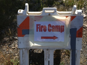 ntial war effort” materials. Granite collapsed, and never recovered.
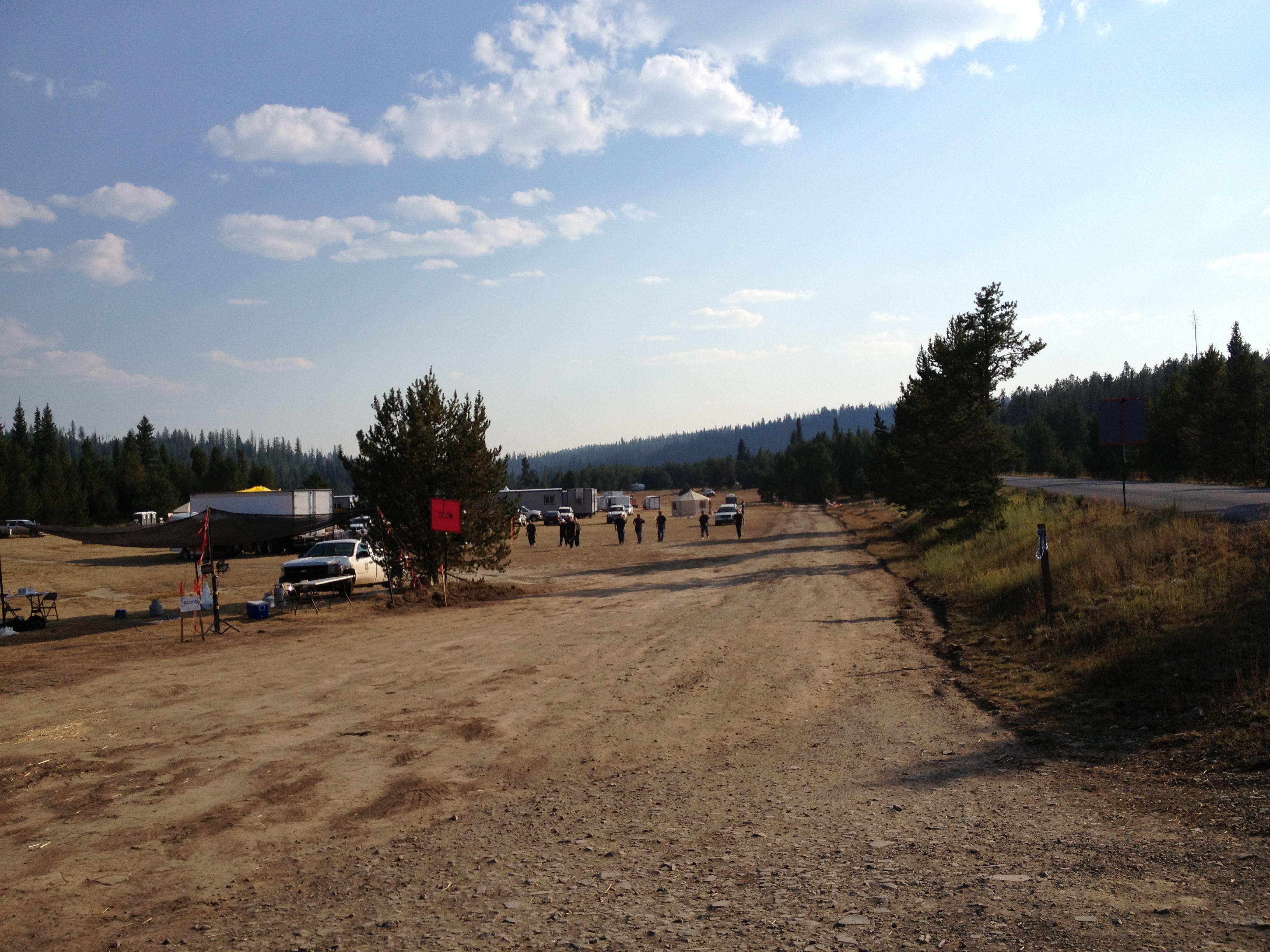
Past Granite, I made up my mind that I would camp at Anthony Lake, some 40 miles distant. I’d be cruising the Elkhorn Oregon Scenic Byway. On my way to that byway I ran across something unsettling – a Forest Fire Camp. During this trip there was a giant fire threatening Yosemite National Park, so forest fires were in the news.
Yet I didn’t know that the Forest Service established camps supporting hundreds of firefighters even before a fire started. Wow. That is serious.
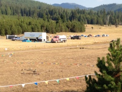 The camp I saw was several acres, high in the mountains, in a big meadow. And as big as it was it was clear that there was room for probably a thousand men up there.
 That made me much more aware of the gravity of the situation.
Beyond the Fire Camp, I ran into something I came out here for. It is the trailhead for the backpacking trail on the North Fork of the John Day River. I had heard about this many years before and now I was here. Too bad I am injured now, and can’t do it. But I will be back.
 It’s very very pretty up here, and there are just not a lot of people to bother you. That is the beauty!
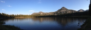
I decide to push east and camp at Anthony Lake. I have been there to ski in the winter, but never seen it without snow. I just have to check it out. On the way I reach a high point in the Elkhorn Moountains, about 7,250ft.
The view goes on forever. It seems a high plateau goes on from here and one could backpack quite a ways.
Then I descend down into the Anthony Lakes area.
The lake is much smaller than I remembered, as I had cross country skied around it two times in the past.
 I had imagined it would have campsites on it. But nope. The campground is to one side, and it has day use areas on the other. There are walk-in sites to another side.
I also paid a visit to Anthony Lakes Ski Area.
Without snow, it looks so different. I quickly realized I could actually drive around the lodge and onto some of the lower slopes I had skied!
This was pure devilish fun! Well, with that bucket list item checked off, I returned to the campground and made my meal. I grilled a pork chop, made mashed potatoes, had an awesome campfire, and salad. Then, off to sleep.
I had hoped to see a million stars – but that was not to be. The smoke from the Yosemite fire partially obscured a picture perfect view. Next time I guess!
xx
44.745707
-118.202163
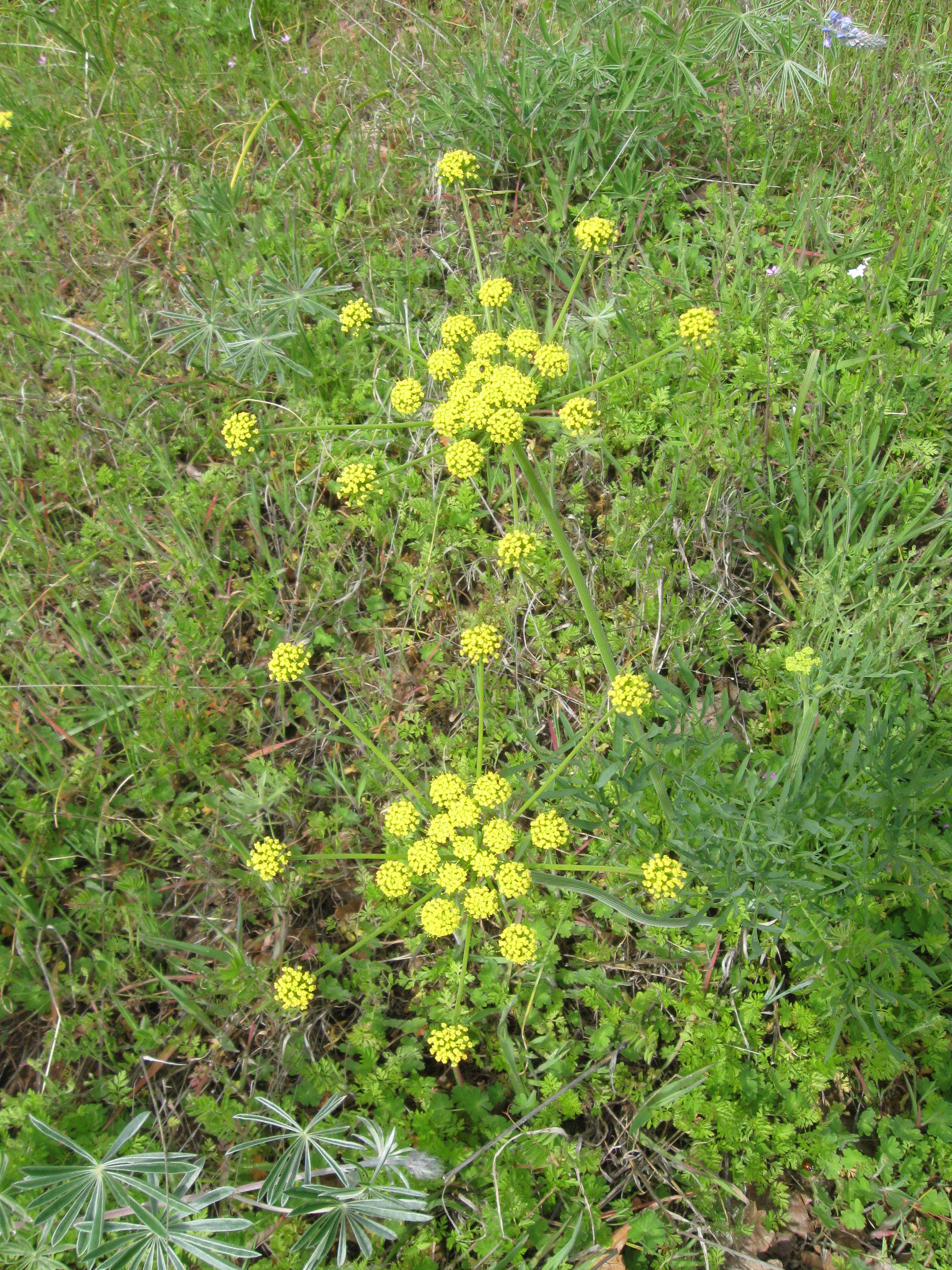
 ril in Portland, OR, and this year’s warmer, drier winter has made for early wildflowers in the eastern end of the Columbia Gorge! With a window of nice weather Laura and I headed out east of the Cascades, where wildflowers carpet the sides of the valley. Laura found a less-frequented hike on the Washington State side, named Lyle Orchard. It’s about 5 miles round trip and climbs to 1,100ft – which offers a spectacular view of the Gorge and the flowers.


