A Trip Kayaking and Snorkeling in Belize – An Introduction

20 04 2014

ImageThe next series of posts to Cabin Fever Chronicles shall focus on a sun-splashed week I spent on Half Moon Caye, a tiny coconut palm island on Lighthouse Reef, 50 miles off the coast of Belize.

Why Belize? Why did I pick this trip? For starters, I usually think of mountains and cultural immersion when fantasizing about an overseas trip. This time, I wanted to switch it up. I’ve been to hot, humid, jungle destinations like Laos, Cambodia, or Northern Thailand. I actually was close to picking a trip to the headwaters of the Amazon. But for the past year I’ve found myself researching places with healthy beaches and coral reefs. I cannot stand big resorts or cruise ships. No, I wanted an adventure. I have not snorkeled on a healthy coral reef since I was 14 years old. More recently, I snorkeled on some reefs off Bali, Indonesia, and Sayulita, Mexico, but these were in decay. Many of the healthy reefs are in the South Pacific, some elsewhere in Indonesia or The Phillipines. I also found myself on the Internet searching for Pacific Atolls. Along the way, I came across rare coral atolls in the Western Hemisphere – and most of them are in Belize.

Another factor in deciding on this destination was my injury. If you read a few blog posts ago, you know I sustained a lumbar injury lifting a kayak – which referred down my hamstring. I’m still healing – so full-on camping is not comfortable right now. But I found a trip with Island Expeditions, and they have tents on Half Moon Caye that have beds in them. Perfect! This trip would involve kayaking, kayak sailing, fishing, and lots and lots of snorkeling. I can do all of that even with my recovering injury. This trip would be a perfect mental-health break from the injury-related-life I have been leading of late.

Belize. It is a country on the east side of the Yucatan Peninsula. The coast faces east – the Caribbean Sea. Formerly British Honduras, Belize, which became independent in 1982, has a population of 324,060, and locals speak English, Spanish, and Creole. Inland, there are Mayan ruins, a few rivers which are fun for whitewater, and interesting caves to explore. Its highest mountain, Doyle’s Delight, is 3,688ft high. The country is only 180 miles long and 68 miles wide – not counting the atolls off the coast. The population is split amongst ethnic Maya, Maya/European (Mestizo), Creole, and Barifunda (African Descent).

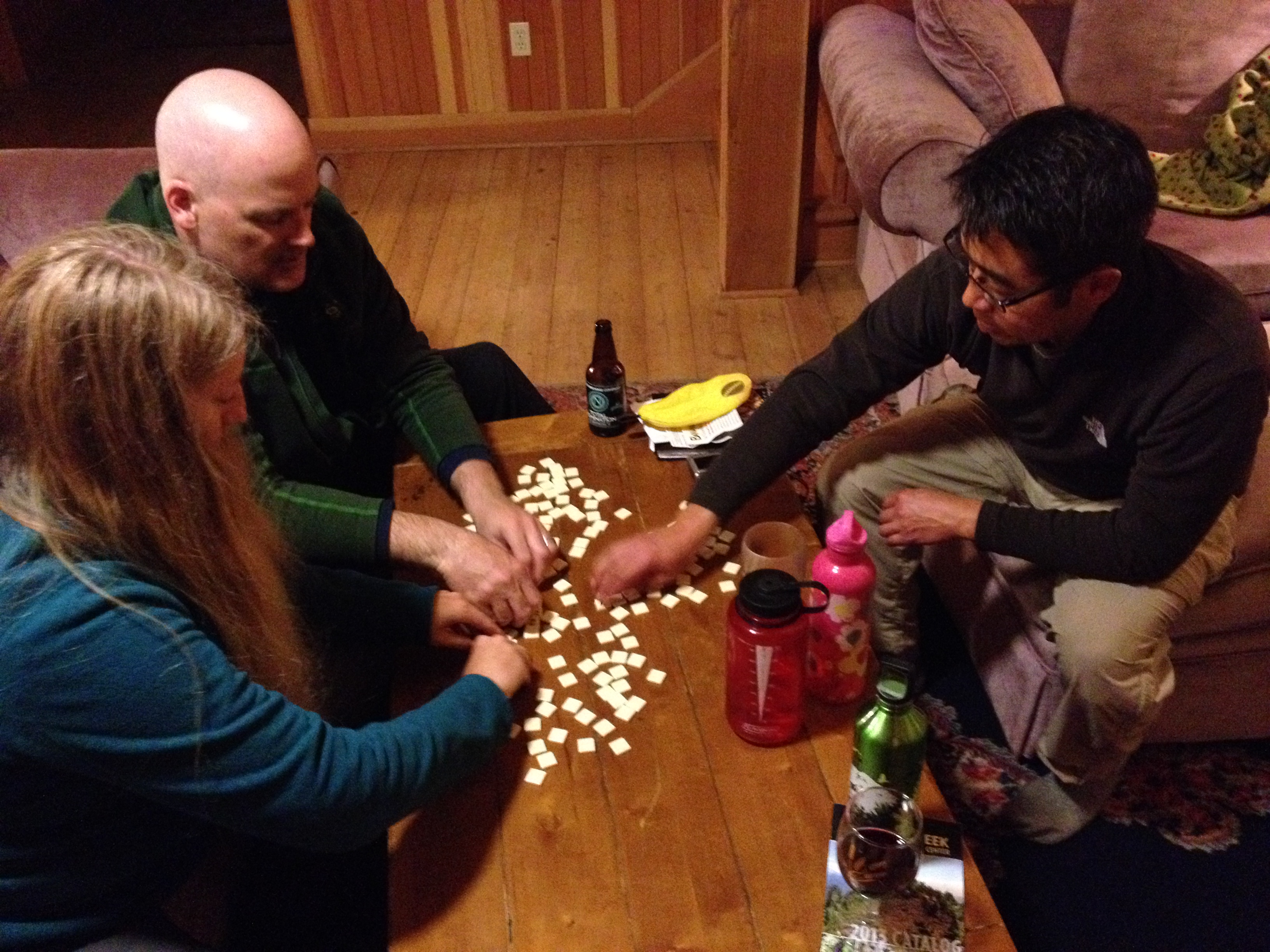
My flight to Belize was an overnight flight, from Portland, Oregon. Our first day was spent gathering up the seven souls participating in our Gilligan’s Island adventure. We would spend the afternoon and evening resting at the Bird’s Eye View Lodge, about 45 minutes from the Belize City Airport.

The following day, after a quick cruise on the lake, we drove to Belize City and met our boat which would shuttle us out to Lighthouse Reef. Our guides oriented us to the reefs off the Belize Coast, and our route out to Half Moon Caye.

Our route today!

Our route today!


Opal Creek Oregon – Explore Ancient Forests

9 03 2014
Image

Here I am at the entrance to Jawbone Flats. A few hardy souls make this their year-round home.

We recently spent a weekend at the cabins at Opal Creek Oregon! Opal Creek Ancient Forest Center and its Jawbone Flats Cabins sit inside the Opal Creek Wilderness, the largest old-growth wilderness in Oregon.

It’s about a two hour drive from Portland. The village houses the Opal Creek Ancient Forest Center, plus cabins in which visitors may lodge. All around lies the incredible ancient wilderness with its myriad trails, crystal pure creeks, and countless examples of edible plants such as mushrooms.

Image

The village is a museum of early 20th Century mining equipment. The irony that is Opal Creek Wilderness is that an extractive industry saved the old growth forest, while rampaging logging was going all around it. It was privately owned mining operation and never logged. Later, a political movement launched a campaign to preserve the area and in 1996 Congress established the Opal Creek Wilderness. The village is “off the grid,” meaning all electricity is locally produced by a small hydroelectric generator harnessing the creek’s power.

To get to Jawbone Flats, you must hike two miles from a parking area. You need to bring in everything you need to eat. Kinda. There is a twice daily shuttle that can bring up your stuff from the parking area. It’s a really pretty hike by Opal Creek. Along the way you pass by some dilapidated mining equipment.

Image

We reached Jawbone Flats and found our cabin. It’s really nice! You can probably house 10 people in the cabin. Very comfy, and the rear of the cabin has a deck overlooking the creek. Then we settled into our rooms.

Next, we headed out onto some trails! Opal Creek Wilderness is truly a jewel! The old growth evergreens are unmatched, and the creek is so pristine.

ImageIt’s such a beautiful area. I highly recommend it. If you go in the summer, the Opal Creek Ancient Forest Center has a menu of classes and trips to choose from, each guided by highly knowledgeable staff intimately familiar with the area.

Image

After our hike, we headed back to the cabin for happy hour, a wok cooking session, and playing board games! Lots of time spent chop chopping ingredients for the wok, and then delicious productions coming off the stove!

ImageImage

After dinner, it’s board game time! If you want a quiet getaway not far from Portland, and want to witness a forest ecosystem unchanged since ancient times, Opal Creek is worth a visit.


Rolling Hills to 22 Volcanic Craters Overnight: Waimangu Volcanic Valley

23 03 2013
IMG_3497

Mt Tarawera, at the end of Lake Rotomahana, split on both sides during its 1886 eruption.

Rotorua New Zealand was our next base camp. Rotorua sits on top of the country’s largest thermal system. Right inside the city of Rotorua, there are active geysers! And for hundreds of square kilometers around Rotorua, there are towns with mineral springs, mud pots, geysers, cracked mountains like Waimangu Volcanic Valley – it’s very evident that Planet Earth’s violent, and sometimes beautiful, geologic forces shaped, and are shaping the very area under your feet!

We were really interested in experiencing some active geology first hand. We’d heard Waimangu Volcanic Valley was pretty interesting. We drove out there. Not knowing much about it, I was not prepared for what I was about to witness!

A spring along the hike

A spring along the hike

We arrived at the park entrance, and picked up the guide pamphlet. It is a self-guided hike assisted at certain points by a shuttle. Reading the introduction, my jaw practically hit the ground.

This is a 17-kilometer-long valley. It contains the world’s largest hot spring, and once contained the Waimangu Geyser, the world’s tallest, reaching 1,500 feet! That’s taller than the Empire State Building. In fact, the entire valley was created in ONE DAY!

Steaming hot mineral deposits

Steaming hot mineral deposits

That’s right. If you can imagine. This was not fiction written from a novelist’s pen. It actually happened. This valley was someone’s ranch, just rolling scrubland hills. Then without warning, on the evening of June 10, 1886, Mount Tarawera, at the end of the valley, split open and erupted. Immediately following no less than 22 volcanic craters along the 17-kilometer valley were born. Plus a gigantic thermal geyser and hot spring area formed. It was the first time in recorded history mankind witnessed the birth of a geyser field!

The Tarawera volcano and craters of the Waimangu Volcanic Valley’s 1886 event are the sites of the largest eruption in New Zealand’s recorded history.

At the time, in 1886, the valley was devastated just like Mount St. Helens. What was once a lush forest with vibrant wildlife was laid to waste, nothing was spared. Atomic bomb shock waves flattened everything and ensuing pyroclastic flows atomized what was left. It was not long before the world learned of the fantastic event and tourists flocked to see the spectacle.

IMG_3490

Until 1904, there was a building for viewing the geyser, and then another eruption destroyed it and soon after the geyser ceased. As with Mount St. Helens, life began to retake the moonscape, and within a few decades, the valley regained its lush look. Except for the fact that there remained a few geysers, a huge lake, steaming rivers, hot springs, and hills that seem to smoke!

img0077

This geyser reached 1,500 feet!

Today visitors can hike the valley all the way to the end, where they can take a boat to see more amazing geologic features on the lake formed by the eruption. From that end point, a shuttle moves you back to the start.

IMG_3469

IMG_3475

You can make out craters, still smoking, in the forest

All along the way, there are more than two dozen amazing sights to witness!

The river flowing through the valley is filled with hot springs along its path. So, as you walk along and witness its flow, you’ll see how mineral deposits shape everything.

There are beautiful bird songs from bell birds and tuis. In the lake, I can count 91 black swans milling about. It becomes hot. Sometimes, you can smell sulphur from the steaming vents.

If you are seeking some hiking, exercise and really want an in depth up front experience of what earth can do, this valley will not disappoint!


Million-Year-Old Buddha Image found in Utah Canyon

11 05 2012

Morning broke bright and clear in our canyon. Some of the deepest blue skies I’ve ever glimpsed. At one end the canyon is watched over by the Gooney Bird rock. However this morning we see a column strikingly resembling a sitting Buddha at the head of the canyon! Could it be that this is a sign?

Buddha image from my collection.

I gazed upon it with awe.

Uncanny!

Hmmm. We also had other ideas. Perhaps it was a gigantic monument to the morning constitutional?

I could not help but think how it could have been that Mother Nature could sculpt such a figure. It sat facing southeast. In the sun most of the day.

It is another crystal clear morning to wake up to. I fixed the coffee and then we got the breakfast going.

In contrast to the canyon where we spent last night, there wasn’t any trouble finding a camping spot.

And here the canyon walls crept way skyward. So beautiful, all the different bands of colored rocks.


Even here there are a number of arches in the canyon’s rocks. It looks like there is something about this region that favors forming these arches.

This might be a box canyon. The end looks as if there might not be a way out. We walk up there.

Today, there are only two other cars camping in the canyon.

It’s desert. The sun quickly becomes warm and as we’re storing things for our trip back to Park City I can already see my skin turning red!

But we must get moving. It’s another bumpy ride back out over the rutted dirt/rock road back to the highway.

We’ve got a deadline back in town! Ed’s a goalie on one of the local amateur hockey teams and it’s playoff time!

The game takes place at the Park City Hockey arena.

This was actually a nail biter.

It went into double OT.

Then there was a shootout to decide.

It didn’t turn our way. But the players were still stoked as it was such a great game!

Our last day, Friday, Alex and I skied at Park City Resort, which is walking distance from Ed’s house. This was a real spring skiing day. Upper slopes OK, lower slopes too slushy – snow grabbing at your skis sometimes. But SO MUCH FUN!


Walking on the Viedma Glacier

21 01 2012

Last night we partied! It was Patricia’s birthday and the hostel was festooned with festive decorations. We had cake and champagne. Then everybody hung out and either played board games or watched videos. Meanwhile the wind outside howled, and occasionally whistled through any cracks in the insulation.

The Patagonian Ice Cap (left) feeds the Viedma Glacier

The Viedma Glacier is our destination today. We all get those box lunches, and this time I just toss my ham and cheese in the waste basket. But it’s got empanadas too, and I like those! We’re up and out the door by 9:30. We head down to a marina on Lago Viedma.

Lago Viedma is another huge glacier-fed lake that sits right out in the high desert. It’s 50 miles long, and is dotted with blue icebergs borne from the Viedma Glacier.

We are to board a boat which will take us around a point and into the lake, and then to the snout of the glacier.

Then, we’ll disembark for a few hours walking on the glacier itself!

The Viedma Glacier is the largest in Argentina. It doesn’t look as large at its snout as Perito Moreno, but above, it’s a bigger sheet of ice.

While it’s sunny back in El Chalten, here out near the Patagonian Ice Sheet, the weather’s so different. It gets even windier, and stormier. The lake is punctuated by beautiful indigo ice bergs. It still seems weird to me to see ice bergs in a lake! But here they are.

As we round a point and the boat swings west, we’re no longer protected by the land, and we face directly into the wind racing down the Andes. The sea state instantly changes into a storm, and the captain races the engine to push through the waves. Many of us had been up above on deck enjoying the weather, but we’re ordered to stay inside now!

As we near the glacier, many more icebergs come into view and of course the glacier’s snout. I am told that boats do not get close to this glacier for views, because instead of calving from the visible end, this glacier has an underwater shelf where it calves, and massive ice sheets suddenly shoot up from below. No boat wants to be on top of one of those!

A berg near the glacier's terminusThis should be really interesting – walking on the ice. Others here have done this before, but for me, this is my first time. I’ve used crampons climbing mountains in the Cascades but nothing like this river of ice.

So I’m pretty excited to give it a try.

We disembark and walk up the rocks near the end of the ice. This glacier has retreated, unlike Perito Moreno.

We are told the ice was moving over these very rocks 20 years ago. The rocks are all smooth. They have streaks across them and deposits ground in. These streaks are scours called glacial striations. They are where rocks embedded in the glacier cut down on the bedrock.

Our guides meet up with us and we get lots of information on the glacier, the ice cap that feeds the glacier, climate change, and about the upcoming hike and equipment we’ll be using today.

The main piece is crampons.

You wear crampons over your other shoes, and it’s best to put crampons on over hiking boots.

The ice today is a bit slushy/wet. It’s full of grit from its journey scraping along, plus winds carrying dust that has settled on the ice. The ice has cracked into thousands of vertical spires of ice. It looks un-hikeable, but we’re about to find out it can be done.

Our guide! Super cute.Crampons securely tied on, we head out onto the ice. These shoes bite into the ice, giving a firm grip. It’s a bit disconcerting to see the rivers of water gushing everywhere and the deep cracks. One slip and it looks like you’d be lost forever!

We climb all over and we’re not the only ones up here.

There are others learning how to use ropes to climb the ice walls. It’s interesting to watch them. We climb up and down “trails” the guides know.

We walk all over, and after a time I realize how easily one could become lost out here.

You lose track of your trail, and everything looks the same.

The ice flows up and down, and you feel like you are walled in. I’m super thankful we have the guides here. They are really professional; they guard any spot where you could slip and fall into a cravasse.

The guides take us into a dead end, and I kind of wonder what’s up.

They start digging holes into the ice. Then, their true plan is revealed…they have a little celebration in store for us.

They pull out some Bailey’s Irish Whiskey from their packs. We are treated to a toast of Bailey’s on glacier ice! Very nice.

Glacier ice and Bailey’s!

This was a fine hike.

Some said they wanted it to last much longer, but I found it a good introduction.

After all, I’d never done this before.

I felt satisfied with my first time on a g00d sized glacier! Up close these are really fascinating natural phenomena. After all, the ice we’re walking on is hundreds of thousands of years old.

Certainly something to celebrate!

With the Bailey’s finished we lumbered back to our starting point, to lunch on those ham and cheese sandwiches (except myself, of course). Then it was back to the wind tunnel (El Chalten).

Tomorrow is the big hike to Cerro Fitz Roy! I’m stoked to tackle it! I’m really enjoying being in the moment, taking each amazing day as it comes! Bring it on!


Torres del Paine at Last!

3 01 2012

Just to get the scale perspective, see the road by the lake?

Today, the highlights of our trip step up and will just keep on coming!

We drive two hours from Puerto Natales, Chile to Torres Del Paine National Park. Torres Del Paine, which appears on countless calendar photos year after year, just doesn’t disappoint!  This 600,000 acre park is South America’s Number One most visited national park. And for good reason. The Torres Del Paine massif is incredible, the hiking is unparalleled, and it’s got lots of jaw-dropping scenery in a compact area. Contained within its boundaries are 9,000 ft horns and spires, plus innumerable glacial lakes, and even the Grey Glacier, a 40-mile long river of ice wrapping around the west, visible from trail side. And behind it lies the Southern Patagonian Ice Cap. This cap of ice is the largest continental ice sheet outside Antarctica, and feeds no less than 300 glaciers! All of this comes right down to the steppe, which looks like Eastern Oregon. It makes its own weather. It is truly a spectacle bey0nd imagination.

One thing about Patagonian highways that’s got to be said is that they are empty. You can drive for a long time, during which you see the road for miles ahead, and there are no other vehicles around. You see dry desert steppe, and when you do see trees, sometimes entire hillsides have been blown down by the wind. But today, it’s not very windy. We have clouds, though. There are mountains all around, sometimes contorted in unimaginable shapes.

As we near, I keep thinking the mountains we see are the Torres Del Paine massif. They are all magnificent, but when the real thing comes into view, it’s something else. Vertical, 9,000 ft. spires dug out by glaciers, but then to one side, there is something only suitable to the Lord of the Rings – several vertical towers, and below the whole thing, many blue lakes dwarfed by the spires reaching to the sky.

We come by a herd of guanacos; in fact we’ll see a lot of these camel-relatives during our stay here!

We come to a trailhead and we’ve got the afternoon to explore. This trail wends between Lago Pehoe and Lago Nordenskjold. In front of us lies one of the “W” valleys Torres Del Paine is known for. If you think about it, a “W” is how this park is generally laid out. The left is a trail along the Grey Glacier, the middle goes up the horns, which we’ll witness today, and the right of the “W” we’ll be exploring tomorrow! WOW. The park is so popular, it’s got a system of vans which can transport backpackers between the trailheads at the bottom of the “W”.

Well, it’s time to get into the thick of it!

We hike, and bring our picnic lunch along. It’s only about 30 minutes before we come along what can only be described as a jaw dropping scene, one which will be duplicated over and over in the days to come! We lunch by this waterfall. Check out this video:

The lakes all over Patagonia, blue/gray with minerals from glaciers, often drain into each other in this fantabulous fashion.

We watch for what seems an eternity. But we move on, to the trail’s end. Along the way I see lots of special birds, and flowering plants only found here. The view is of Valle del Frances, surrounded by those glacier-topped vertical horns, and Lago Nordenskjold underneath. Glaciers unfold, wrapping and warping over the rocks.

The glacial lakes below the scoured valleys bear witness to timeless geological forces. The tops of these horns are sedimentary rocks heaved up from the ocean bottom, and the grey underneath is solidified granite which intruded from the earth’s liquid mantle. All to be cut down by ice! Wow. Holy cow. When we get back to our transportation, we are shepherded to Refugio Las Torres, which is a hostel at the base of one of the valleys at the right side of the “W.” We travel over bridges so rickety that our van must go over them empty. Everybody has to exit the vehicle as it goes over. The hostel “refuge” is six people to a room. It’s got a central eating “lodge” where we have dinner, and tomorrow, breakfast.

Our place for tonight

A bottle of Malbec costs only $7 here. I’m not complaining. But maybe I ought to complain that we are to hit the trail tomorrow at 7:00 a.m.!

In keeping with the theme in this blog I ought to mention we are here in early season. The park’s campgrounds are only 10% full. Our “refugio” has been open only two weeks. As such, our lodgings need some work when we get there. The heat needs to be turned on. But all is OK. It all works out. We get heat and HOT fantastic showers. We are ready for the assault on the Towers tomorrow!