
Mt Tarawera, at the end of Lake Rotomahana, split on both sides during its 1886 eruption.
Rotorua New Zealand was our next base camp. Rotorua sits on top of the country’s largest thermal system. Right inside the city of Rotorua, there are active geysers! And for hundreds of square kilometers around Rotorua, there are towns with mineral springs, mud pots, geysers, cracked mountains like Waimangu Volcanic Valley – it’s very evident that Planet Earth’s violent, and sometimes beautiful, geologic forces shaped, and are shaping the very area under your feet!
We were really interested in experiencing some active geology first hand. We’d heard Waimangu Volcanic Valley was pretty interesting. We drove out there. Not knowing much about it, I was not prepared for what I was about to witness!

A spring along the hike
We arrived at the park entrance, and picked up the guide pamphlet. It is a self-guided hike assisted at certain points by a shuttle. Reading the introduction, my jaw practically hit the ground.
This is a 17-kilometer-long valley. It contains the world’s largest hot spring, and once contained the Waimangu Geyser, the world’s tallest, reaching 1,500 feet! That’s taller than the Empire State Building. In fact, the entire valley was created in ONE DAY!
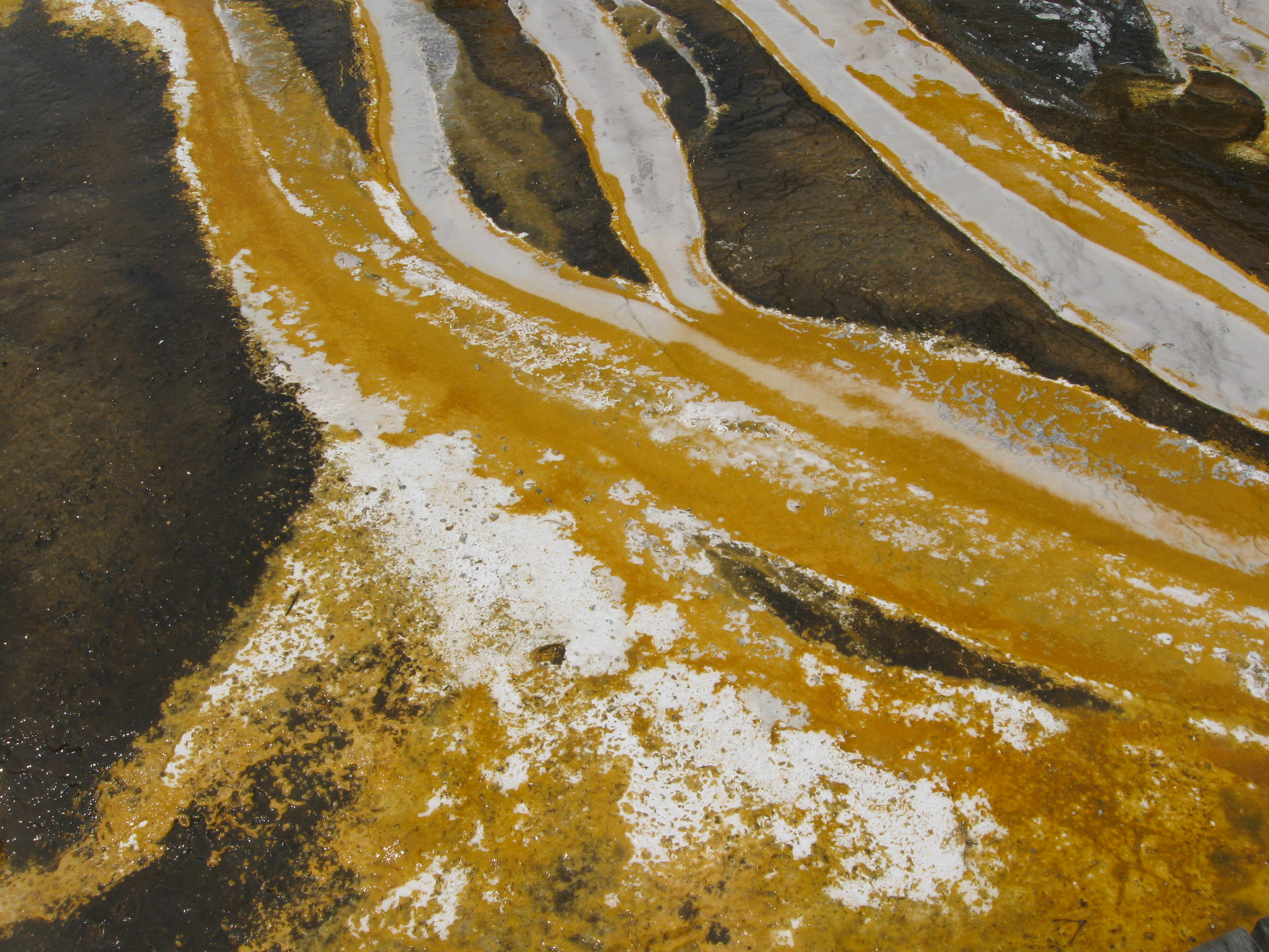
Steaming hot mineral deposits
That’s right. If you can imagine. This was not fiction written from a novelist’s pen. It actually happened. This valley was someone’s ranch, just rolling scrubland hills. Then without warning, on the evening of June 10, 1886, Mount Tarawera, at the end of the valley, split open and erupted. Immediately following no less than 22 volcanic craters along the 17-kilometer valley were born. Plus a gigantic thermal geyser and hot spring area formed. It was the first time in recorded history mankind witnessed the birth of a geyser field!
The Tarawera volcano and craters of the Waimangu Volcanic Valley’s 1886 event are the sites of the largest eruption in New Zealand’s recorded history.
At the time, in 1886, the valley was devastated just like Mount St. Helens. What was once a lush forest with vibrant wildlife was laid to waste, nothing was spared. Atomic bomb shock waves flattened everything and ensuing pyroclastic flows atomized what was left. It was not long before the world learned of the fantastic event and tourists flocked to see the spectacle.

Until 1904, there was a building for viewing the geyser, and then another eruption destroyed it and soon after the geyser ceased. As with Mount St. Helens, life began to retake the moonscape, and within a few decades, the valley regained its lush look. Except for the fact that there remained a few geysers, a huge lake, steaming rivers, hot springs, and hills that seem to smoke!
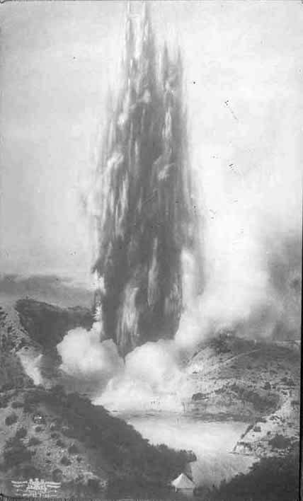
This geyser reached 1,500 feet!
Today visitors can hike the valley all the way to the end, where they can take a boat to see more amazing geologic features on the lake formed by the eruption. From that end point, a shuttle moves you back to the start.

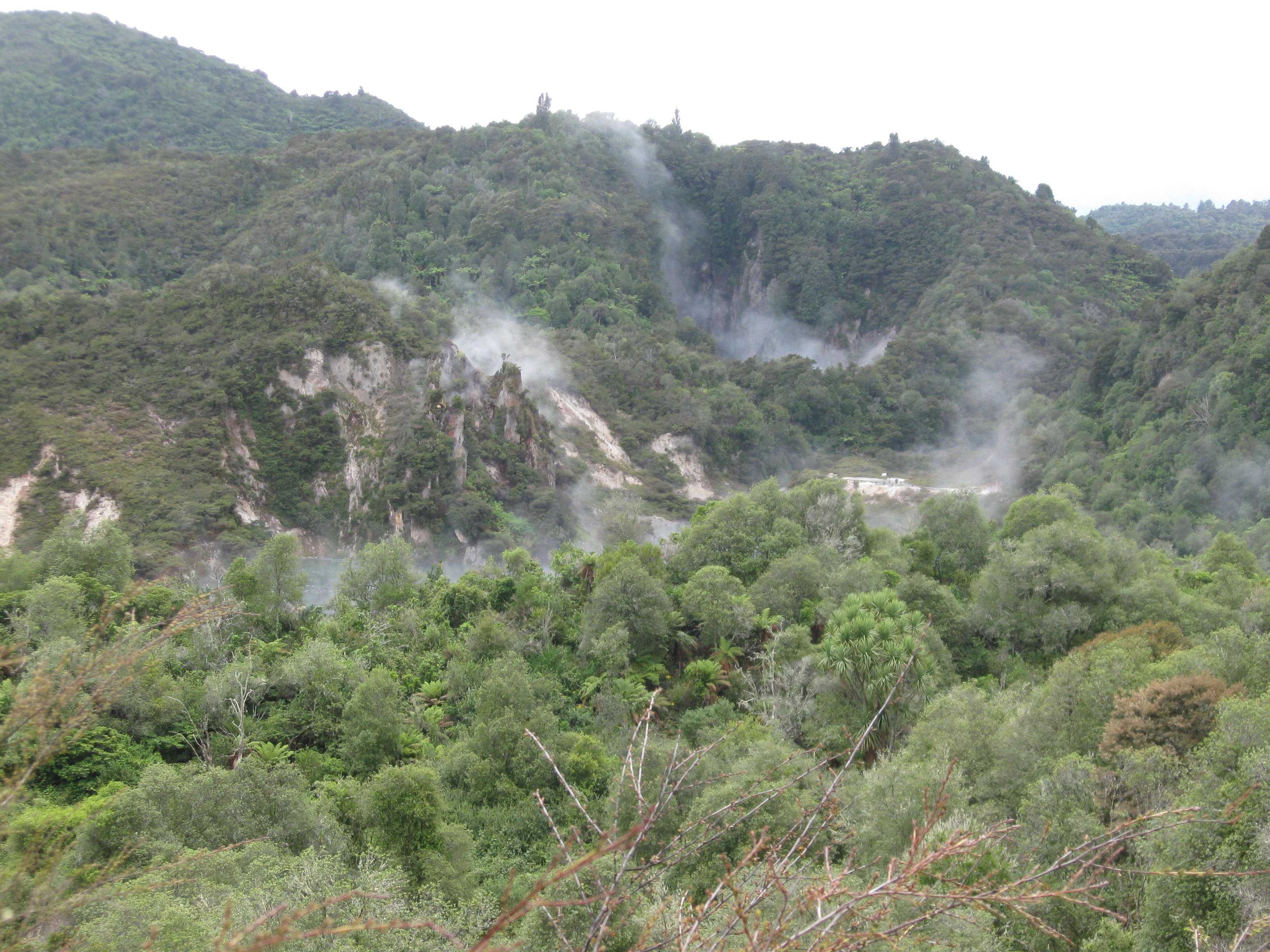
You can make out craters, still smoking, in the forest
All along the way, there are more than two dozen amazing sights to witness!
The river flowing through the valley is filled with hot springs along its path. So, as you walk along and witness its flow, you’ll see how mineral deposits shape everything.
There are beautiful bird songs from bell birds and tuis. In the lake, I can count 91 black swans milling about. It becomes hot. Sometimes, you can smell sulphur from the steaming vents.
If you are seeking some hiking, exercise and really want an in depth up front experience of what earth can do, this valley will not disappoint!
