North Fork John Day River and Granite Oregon – Gold Country!

31 10 2014

north fork john day river, camping, oregon, hikingHiking on the North Fork John Day River Wilderness Trail has been on my bucket list. So I made plans with my friend Tully to head out there and explore the river, and to check out the central northeast Oregon area – also known for its place as Oregon’s Gold Rush region.

The North Fork John Day River is a National Wild and Scenic River for good reason. It’s remote, it’s to-die-for beautiful, and it’s got historical gold miner’s cabins sprinkled along the way. One can do out and back hikes, or circular routes, or even through hikes where one car sits at the beginning and the other at the end.

An ideal spot for exploring the area is the North Fork John Day Campground. It’s on Forest Service Road 52 and is right at the intersection of the Elkhorn Scenic Byway and the Blue Mountain Scenic Byway.

When we arrived, there were only three campsites occupied of the twenty available. Instead of camping at a drive-in site, we picked a walk in site right on the river. It had plenty of real estate and we couldn’t see anyone from the site. Our first dinner was a skewer bbq – chicken with veggies on skewers and some rice.

Next morning it was time to hike the trail by the river. The trail wends its way sometimes right along the river and often climbing 100ft above. But always it’s really beautiful.

north fork john day river, columbine, wildflowers

Columbine

indian paintbrush

Indian Paintbrush

We saw a lot of wildflowers along the way.

Lupine, Indian Paintbrush, Columbine, and others I can’t positively identify.

There were popcorn clouds, so the lighting in the river valley varied as we walked along.

The breeze was refreshing.

We came upon some strange things in the trail. It looked like hair. Lots and lots of hair. Or fur. Light brown fur. But no skin. What could it mean ? And then, not long after, we saw the remains of a large animal down upon the bank of the river.

DSCF1577 Was it a horse? Or an elk? Its head was nowhere to be seen. What killed it? It might have been a cougar. Hunting season was back in the fall.

In any event, the carcass had been picked clean. Nothing left but bleached bones.

So along the trail we walked. Further down the river we glimpsed some history we’d heard about.

This region, which includes the towns of Sumpter, Bourne, Greenhorn and Granite, was a Gold Rush area in the late 1800’s and even into the early 1900’s. Even today, there are claims along some of the creeks.

The first thing we encountered was a miner’s cabin. It looked like it had just been abandoned.

DSCF1573DSCF1575There was still some structure to it. It even had a kitchen counter and rusty remains of beds.

I sure wouldn’t want to stay in it!

One has to wonder what was going through the minds of the people that built these places.

The windows definitely were not from 1890. They looked like they were 1970’s vintage.

It must have been a rat and bug infested sleeping experience for sure.

The place had an outhouse not too distant. Peering into that structure gave me the creeps, as if Hannibal Lechter from “The Silence of the Lambs” lurked somewhere down below.

DSCF1566The North Fork John Day River Trail is a beautiful experience. I did not backpack it this time – as Tully doesn’t backpack. But I will return here and do a backpack for sure. It’s got to be the best way to experience the area.

The following day we decided to drive out to Granite, Sumpter and even Bourne. This is the heart of Oregon’s Gold Rush Territory.

Leaving the campground, Granite, Oregon is only seven miles away. It has a population less than 50 and struggles to survive as a recognized town. But it does have a gas station and a store. Only not open when we were there! Interestingly it has a free Internet wireless antennae right in the midst of the 30 or so homes littering thee hill it lies on.

We drove on to Sumpter, Oregon. There are countless mining claims lining the road. We never saw an

ybody mining but there were hundreds of piles of “tailings” where people had piled rocks and sand in their efforts to find the gold.

IMG_1073

On the way we decided to explore a dot on the map called Bourne. Driving up its little side valley, one wends through countless 15-ft high piles of tailings from past mining endeavors. Almost when you think it’s time to turn back, you find Bourne. Sitting at the end of the road, in a valley, are maybe two dozen homes some of which have actual mine shafts on their property.

Not much going on there these days. We got out of there pretty quick.

After Sumpter we decided to head over to Anthony Lakes, on the other side of the Elkhorns. The road climbs to 7,450 feet before descending to the lakes. The Anthony Lakes Ski Area was long closed for the season, but I just had to drive my car up to the ski lift to see if I could catch a ride!

All in all we had a good trip up there. It’s quiet, remote and there’s quite a bit to see if you make the effort! You will not find Disneyland crowds for sure.

anthony lakes ski area

IMG_1072


Waldo Lake Oregon – Water Doesn’t Get Any Purer Than This!

26 09 2014
paddling,waldo lake,oregon,camping,kayaking oregon

Paddling over the indigo waters on a calm morning.


There are a lot of breathtaking places to paddle in Oregon. Many places with jaw dropping views. But only one, Waldo Lake Oregon, has such pure water and easy back country kayak camping – with no power boats to interfere with the serene experience!

Waldo Lake is unique in Oregon. It’s 22-miles around, making it the 2nd largest natural freshwater lake in the state. It’s natural – not a reservoir. It’s high elevation – 5,414ft. No power boats. Just human powered craft, like canoes, kayaks, or row boats, and when the wind picks up – you’ll see sailboats plying its waters. The water is so pure Waldo Lake set the world’s deepest visibility record – you can see down 157-ft! It is almost as pure as distilled water.

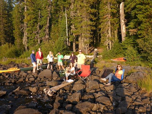
I organized a group of 12 friends (and Cameron, a 3-year old happy camper) who convened at Waldo this past weekend. Waldo is renowned for its primitive camp spots on the west side of the lake. But this weekend, dry conditions caused the Forest Service to issue a ban on campfires outside established campgrounds.


kayaking waldo lake,kayaking oregon,camping waldo lake,camping oregon

Katie, Christian and Cameron

We needed a fire to cook a salmon for six – because my friend Daniel Fox, who was paddling from Victoria BC to San Francisco, had stopped in Astoria, Oregon and just caught a nice Chinook salmon on the way! It had to be cooked on the fire. So, we settled on camping at North Waldo Campground. It was almost full when we showed up – only three campsites – and we needed all three! It was totally last minute. We all had packed compactly for wilderness camping. Once the car camping decision was made I pulled out everything. The barbeque, the tiki torches, the tablecloth!

north waldo campground,waldo lake,camping,hiking,oregon,kayaking,canoeing

Happy hour watching sunset!

The salmon turned out delicious and there was plenty for all. Simple – cooked in olive oil wrapped in tin foil and some dill added. On the side were veggies cooked in tin foil. Really yummy!


camping oregon,camping waldo lake,waldo lake,north waldo campground

Folks at site #32! Waldo Lake awaits.

Morning all awoke at a different pace. At campsite we were up by 7:00 and ready go to by 9:00 – but a visit over to George & Kristi’s site revealed they’d just awakened when I got there at 9:30.

My breakfast was just oats, berries and yogurt…Kristi’s was more like home! Either way breakfast in the woods is better than at home!north waldo campground,waldo lake camping For me, anyway.


View west with kayaksIt was time to set out on the lake. There is much to explore. There is “the burn” on the north side, full of coves and warmer water.On the west side there are primitive camping sites for miles. There is a trail to a lookout, up 2,000ft, where views of Central Oregon can be glimpsed. And halfway down the west side of Waldo Lake, Rhododendron Island. It’s a good spot to land your craft for a picnic!

The water of Waldo Lake is “dramatically ultra oligotrophic” meaning crazy clear with little organic matter. Chemically speaking, it’s more pure than distilled water. At an elevation of 5,414 feet, it’s so high it has no incoming streams. The water comes from snowmelt or springs. As such it’s so pure that a food chain is not supported. We saw only four seagulls and certainly no ospreys.

Words cannot really describe the clarity or color of Waldo Lake’s waters!

dramatically ultra oligotropic,waldo lake

Shadow, some 60 feet down. In deeper water the blue darkens.

Out in the middle of the lake, the water can appear purple-indigo. Look up ultramarine blue.

I took a photo of myself from under the water.Rod from underwater - Copy

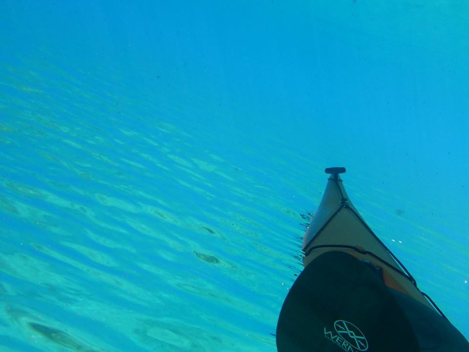
We experimented with taking underwater photos from all sorts of angles.


kayaking waldo lake,paddling oregon,camping oregonOne such photo was taken by Bill Baxter from underneath his kayak! It makes the surface kind of look like blue mercury!

It was a glorious day! Our group split up. Some, led by April, set out to kayak to a trailhead and climb some 2,000 feet to an abandoned fire lookout. From there you can see the lake plus all of the Central Cascades Region of Oregon including Diamond Peak, the Three Sisters Wilderness, and Bend.

The rest of us paddled south to have a picnic at Rhododendron Island. On the wind protected side of the island it was HOT!


waldo lake,oregon, waldo lake snorkeling

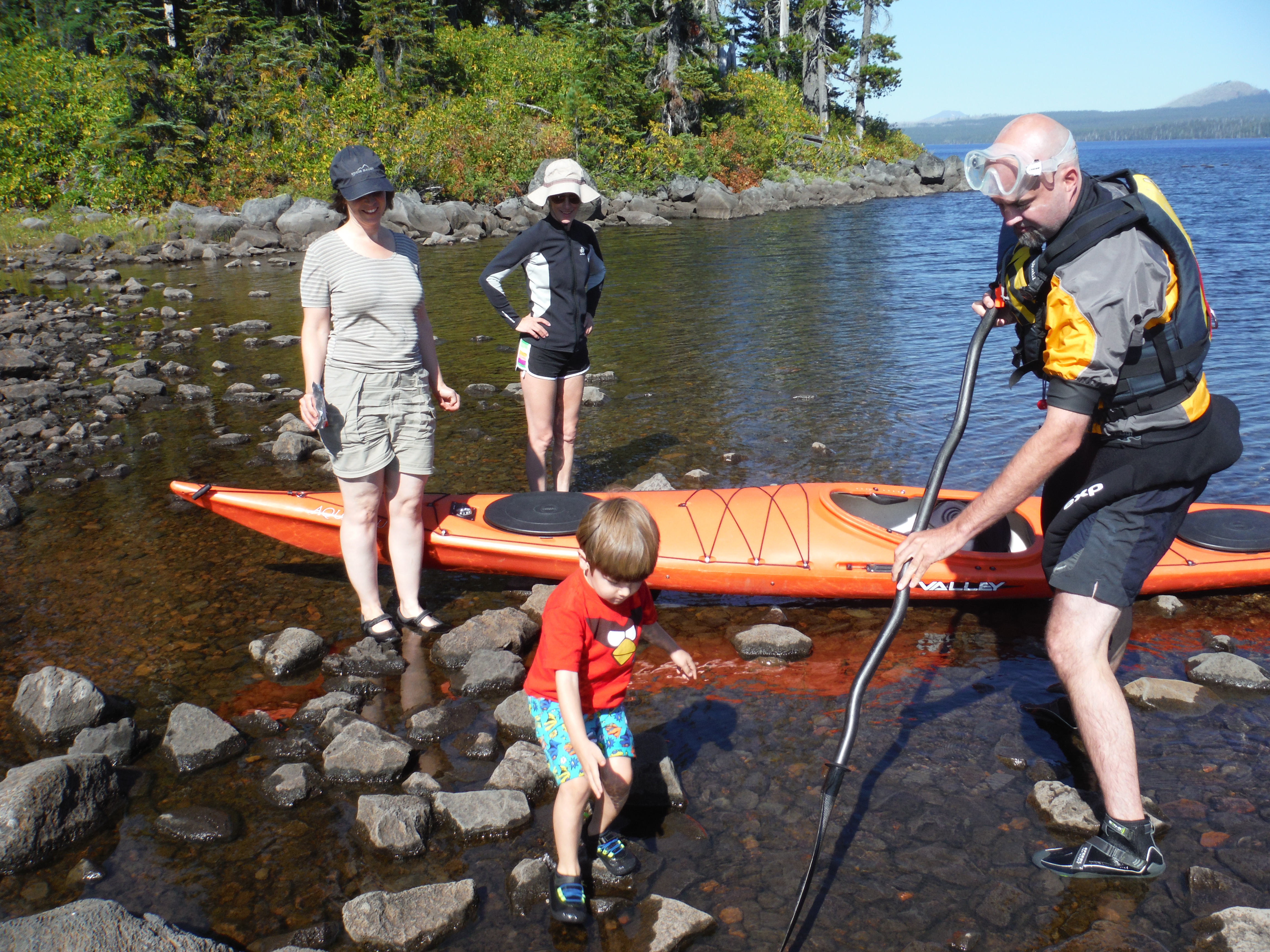
Bill shows Cameron a frog!

After lunch we dared the chilly waters. Bill seemed less concerned than most and was out there with mask and camera quickly.

waldo lake water,waldo lake,oregon

You can see across as well as down


It took me forever to finally get all the way in the water. I should have just dove in!

Julie’s thermometer said it was 66 degrees. That is not terribly cold!Half Underwater

We all got together for a Mexican “bar” meal back at the campsite. It was a make-your-own burrito affair.

We set out the ingredients, then one would wrap up in aluminum foil & melt/heat over the fire!

Katie gets Cameron ready for the water

Katie gets Cameron ready for the water

It was a good reward after the hikes, paddling and picture taking!

We all agreed we will come back next year.

NOTE!! Waldo Lake is full of biting bugs/mosquitoes until mid August.

Plan your trip for late August or September. We think the best way to experience Waldo Lake is to camp outside the established campgrounds on the west side of the lake. There are plenty of gorgeous sites. But if your preference is for car camping, we recommend making a reservation – we managed to get the last three sites! Waldo Lake is unusual in that it gets more busy after Labor Day – and that’s because everybody’s avoiding the mosquitoes.


Snorkeling The Great Blue Hole – Lighthouse Reef Belize!

19 05 2014
snorkeling the great blue hole belize

A lush ecosystem just under the surface!

On my vacation with Island Expeditions to Half Moon Caye Belize, my favorite snorkeling spot by far was The Great Blue Hole. It is featured in Lonely Planet Publication’s recent book, “The World’s Great Wonders.”

Made famous by Jacques Cousteau, The Great Blue Hole lies in Lighthouse Reef, 55 miles off the Belize mainland. He said it’s one of his top 10 dive sites in the world. Physically it’s 1,000 feet wide and 400 feet deep – whereas the rest of Lighthouse Reef is 22 miles long and 8 – 10 feet deep. The outer ring of the blue hole is an amazing forest of coral just below the surface. Click here for a wonderful time snorkeling amongst the corals!

blue tang swim in the great blue hole belize

A school of blue tang

No diving gear is required to explore this lush paradise of fish and coral. Divers can descend to explore the many caverns below. Click here for blue tang synchronized swimming!

The Blue Hole wasn’t always a hole. Turning the pages of time way back to the Ice Age, Lighthouse Reef was an island several hundred feet above sea level. At that time, the Blue Hole was above sea level and it was a cave. It was a great cathedral with side caverns filled with growing stalactites and stalagmites.

stoplight parrotfish at great blue hole belize

A female Stoplight Parrotfish pauses at a “cleaning station”

Then the earth warmed, the Ice Age ended, and as glaciers melted, the sea level rose. The island was submerged under water and became Lighthouse Reef. The roof of the cave collapsed, and sea water entered, creating what we see today.

Our Island Expedition guides shuttled us out to the Blue Hole as it’s pretty far from Half Moon Caye.

shuttle to the blue hole belizeOnce there, we slip on our flippers, don the dive masks, and somersault into another world. Once I adjust my mask and focus, a wave of excitement washes over me! This spectacularly preserved ecosystem is but a few feet below the surface, and I can swim right through it.

This is the healthy reef system I was longing for – everything I wanted to see. It is the ultimate snorkeling experience. Snorkeling the ring surrounding the Great Blue Hole, you witness healthy brain coral, staghorn coral, sea fans, barrel sponges, great barracuda, reef sharks, midnight parrotfish, grunts, blue tang, hawksbill turtles, angelfish, fairy basslets, eagle rays, and much much more!

Wrasse living near a sea fan blue hole belize

Wrasse and a sea fan

We spent three hours at The Great Blue Hole, but I could have explored a full day there. I knew that down below snorkeling level, there are great predators. Great Hammerhead Sharks, Bull Sharks, Lemon Sharks, and more spend time at depths in the Blue Hole. But the examples of these species are juveniles – they come to this spot for protection from predation by the full grown members of their own kind out on the ocean side of the reef.

brain coral at the blue hole in belize

Brain Coral, on the right

For this snorkeling trip, I purchased an underwater camera capable of video. It is the Fujifilm XP60. Like most point and shoot cameras these days, it only has a video screen. I am far sighted. So it was difficult to know, looking at the blurry screen in front of me, if I was definitely in focus, or even had the subject correctly framed! Add to that my body bouncing on the surface, or down under, holding my breath. Further, fish don’t just pose for pictures. They are always moving. I learned to listen to the beeping sound for focus.

Another factor I learned about is that underwater, the further you are away from your subject, the more blue-tinged the photo shall be. The closer I took the photo, the more the real colors showed up. Andy, one of our group, knew how to free dive. He could go down 20 feet and just hang out down there and got the most incredible close up photos of fish.

colorful sea fans at the great blue holeAnother factor in getting good photos of fish is their behavior. Fish tend to retreat into their hideouts when you approach. But if you linger a bit, they come back out. Lingering underwater with lungs full of air is pretty hard because your body tries to float up. Andy’s trick is to hold onto something like a rock.

He gave me some tips on staying down longer. Instead of using your air/energy do go down by kicking hard with your flippers, get completely vertical with your head down and legs straight above and let the weight push you down. When you are feeling pressure, pinch your nose and blow out to equalize the pressure. Now that you are down, and equalized, you have more time to stay down…and you can grab a rock to keep you from floating up too fast.

I tried this and many times, I got so comfortable down there I lost track of how far I had to go up to catch a breath! It was fun, and a new thing for me.

The Blue Hole was certainly well worth visiting! But it’s far offshore. So I recommend spending a few nights on one of the islands out on the reef. You can always book with Island Expeditions! They’ll take good care of you.


Snorkeling around Half Moon Caye Belize!

8 05 2014

I chose this trip because I had learned Belize has some of the Atlantic’s only coral atolls – and that their reefs are super healthy. It was all true. Snorkeling just off Half Moon Caye Belize is super easy. Simply slip your mask, snorkel, and flippers on, and a mere 50 yards from shore amazing underwater wildlife thrives.
Queen Triggerfish at half moon caye

Queen Triggerfish

This blog post covers some simple snorkeling just off the island. On the west side of the island, Lighthouse Reef’s 8-10 foot lagoon sports countless coral heads, which are home to dozens of species of fish, turtles, lobster, and squid.

Blue Chromis on lighthouse reef belize

Blue Chromis

Yellow grunt at half moon caye

Yellow Grunt

On the east side of the island, it connects with the reef ringing 22-mile Lighthouse Reef. Our first snorkel took place out there. Right off, I was rewarded, witnessing so many brightly colored reef fish living out their lives in this protected reserve.

Grunts are very common on the reef!

Lots of grunts on the reef!

Some of the most common fish on the reef are grunts. There are different variants, but a frequently seen grunt is the Blue-Striped Grunt.

Blue Striped Grunt

Another fish I saw lots of is the Blue Tang.

A blue tang seen while snorkeling Belize

The Blue Tang – ubiquitous reef inhabitants


Spotfin butterflyfish snorkeling belize

A pair of Spotfin Butterflyfish

Rarely seen are the Spotfin Butterflylfish.

There were sharks, too. And rays. And Parrotfish, and Barracuda. And Squid.

Nurse shark seen while snorkeling lighthouse reef belize

I swam right over this Nurse Shark – I almost didn’t notice it!

I brought an underwater camera along for this trip. I was learning to use it as the trip progressed, and I was able to get some video of underwater wildlife.

In this video, I was shooting for images of parrotfish and blue tang on a coral head – but I did not know I was about to have my first shark encounter!

In this video, I simply swam 50 yard off the beach and saw parrotfish and trunk fish!

Here, you can see a beautiful Stingray I encountered just off the beach!


Kayaking Lighthouse Reef and Half Moon Caye Belize

2 05 2014
wet exit lesson island expeditions half moon caye

Tisha gets a wet-exit lesson!

A week kayaking and snorkeling on Half-Moon Caye Belize guarantees a return to natural rhythms – awakening to the sunrise, sounds of gentle surf and rustling palm fronds, paddling sapphire clear waters, snorkeling amidst nature’s underwater splendor, and no hashtags. Plus, the 80+ degree water doesn’t hurt, either!

Lucy paddling out to the wreck on the reef lighthouse reef

Lucy paddling out to the wreck on the reef

Paddling Lighthouse Reef is definitely living a fantasy. The water is utterly sapphire clear and it’s warm. Inside the reef’s 22-mile long ring, the lagoon is only 8-10 feet deep. The protected waters are packed with an array of life. Our guides were of Garifuna, Mayan and Mestizo ethnicity – and they’d switch between English, Creole and Spanish at will.

Kayaks in the Island Expeditions fleet

Kayaks included Necky single or tandem polyethylene kayaks, Seaward tandem fiberglass kayaks and a few Boreal Design polyethylene single kayaks – and SUPs. The tandem kayaks were set up for sailing.

Island Expeditions paddling accessories

They also had a selection of Kokatat and Astral PFDs. A good portfolio of equipment for a tour operator, I thought.

Our agenda shifted each day depending on weather conditions. Sunrise was followed by 6:30 a.m. yoga with Tisha, from Vancouver BC. After breakfast, we would launch kayaks and paddle out to the reef, where we would snorkel.

Day one was mandatory snorkeling and kayaking introduction including wet exits and rescues.

DSCF1213One big question for me: Considering my back and hamstring injuries, which I’ve been working diligently to resolve, how will they handle trying to roll a kayak or do a rescue? The only way to know is to try. So upon launching, with the guides observing, I proceed to successfully roll my kayak five times! No back pain. Then, I try a re-enter and roll. A re-enter and roll is performed with the kayak upside down floating on the surface. I take a deep breath, get into the kayak upside down, and roll it up. Voila! I did it, no pain! Now to try an assisted rescue. In this case, with someone else stabilizing the boat, I pull myself onto the rear deck face down, inchworm my body/legs into the cockpit and then corkscrew right side up. OUCH! That was NOT GOOD! That exercise positively zonked my hamstring. But otherwise, paddling went well.

One afternoon we tried kayak sailing. We used ruddered tandem kayaks, and the sails were mounted in between the cockpits. I have to say it was fortunate I have a lot of sailing experience, because the guides pretty much said, “Here you go. Sail down to a big stick down the reef and then come back.” I steered and held the sail and my “crew” was Tisha. Remember that sailboats have keels or centerboards, which are like a fin in the middle of the boat. Kayaks don’t have them. So sailing a kayak is more an exercise in getting there without paddling, but not efficiently or in any way IMHO satisfyingly. We all arrived at the stick within one minute of each other…but that was the more downwind leg. On the way back, it was what we sailors would call a close reach – meaning we were more or less with the wind coming from the side. The return leg really “separated the men from the boys,” and I had to use every trick in my sailing skills base to get that kayak going straight instead of sideways, and to land on the island and not miss it entirely and wind up in the ocean. When we turned around at the stick, Half Moon Caye was almost invisible. I had to hold the sail as low and stiff as possible, using my outstretched arm, to spill air, whilst pushing the rudder with my feet so we had the correct angle. Lucky for me I was wearing my Astral Brewer shoes. Others got blisters! We learned to lean into the wind to keep the boat tilted right. Anyway we were so focused we simply doubled down on getting back to the island, and never looked back. When we landed, we were amazed that the others were dots on the horizon! We KILLED IT! We had 30 minutes of swim time before anyone else landed. After the experience, though, I say sailing is for sailboats!

Here’s a video of Tisha learning to wet exit her kayak!

Here’s a video of kayaking off Half Moon Caye…!

Next post – we’ll explore snorkeling Lighthouse Reef Belize!


Half Moon Caye Belize on Lighthouse Reef with Island Expeditions

25 04 2014

If you have seen “Gilligan’s Island,” then you might have imagined Island Expedition’s small operation on Half-Moon Caye. It is a true slice of paradise! No more than a mile long, coconut palm forested Half-Moon Caye sits in the southeast edge of Lighthouse Reef.Calm Day  North

Just off its eastern edge, the water drops to 12,000 feet deep. But inside the 22-mile long lagoon, the water is no more than 10 feet deep. This creates some interesting explosions of sea life, which we’ll explore in later posts.

Half-Moon Caye and several square miles around it are a World Heritage Site. The caye hosts a colony of rare red-footed booby birds.

These birds are amazing acrobatic aerial fishermen. Every day hundreds issue forth to forage in the ocean.Image

They bring back food for their young, but they are never alone.

Image

Red-Footed Boobie

Red Footed Boobies are symbiotically connected to Frigatebirds, which steal the food for themselves.

Image

Like an F-15 the Frigatebird wheels to steal some food.

Frigatebirds are even better fliers than boobies. But they have absolutely no fishing skills. They are completely dependent on stealing food from the boobies. So much so, that frigatebirds defend the entire colony from other scavenger species such as sea gulls or petrels. Oddly, the boobies seem OK with surrendering food.

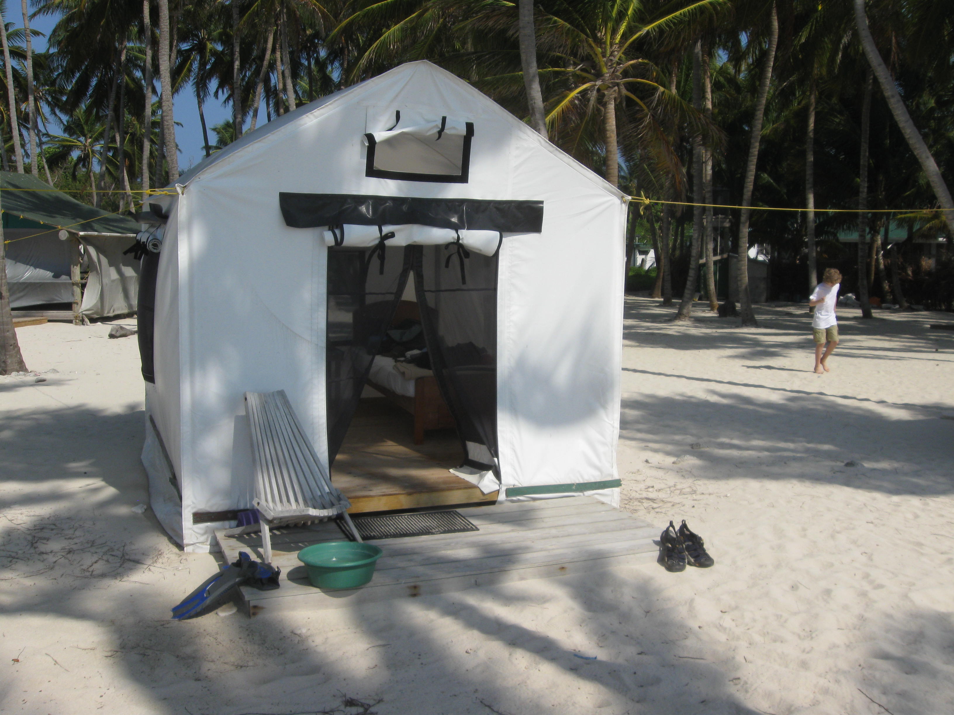
Island Expeditions had about 12 platform tents arranged along the east side of the island, facing the ocean. Just beautiful, with coconut palms overhead.


ImageI certainly enjoyed my tent, which had two twin beds inside. ImageIt was simple yet thoughtfully laid out. It had strong pipes for a frame. It had a nightstand, a table, a laundry line, a hanging “dresser,” and an anti vermin cannister just in case. It stood up to the 24mph winds one night.

One job all of us had was keeping sand out of the tents!

Here is a video of the layout. Here is a video on a calmer day…with snorkelers!

Lodging is a misleading term, because we “lodged” in platform tents – each with beds. No super resorts here: exactly what I wanted. There were 12 tents lined up along the shore. Island Expeditions runs a sustainable operation – with water from rain collectors, a well, and composting toilets. Electricity was on four hours per day, just enough to charge your camera batteries. So, we were far from luxury yet far from roughing it. The kitchen served up three sumptuous meals daily.

Image

Dishes included Creole fair (lots of bbq), plus conch soup, coconut pie, pineapple and mango, and when we caught fish, catch of the day.

Image

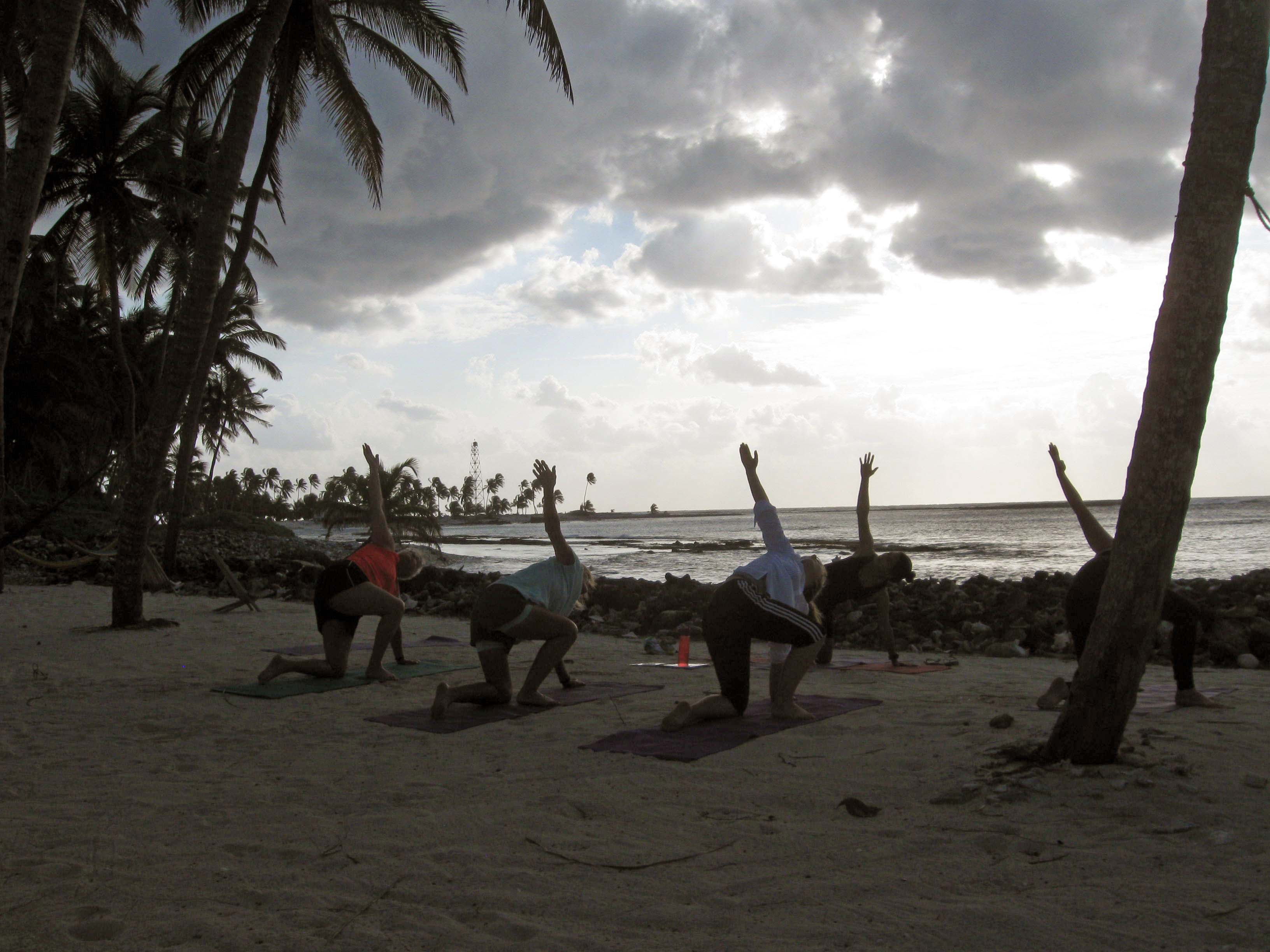
Rise and shine! 6:30 a.m. yoga.

We were fortunate to have Tisha, a yoga instructor from British Columbia, on hand. Each morning she’d lead us in stretching and moves to open up the day.

In the evenings, we all gathered in the dining tent for discussions of the days adventures and misadventures.

ImageImage

With island life taken care of, we had much off shore activities to pursue. So the next series of posts will explore kayaking, fishing and snorkeling in Lighthouse Reef, and the Great Blue Hole!

Image

The lagoon at sunrise.