Trekking Peru: The Cordillera Huayhuash – Acclimatization Days 1-2: Huaraz

10 07 2017

20170619_100215

Here we go! This the first of about a dozen blog posts covering my June 2017 trek in Peru’s Cordillera Huayhuash! This was a big deal. Back in 2007 I did a Himalayan trek of Bhutan’s Chomolhari with Cathy Ann Taylor, and it stuck prominently in my mind. I watched her Cattara website for an Andean trek and when this one popped up I jumped at it!

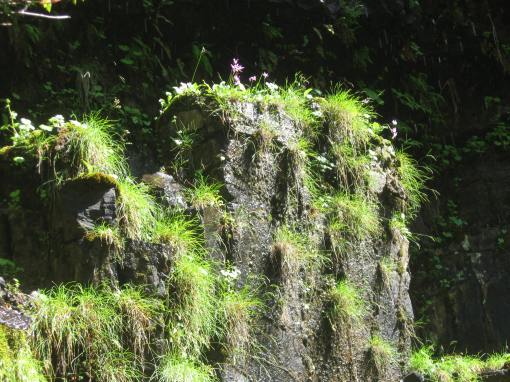
These treks are simply the “bee’s knees” of hiking/camping trips. They involve undertaking the “ultimate challenge” level of athletic perseverance and mental toughness. Hiking 8 a.m. to 3:00 p.m. day after day at altitudes ranging from 13,500 – 16,404. All that effort is rewarded with beautiful, dry weather, flowers along the way, and views so spectacular as to literally defy description. But there is more: You don’t have to carry a big pack. Or cook. Or set up your tent. Staff brings coffee/tea to your tent to awaken you in the morning. And, they bring you hot wash water morning and after your hike. On this trek, we even had a portable shower – and one of our stops was at a thermal bath!

Why do these treks? I’m sure everybody has their own reasons. For me, it’s the chance to see mountains so big they are unimaginable at home. To conquer the athletic challenge. To completely disconnect from the snowglobe of distractive thoughts and temptations that are the Internet, e-mail, news, and ties to home. To peel off layer after layer of that routine, getting to the core and reconnecting with natural rhythms once again. For it is only then, free of the pull of those “can’t waits,” that things start to get back into perspective.


Huascaran from Airport

22,205ft Huascaran towers over the airport at Huaraz, Peru


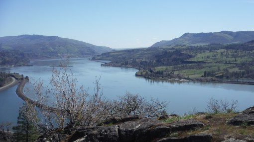
There would be 13 trekkers on this trip. We all flew into Huaraz to meet Cathy Ann (CAT). Our first two days would be acclimatization days, staying at the Hotel Club Andino. Huaraz, with a population over 100,000 sits at 10,150ft. At this altitude even climbing the hotel stairs was a struggle! But we’d have to do more – for our very first camp would be at 13,776ft!

Hotel Andino is a Swiss-owned Euro-style hotel perched on a hillside street at the top of town. Rooms have a mountain view and the restaurant is 1st rate.


20170618_064954

View from my room!


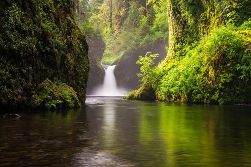
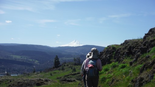
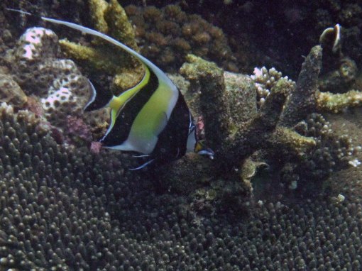
On day two, the plan was a 4-mile hike at Huillcachocha Lake, up to 12,650 feet. We hiked to a rock where Inca sacrifices were performed. From this hike, we had horizon to horizon views of the entire Cordillera Blanca Range! And we encountered some local families going out for the day.

Family_edited-1

To me, the thin air and exertion of this “warm up” hike seemed like the max. But I knew in the next two days we’d be hiking to over 15,387′ and yikes. Can I do this? Will I make it?

The staff was excellent, making a slow, do-able pace. And they let us take breaks to get water, snacks, and adjust our clothing. The views would be one thing that would keep me going!


Cordillera Blanca Pano

View of the entire Cordillera Blanca! It’s the range next to the Cordillera Huayhuash.

CAT shows map

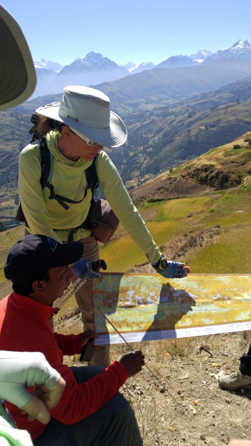
CAT and our local lead guide, Roger (pronounced “Roher”) of ExplorAndes, show us a map of the area

Rod and Anna

Myself with Anna, local Assistant Guide

So, how much equipment, staff and stuff did this 12-day expedition take? 10 Llamas, 16 donkeys, 2 “emergency” horses, 13 staff, kitchen tent, meal tent, a dozen or so Eureka! tents for guests, plus food and emergency gear. Yes, we had supplemental oxygen just in case. Quite the production!


The day’s acclimatization hike complete, we enjoyed a terrific welcome dinner at the hotel. Tomorrow, we’d be off on a 5-hour drive to our first trek-camp!

So, you may ask, “How do I prepare for such a trip?” Answer: 4 months of preparation. Lots of cardio. Running is fine, but about six weeks before the trip, switch to hour long hikes/walks. Four times a week. Hikes with elevation gain are the best preparation because instead of static roads, you’ll get the benefit of walking amongst rocks and such. Even better, hike with a 20 pound day pack. Because on the trek, you’ll be carrying a day pack with rain gear and layers, plus two liters of water.

OK, upcoming are a series of posts from the trail! Passes, 20,000 foot peaks, avalanches, glaciers, emerald lakes, Llamas, and flowers galore! Stay tuned.


Columbia Gorge Hikes: Eagle Creek

12 06 2017


IMG_0268

A typical trail side view.


No visit to the classic Columbia Gorge would be complete without a hike up the Eagle Creek Trail. Only 30 minutes from downtown Portland, Oregon, Eagle Creek offers complete refreshment for urbanites in need of a re-set, and amazement for tourists in search of views, waterfalls, ospreys, bald eagles, salmon and more.

Starting at its confluence with the Columbia River, Eagle Creek Trail gently ascends, reaching more than 800 ft in elevation, connecting with other Mt. Hood National Forest trails. The trail could be characterized as canyon-climbing and forested, with waterfall views dotting the way. It contains the classic Punchbowl Falls, often seen in kayak photos.


IMG_0264

Punchbowl Falls


Eagle Creek Punchbowl Falls

On virtually any day in any season, a Columbia Gorge hike can be great. But it gets more complicated than just heading into the Gorge. Some hikes like Coyote Wall (in previous blog) are good for early spring. On warmer days these trails – with little shade – can become like solar collectors. Hikers roast. So when it heats up,  Eagle Creek Trail is a good choice.


IMG_0267

On the steep canyon face, Laura enjoys the fresh water cascading from above! There is a cable to grasp for safety.


It offers a forested canyon with a north-south orientation. So, while it might be a bit cool on rainy spring days, it is sublime on hotter summery days.

IMG_0257


IMG_0259

Wildflowers take advantage of our wet spring.


IMG_0265

One of the side creeks the trail crosses.


OK – I’ll let this blog be brief. Eagle Creek is a must for a visit to the Columbia River Gorge! Don’t miss it. You’ll be greatly rewarded.


Columbia River Gorge: Hiking the Coyote Wall / Labyrinth Area, WA

1 06 2017

20170403_113518

Like the Lower Deschutes River area, the Washington side of the eastern Columbia River Gorge offers beautiful spring hikes with lots of SUN, whereas it might be cloudy in the Portland, OR area. This spring, I discovered the Coyote Wall / Labyrinth trail system.

To reach this beautiful area, take I-84 east from Portland, and cross the Hood River Bridge to the Washington side. Head east on Hwy 14 past Bingen. In about 3-4 miles you’ll encounter a lake on the left. That’s Locke Lake. To reach Labyrinth you’ll have to walk along the north lake shore road maybe a mile to get to its trailhead.

The Washington side of the Eastern Gorge is ideal in early spring because like a solar collector, it faces south, it is sparsely treed,  so it gets lots and lots of sun. This trail system climbs some 1,775 to max out at 1,895 ft elevation. It is shared by mountain bikers and hikers – and their canine friends.

If you like waterfalls, sparse trees, immense views, and wildflowers – and who doesn’t? This system is for you. But if you cannot handle some climbing be warned. It may be that the beauty will just carry you through.

I had recently been to the next-door Catherine Creek trail system. Catherine Creek is so open as to be boring in comparison. Catherine Creek has vast open fields which seem to go on forever. Alternatively Labyrinth has countless micro “worlds” filled with little canyons, trees, flowers, waterfalls and views popping out. Each one different.

DSCF2096

It’s possible to lose one’s way up there, so I suggest consulting an online guide with detailed instructions before heading out.

Laura and I encountered countless wildflowers along the trail.


One after the other, these little canyons keep coming, and then, the trail leads to an eye popping view of the entire eastern Columbia River Gorge. The trail eventually leads to the Coyote Wall, which is an escarpment some 70 feet above a valley and goes along a mile or so.

DSCF2098

Now, that’s a time to pause, relax, and take stock of life for a bit! On this day, we were really fortunate to be treated to calm winds. And, the hills were literally “flowing,” draining the burden of the spring rains!

In mid-summer, like many places in the eastern Gorge, this place bakes. So at that time of year, I’d probably pick another hike. But perfect in spring!

DSCF2101

That’s 11,240 ft Mt Hood!


Hiking the Lower Deschutes Canyon, Oregon in Spring

30 05 2017

20170327_132533

The winter of 2016-17 brought record rainfall to many parts of the Pacific Northwest, including Portland and Seattle, which saw all-time records for the October – April periods. It was great for skiers. Great for replenishing reservoirs. But it. Just. Kept. On. Raining. Sometimes, the only way to escape Portland’s gloom is to head east, past the Cascades. There, the clouds part and it’s likely a sunny hike can be had!

There are many good springtime hikes in the eastern Columbia Gorge. Wildflowers start coming out in March and peak sometime in late April. One nice choice are the trails along the Lower Deschutes River Canyon. There are three main trails leading from the mouth of the river. One is an old railroad bed converted to a bike trail. Another follows the riverside, snaking along. And a third is in between these two. It is possible to go many many miles upstream following the old railroad bed.

20170327_124653

To get there, take I-84 east from Portland, past The Dalles, to Deschutes River State Park. Park at the area in the southern part of the park.

Laura and I decided to do this hike as it’s a rolling terrain hike and doesn’t involve lots of elevation gain. A loop is possible by taking the river trail about 3 miles to where it climbs and connects with the railroad bed trail.

We had wonderful weather. It was warm in the sun. A train on the opposite side slowly made its way, stopping for a time.

The river was flowing swiftly, emptying Central Oregon of all the excess water from the spring rains.

We saw the occasional balsam root flowers starting to emerge, plus some others I couldn’t identify.

Total hike mileage was 6.5 miles, a good conditioning hike.

20170327_131912

Laura photographs some emerging flowers

The Deschutes River cuts through some of Oregon’s interesting Geologic features. So the trail offers some natural interest. Along the way one can view layers of basalt and ash laid down over millenia. In some spots natural lava bridges formed.

20170327_140413

Weather plus the river have carved some interesting shapes into the rocks here. For wildlife, we saw mostly ospreys and buzzards. Supposedly there are deer and rattlesnakes in the area as well. It’s popular with anglers for the trout and salmon. And backpacking is possible along this trail, too.

20170327_132137

For me, spring and fall are the best times to hike this canyon. Obviously it offers sun when Portland is cloudy. But in the midst of summer, this canyon has three things I don’t like: Intense heat, little shade and often punishing wind. In the summer, it just bakes here. And that heat, which makes air rise, means something has to displace it. And that is air from the Columbia River and the Pacific. In the summer, by afternoon, it can be like a convection vortex here. I have even seen a kite torn from its string! Rafters cannot make progress against this force – often being forced to spend the night and start off in the morning.

So for me, it’s all about the seasons, and this hike is just GREAT in spring!


Snorkeling in Nha Trang, Vietnam

17 01 2017

Our destination after Saigon was the coastal town of Nha Trang. After the noise, congestion and pollution of chaotic Saigon everyone was looking forward to some quiet time by the sea. Well, we were completely unprepared for what a mega town it is. Nha Trang is far from a sleepy beach town! It’s got 35-story hotels and boasts a population of over 400,000! So much for the Margaritaville experience. More like Atlantic City New Jersey or something! Nevertheless, I was able to get some decent snorkeling in.

The week prior to our arrival it had rained hard. So hard that runoff turned the sea brown that week. I was concerned the water would be too cloudy for good snorkeling. More than water clarity, I’d heard that many reefs in Asia were damaged due to dynamite fishing. In some places, people are so poor they don’t use nets or lines. Instead they blow up everything and haul in whatever floats to the surface. By doing that, they destroy entire ecosystems. Years before I’d snorkeled in Bali and it was tragic. The coral was dead. Only a few fish to see. I feared the worst.


blog2018

Well, well! Took a chance and was rewarded!


Nonetheless, six of us booked a boat to go out beyond the bay to Moon Island. We all said to ourselves, “Even if the water’s cloudy, heck at least it’s a boat ride, right?” Well, much to our delight, the water was clear. And the reef? Healthy!

The boat, which was also equipped with scuba gear, took us to a secluded spot maybe 50 feet from shore. I donned the mask, snorkel, and did my customary snorkel/scuba back flip into the water. The water was beautiful. Warm. Pretty clear! And the corals were so close to the surface, one only needed to drift along to view.

I’d been to Belize in 2014 and learned how to free dive. That skill came in handy in Vietnam. You simply take a breath, turn completely vertical, and allow your weight to sink you down. Sometimes having a rock or two in hand takes you down faster. This way, when you arrive down some 15-20ft, you have not expended energy to get there. My tour-mates were all amazed to see me down that far. Once down, you have a maybe half a minute to swim amongst the wonder. I found I got so intrigued that, when I needed air, I was suddenly freaked that I had 20 ft to rise!

It was a good day. We were all delighted we’d taken the risk because it paid off. Not only had we taken in some good snorkeling. But we’d escaped the busy hum drum of the Nha Trang waterfront!


Biking in the Rain in Hoi An, Vietnam

9 01 2017

dscf2035

On our bucket list for our visit to Hoi An was a morning bike ride. Hoi An is pretty flat, and the traffic moves at a pedestrian pace, so the slower, easy-going bike is a good way to enjoy the city and surroundings. But in November, Hoi An is known for biblical downpours, and we were not disappointed!

dscf2033

Cindy gets all custom fitted

The route would include gliding past wetland agricultural areas, villages, a food market, and then back along the Hoi An waterfront.

We’d been advised to carry water for rehydration, and to bring along at least a rain jacket.

Although we left by 9 a.m., it was already very humid.

It doesn’t take long in Vietnam to get sweaty. We got our bikes, moved the seats into correct height, pumped up the tires, and we were on our way.

We began pedaling along streets in town and soon headed out to some submerged farmland, where we rode along paved berms in between fields. I was unsure to call them fields or paddies. They seemed to be growing rice here, but also there were other crops, too.

dscf2040

We encountered a farmer riding his water buffalo. The water buffalo was very much focused on his breakfast of grass.

And then, without warning, the fire hose turned on! When it rains in Hoi An, all you get is one or two drops notice before the bucket is thrown at you! It rains so hard that no technical outdoor gear can stand up to the humidity, your perspiration and the volume of water coming from the sky. You are going to get soaked, and anything in your pockets, too.

dscf2042

Kristi and Cindy at the market

Instantly every local is donning ponchos. Rain doesn’t slow them down one bit. We paused for a visit at a local fresh food market and holy cow rain was cascading down on everything. I had a waterproof camera, but the lens got droplets on it!

Regardless of the monsoon, business must go on! They were selling everything. Produce, fish, chicken, pork. I saw a wahoo, lots of crab and some oysters, too.

Once the rain let up we got back on the bikes and headed back to town. But my bike broke down. The right pedal crank arm just slowly weakened and fell off! Metal fatigue. So I limped back using the left pedal only, until a replacement bike could be found. Back at the hotel, soaked, I just jumped in the pool. It was quite refreshing! And while there, another sudden downpour fire hosed me from above. But, since I was in the pool, it seemed refreshing.

If you are visiting Hoi An Vietnam, definitely try a bike ride. It’s a nice way to go!