Tongariro National Park and Mt. Ruapehu Serve Up Pestilence from Above and Below

13 03 2013
IMG_0233

Mt. Ruapehu

Tops on our bucket list for New Zealand’s North Island was Tongariro National Park. New Zealand’s oldest national park is a high altitude volcanic wonder. Inside its borders is 9,177 ft Mt. Ruapehu, the country’s largest and most active volcano. New Zealand’s largest ski area, Whakapapa, lies on its slopes. Plus 7,513 Mt. Ngauruhoe, a perfect cone with a blackened, smoking plateau beneath – which was filmed as Mordor and Mt. Doom for the Lord of the Rings movies. Tongariro lies under the other two and is composed of multiple cones.

Model of the three volcanoes

Model of the three volcanoes

Rained out in Wellington, we hoped the improving weather forecast for the park would turn out to be true. We stayed at the Rainbow Motel in Tokaanu, on the southern shores of Lake Taupo – 40 minutes from the park.

The entire region sits directly on top of clashing of the Australasian and Pacific Tectonic Plates, and thus is full of volcanoes, geysers, hot springs, calderas, and endures the occasional earthquake. Our accommodation at the Rainbow Motel had two single rooms plus a bed and couch in the living room, with kitchenette facilities. While the bed was positively awfully unsupportive, the Rainbow Motel has one perk which served us marvelously. Sitting on top of a geothermal area, it sported hot spring baths!

Often lauded as New Zealand’s greatest hike, the Tongariro Alpine Crossing was a must-do. This challenging all-day hike climbs in between Tongariro and Ngauruhoe and takes hikers directly into Mordor! It is full of blackened fields, sapphire volcanic lakes and steaming, stinking fumeroles. Elwin and I were itching to get on it. It is not possible to get to the trailhead by your own car. You must ride a bus which takes hikers inside. The hike is supposed to be one-way. Hikers meet the bus at the other end of the crossing.

This day we planned to hike the slopes of Ruapehu – taking a chairlift to a high trailhead. We drove up to Whakapapa Village, which is the base area for hikes on Ruapehu. But today hiking was not to be. Completely at odds with the meteorologists forecast, we find everything closed due to wind, rain, snow, and even more!

Wind/rain/volcanic activity conspire to ruin our day!

Wind/rain/volcanic activity conspire to ruin our day!

In fact the Ruapehu volcano itself was adding its mischief to ruin our day…throwing threats of eruption and lahars at us! NO hiking today. With 70 kph winds, possible eruptions, and lahars, the chairlift was closed as were most of the trails!

IMG_0244

So, sulking, we headed back to Tokaanu to figure out what to do. On the road we see a sign for hot springs.

With a day to fill, we had nothing to lose! So we checked out the Tokaanu Thermal Pools. We weren’t interested in soaking in the pay-to-soak part of the park.

However, there is a trout stream and free walk amongst very interesting hot springs, thermal pools and plopping mud pots.

If you recall the Lord of the Rings movie “The Two Towers,” the scene of the “Dead Marshes,” where Frodo is advised “Don’t look at the lights!” in the water, you know what it’s like here. There are wooden walkways meandering amongst completely transparent steaming pools which tempt one to look deeply. So deeply you feel drawn in!

Trout like cold water. Interestingly there is a cold water stream running right through the area, and it’s choked with rainbow trout! We walk a bridge across and 4-5 pound trout swim beneath.

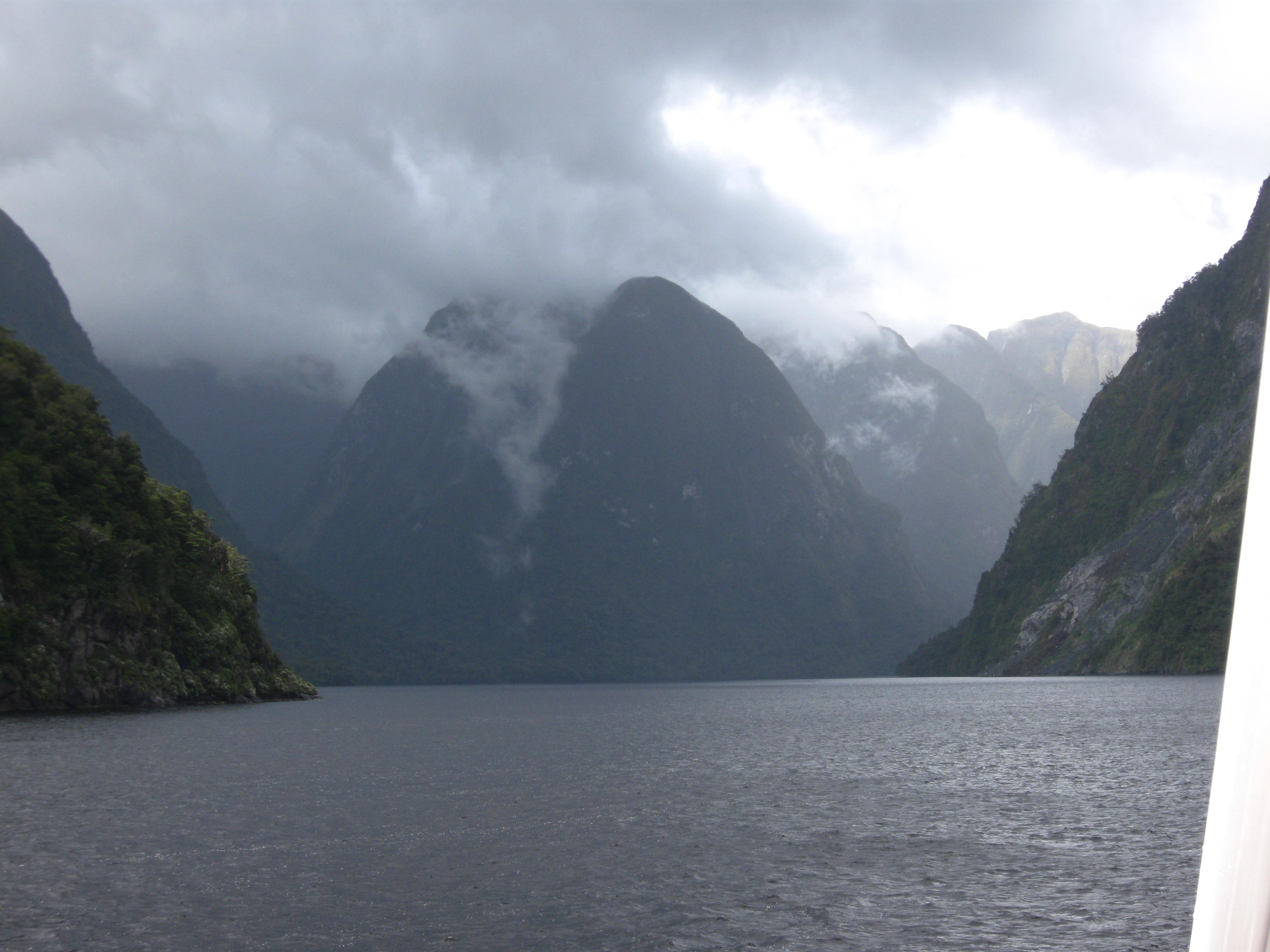
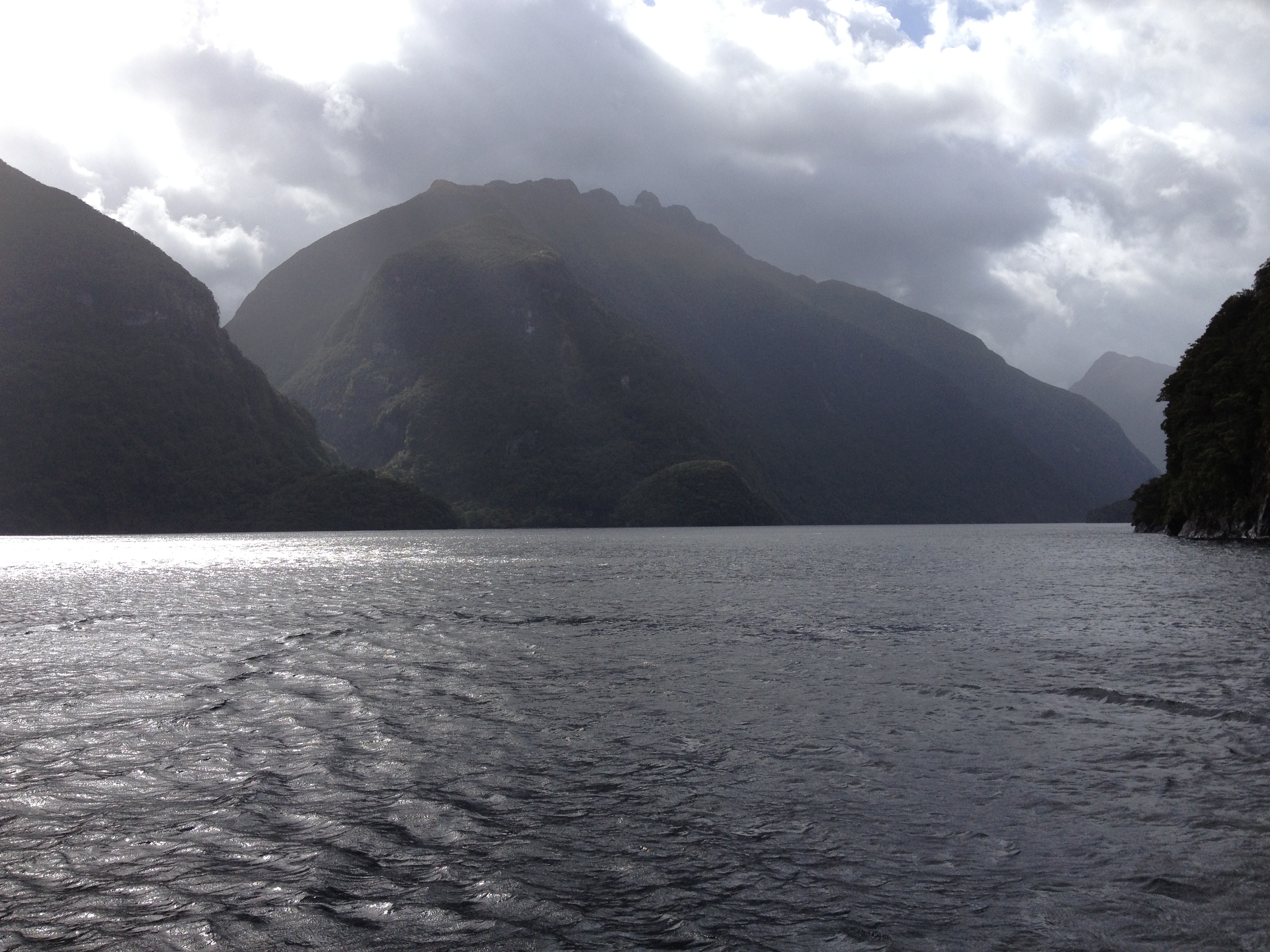
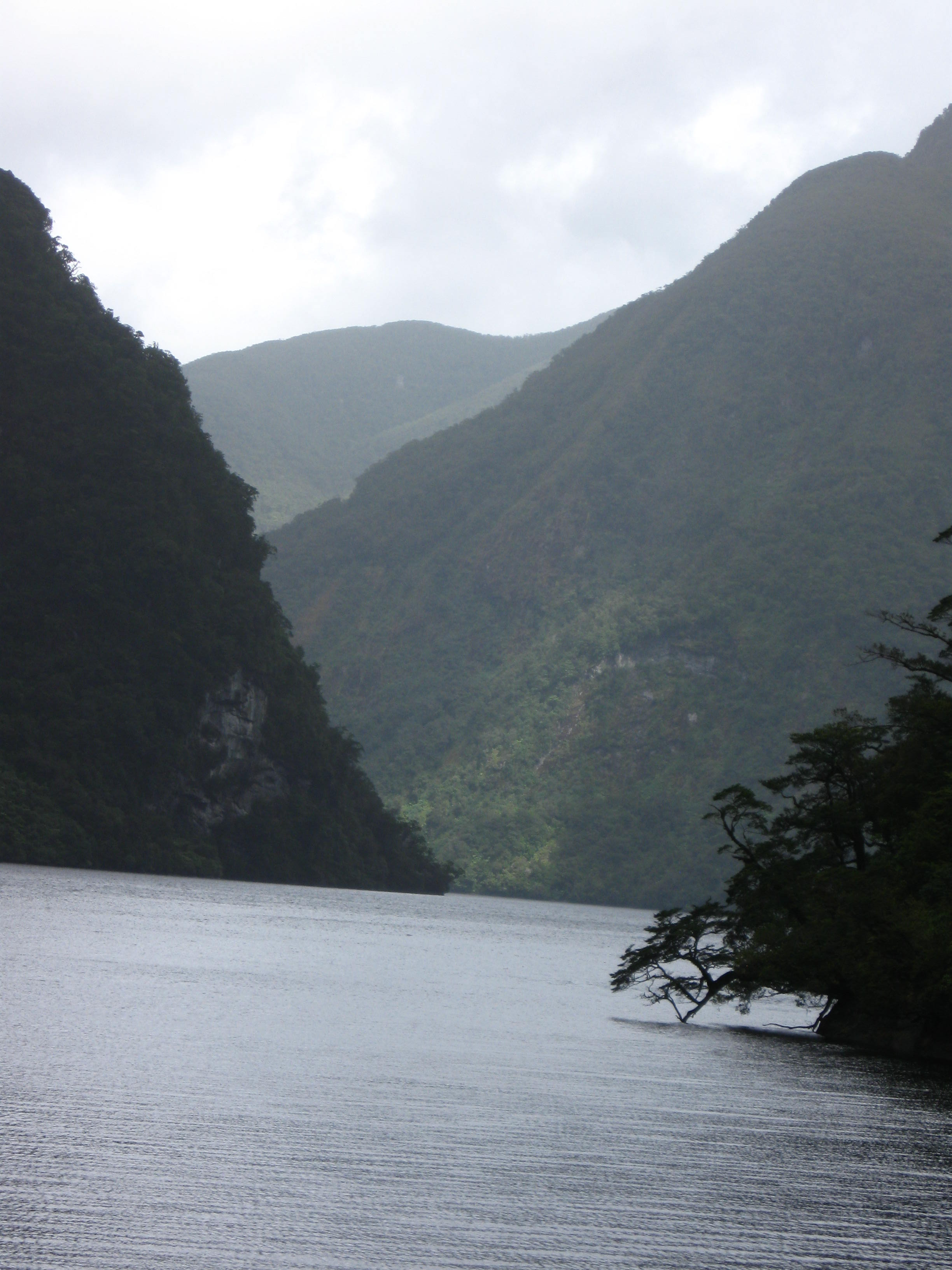
Now what to do? Well, we are very close to Lake Taupo. So we choose to hike a ways along its shores.

Lake Taupo is another geologic wonder. This lake is a caldera formed by one of the largest eruptions on Earth in the past 25,000 years. I kept thinking about another caldera, Crater Lake in Oregon. And one of the largest eruptions in human history, Tambora Indonesia. And Lake Tahoe.

For comparison, let’s look at surface area. Lake Taupo=238 square miles, Crater Lake=21 square miles, Lake Tahoe=192 square miles. Depth: Taupo=616 ft, Crater Lake=1,949 ft, Lake Tahoe=1,645 ft. Volume: Lake Taupo=14 cubic miles, Crater Lake=4.5 cubic miles, Lake Tahoe=93 cubic miles. So although Lake Taupo has the largest surface area, Lake Tahoe dwarfs Lake Taupo in total volume. Lake Tahoe is big AND deep!

Everybody likes volcano eruption comparisons. You probably have heard of Mt. Mazama, which blew up to make Crater Lake. Or, Tambora. Or, Krakatoa. But you might never have heard of Taupo. Let’s see: Tambora ejected 38 cubic miles of matter, and is the largest eruption in recorded history. Krakatoa, the loudest in recorded history, ejected 13 cubic miles. Mt. Mazama, 93. But Taupo’s Oruani eruption ejected 330 cubic miles of matter!  The Volcanic Explosivity Index is a 1 – 8 scale with 8 the highest. Krakatoa is 6, Tambora is 7 and Taupo is 8. Why have you not heard of it? Because it was before human history, 26,500 years ago. So, this entire region of New Zealand’s North Island seethes with the earth’s violence!

All along its shores are feather light rocks. Can you guess what type?

If you guessed pumice you are right. Pumice is ejected by volcanoes and is full of air pockets from the gas. Back at the Rainbow Motel, we soaked ourselves in the on site thermal baths. That made for a relaxing day, despite the weather. We’re crossing our fingers for a hike tomorrow.


Kayaking New Zealand’s Abel Tasman National Park

5 03 2013
IMG_0163

Which beach today?

Today we kayak Abel Tasman National Park! This park is arguably labeled New Zealand’s best kayaking destination. While I tend to disagree, it is undoubtedly a dream come true for sea kayakers. And we’ve been looking forward to this the whole trip!

Pre trip briefing for the paddlers

Pre trip briefing for the paddlers

We have been watching the weather closely, and right on schedule (for this vacation) another Antarctic storm is due sometime today. When we get to Marahau Sea Kayaks kayak outfitters in Marahau, the staff is fretting because the storm is due about mid day, when all their novice kayak renters are going to be out in the park. They are two steps away from cancelling everyone. But they decide to let people go out, hoping the storm is late.

Because I am a kayak instructor/guide, they let me rent a single kayak and let us go out by ourselves. I go over the safety issues and equipment with Elwin and Angelique. Plus explanation of the parts of the kayak, adjusting the seats and footrests. Then on to a tutorial on paddles and how to hold the paddle.

While we are getting ready, the local instructors are prepping groups to go out. They are going through the same procedures as we. It’s interesting to see how they do things in another country. Actually it’s incredibly similar to home!

We trailer the boats to the put in.

We trailer the boats to the put in.

Once we launch, I give Elwin and Angelique, who are paddling a tandem kayak, a quick course on efficient paddling, how to go forward, stop, turn, and go backward. And of course the capsize drill.

Then it’s time to head off! Because of the potential storm, I plan to head north up the coast, and check out the two offshore islands first before the storm closes in. They are Adele Island and Fisherman Island.

Let me just say it. It’s NYCE! Niiiiiice! Really nice. Those sapphire blue waters, limestone formations, warm air and rhythmic ocean swells, plus the salt air are just wonderful. Yesterday I spied a perfect lunch spot on a beach on Adele Island, which had several kayaks on it. We’re heading there.

IMG_0201

Heading across to the beach for lunch

But when we get there, the beach is missing. That’s because the tide has covered what I saw hiking yesterday.

So instead of lunching here, we head across to the mainland to another, very small, golden sandy beach for lunch.

IMG_0202

Angelique unpacks lunch!

It’s about noon, and the storm hasn’t arrived yet. We lunch and relax and soak it all in.

We really enjoy the beach. Still, I have to note that there are some motorboats in the area, a few jet skis, and some larger boats carrying up to 40 tourists which ply these waters. So it’s not the untouched, ultimately quiet spot I wish it were. It’s a magnet because of its beauty. The other thing is we are here in New Zealand’s high holiday season. So, Kiwis are on vacation all over the country. The schools are closed and people take off for a good part of January every year! So like us, they are on holiday, too.

IMG_0210IMG_0206

We head back to Marahau because I spot wind waves in the distance, an indication the storm may be on its way.

About 45 minutes into our return, it doesn’t look quite so bad, so we decide to head back out to the islands for a closer look. Then we’ll turn back toward Marahau.

We kayak right to the point at Fisherman’s Island and then head straight for Marahau. This takes us across the bay. One choice would be to head along the shore. But that would take longer.

Thirty minutes into our journey a squall approaches over the mountains behind Marahau.

Paddling across with the storm coming over the mountains

Paddling across with the storm coming over the mountains, easy before the squall hits.

I can see it’s raining in the mountains, and expect it to make its way to us. But right now it’s fine where we are. We paddle on. Twenty minutes later, I can see gusts visible as black spots on the water heading our way. As they, and wind waves hit us, I have us head directly into the wind, because Elwin and Angelique don’t have experience with sideways waves. Angelique really likes paddling aggressively! At that point, this direction would take us ultimately to a point protected from the wind, and we could snake along the shore protected from the wind – which was coming from the mountains behind.

Mother Nature was kind to us today. Just as it came, the squall dissipated and moved on. We didn’t even get a drop of rain. With that, we redirected back across the bay to Marahau. Everyone today managed to get in a good day of paddling today, but gray storm clouds were making their way across the mountains.

All I can say is we go our paddling day at Abel Tasman National Park! We had fun and Mother Nature held off for us this time!


Hiking Zew Zealand’s Abel Tasman Coast Track

28 02 2013

IMG_3449Abel Tasman National Park, at the northwest tip of New Zealand’s South Island, is a warm weather lover’s paradise! It belongs on your Kiwi bucket list. Endowed with lush peninsulas and private bays with golden beaches and turquoise seas, it irresistibly attracts outdoorsy types. The Abel Tasman Coast Track, one of New Zealand’s Great Walks, allows hikers to experience the park’s wonder, passing along beaches, through Jurassic Park-like forest, before climbing to jaw-dropping views. It is also renowned for sea kayaking and kayak camping. Abel Tasman National Park is a sure bet to deliver soul-cleansing pleasure. Open your ears, breathe deeply and let your eyes feast on the views. Then grab a paddle and immerse yourself kayaking in the sea!

There are many ways to enjoy the park. Backpacking (or “tramping” in Kiwi) its 54 km coastal track, hiking, swimming, kayaking and kayak camping are but a few. We chose to spend two days there, and experience the park by foot one day and by kayak the next.IMG_0166

One of Abel Tasman National Park’s to-die-for experiences is sea kayaking. So we called ahead to Marahau Sea Kayaks to reserve kayaks for the second day. This outfitter in Marahau was amenable to my request for a single kayak – most rentals in New Zealand are tandems. I’d lead Elwin and Angelique, who’d be in a tandem. I’m a kayak instructor – so I’d give them some first-timer lessons!

IMG_3447

3 Kayaks down there! Click and zoom to see them…

But today’s adventure called for hiking. There are many choices. We wanted to do a thorough hike on the coastal track. There are no roundabout trails – it’s only out and back. However, you can take a water taxi to a trailhead and hike back to your vehicle – so we picked that idea. We set off from the Nikau Apartments in Nelson, and arrived in Marahau at 8:00 a.m. It would be an all-day adventure!

And what a day it was! We met our water taxi at Marahau, and it would drop us off on the beach at Bark Bay. From there, it’d be a five to six- hour hike back to Marahau.

Bark Bay is a pretty golden sand beach with a tent campground set behind the trees. Behind lay a peaceful lagoon. Here our day long hike begins!

IMG_0169

Here the coastal track follows the bays tucked in the many peninsulas along the headlands. At first, I’m hiking close to the water’s edge but in the forest. It is about 80 degrees. There are no mosquitoes nor biting flies. Just cicadas buzzing. I hear Bell Birds and the occasional Fan Tail alights nearby to check me out. It is dry-very little wind. This perfection is totally intoxicating and I become lost in the moment…the low level forest is full of giant black tree ferns…maybe I am in Jurassic Park!

This is truly incredible since it’s early January – my winter but summer in the southern hemisphere!

If you are an avid American hiker or backpacker – or kayak camper living in the American West, you might expect a solitary/private experience in Abel Tasman. If that is what you want, you’ll be disappointed. This track is very popular. So much so that you won’t be able to just set up a tent in the woods. Rather, due to volumes of visitors, there are huts, or designated tent campgrounds. You’ll also meet sailboat cruisers and some powerboaters who’ve anchored offshore. At least you’ll meet fellow outdoor lovers from all over Planet Earth. The two girls from Finland I met came the furthest.

I stop to take some pictures, and lose track of Elwin and Angelique. After 45 minutes trying to catch them in vain, I just set my own pace, enjoying every step of the way. There are a good number of backpackers – I hear French and German spoken.

I walk across a couple of suspension bridges, on either side ferns, with a clear pool underneath. Then I begin to climb away from the shore, up to the bluffs above. There, the forest becomes less jungle-like and more dry.

In many places it opens for periods of walking with views of islands, kayakers, and across the Cook Strait toward the North Island.

IMG_0173There are so many cool bays and inlets. There are lots of possibilities for tomorrow’s kayaking!

All along the Abel Tasman Coast Track there are opportunities to take side trails to secluded beaches, peninsula lookouts and lagoons.

IMG_0186

A sweet picnic beach

I keep track of the time and my progress. At Anchorage one of the stops, I begin to realize if I spend too much time on a side adventure it’d be after 5:00 when I return! So, with that in mind, I limit myself. But there are so many opportunities to pause, and drink in the view. I take one of these and sit down, watch the kayakers below, and eat my lunch.

Somewhere along the way I entertain myself by turbocharging my pace. I hear hikers coming from behind, some kids amongst them, and I imagine they’re Lord of the Rings Orcs hunting for me. No matter how hard I go they keep dogging me! But at some point I pass another side trail leading to a beach and after that I don’t hear from them anymore. From a high bluff I look out and realize it is freaking January! How can this be?

Finally, I descend to the end stretch, a flat section eventually terminating at Marahau. I hear “Rod!” from behind. It’s Elwin, with Angelique behind. Somehow I managed to lead them this whole time. Or, maybe they took a long side adventure. Either way we will wind up at the end together. My feet and Angelique’s legs are both hurting! I’m glad it’s not any further.

IMG_0191

Back in Marahau I check in at Marahau Sea Kayaks and they have dozens of boats ready for departure. A group shall be going out! But they’ve allowed us to go out privately since I’m a BCU certified coach. Looking forward to sea kayaking tomorrow!

We head back to Nelson, to catch the movie The Hobbit…


Stuck in Wanaka, New Zealand: Mother Nature’s Wrath Alters Our Plan

22 02 2013

Weighing on our minds the past few days was a series of Antarctic storms. These had smashed the western coast of the New Zealand’s South Island every few days since I arrived. And now our plans called for driving up that coast. It is beautiful and has the world renowned low elevation Fox Glacier and Franz Josef Glaciers. But to get there, we’d have to cross the mountains. What would Mother Nature have in store for us?

Today we drive from Te Anau to Wanaka. Plans called for playing in Wanaka and then making an epic crossing of the Southern Alps via the Haast Pass to the coast. There are only two roads across the Southern Alps between here and Christchurch. The other is Arthur’s Pass. A recent storm had already closed the coastal highway but it had been repaired due to heroic efforts from New Zealand highway crews.

Now another storm approached, and upon our arrival in Wanaka, it unleashed its fury. It was pouring and due to continue for 12 hours. Our hostess at the Matterhorn South tried her best to find things for us to do, but other than movie theaters, there really wasn’t a lot to do other than walking the shopping area. The typically fantastic view of Lake Wanaka was completely obscured. Our room at the Matterhorn South needed some serious cleaning and updated bedding. At least the hostel was in downtown and had an upstairs with a library, fireplace and wide screen TV.  We spoke at length with a woman from Perth, Australia who was to climb Mount Aspiring. And a gentleman from Christchurch who had vivid descriptions of the earthquakes.

All we could do was make dinner in the kitchen and wait. Next morning, I checked via my iPhone and learned that the Haast Pass route was closed. In New Zealand, rain causes rivers and lakes to rise rapidly. Part of the road was built right next to Lake Wanaka – and the lake flooded out the road and was still rising. Worse, the other route across, further north, Arthur’s Pass, was also closed! Forecast was that maybe the lake would recede…but later in the day. Could we wait? No, because we had reservations in Abel Tasman National Park, on the northern tip of the island, in just 48 hours.

Disappointed, frustrated and in denial that something we’d looked forward to witnessing for months was slipping away, we pulled ourselves together and researched alternatives. I’d already experienced how the eastern side of the island can have much drier, warmer weather so I looked at the IMG_0137map and suggested we aim for Kaikoura. It’s a couple hours north of Christchurch, it’s on the beach, and has a peninsula worth hiking.

With that we headed to Kaikoura, and just like magic, on the eastern coast it was summer again! This lifted our spirits so much. We found a hostel and a room steps from the beach.

So, it was time for some late afternoon beach combing and then supper!


Lake Te Anau and the Kepler Track

19 02 2013

IMG_3423 The next day broke sunny with a little chill in the air. We wanted to get out into it, hike, breathe, check out the sights. Get our bodies moving. Our hotel manager suggested the Kepler Track because it is so close to town.

We were only planning on a three hour hike. That seemed to fit the bill. The Kepler Track is one of the many Great Walks of New Zealand. Most famous of these is the Milford Track. Also in the area is the Routeburn Track.

New Zealand’s “Great Walks” is a developed hiking and camping trail system designed so that the thousands of “trampers,” as they call them, can hike and spend the night on the trail with minimal impact on the environment. This means that many trails are much more maintained and developed that we might be accustomed to in America. And most times hikers or kayakers are required to either camp in designated campgrounds, or spend the night in a “trail hut.” These huts are reservation-based, and contain kitchen facilities. This means your “wildIMG_3425erness experience” will likely include nights shared with gregarious trampers from the world over. It’s just part of the Kiwi experience. The Great Walks, and lesser tracks, are found all over New Zealand and explore everything from glaciated mountains, lush semi tropical forests to warm coastal bays and inlets.

Want to see what this is all about: Get ready and watch this video!

See the Kepler Track in action!


IMG_0131The Kepler Track begins on Lake Te Anau, following a forested path near the water. Birds like the Tui or Bellbird call all during the hike cicadas also hum.

To hear the bell bird, listen to this video:

Another call is the Tui, in this video:

IMG_0133

All along the trail there are southern beeches, and the unique black tree ferns. These tree ferns grow upwards of 25 feet and can also be found in Tasmania. They’re really cool!

When you go for a multi-day hike on New Zealand’s Great Walks system you are engaging in what Kiwis call tramping. Tramping in New Zealand is not the sort of slutty activity we might think of in The States. Rather, tramping is something of a combination of “trekking” and “camping.” You can stay in either designated campsites or huts. Huts have bunks, mattresses, heating, toilets, and cold running water. Even the campsites have toilets, sinks and a water supply. These are not first come-first-served-you need to book a space in advance! Fancy, glossy brochures on these famous hikes are available for free at information centers throughout New Zealand.

We did not make it above the forest on the Kepler Track. That will be another trip! Still a lovely day we had. Next we head for action packed Wanaka and the west coast of the South Island.


New Zealand’s Fiordland National Park and Doubtful Sound

18 02 2013

We spend the better part of a day driving the South Island between Twizel and Te Anau, which is the gateway to Fiordland National Park and Doubtful Sound, and Milford Sound. We will be visiting three of the South Island’s largest lakes, Lake Wakatipu (New Zealand’s longest at 50 miles), Lake Te Anau (New Zealand’s largest lake by volume), and Lake Manapouri. We’re bypassing outdoor tourism hotspot Queenstown.

IMG_0122

Lake Wakapitu

For a good portion of today’s journey we pass along Lake Wakatipu – which twists with the mountains. The area near Queenstown has lots of sailboats plying the waters nearby, and the mountains rise up straight out of the lake.

In mid afternoon we arrive in Te Anau and check in at the Red Tussock Motel. We’ve got an apartment – two bedrooms, kitchen, bath, and living room. It’s quite nice. Once more Angelique gets the queen and Elwin and I get the two twin beds in the other bedroom. On arrival it’s about 80 degrees with fair weather clouds. The Red Tussock Motel is 10 minutes walk from the shore of Lake Te Anau and the downtown area. It’s a very walkable town – and seems pretty much tourism dependent from what we can see. Paul Lepper and other Kiwis we’d met insisted that the best fiord to visit isn’t the famous Milford Sound, but rather the 10 times larger and less busy Doubtful Sound. To see Doubtful Sound, though, one cannot go alone. This is because one must cross Lake Manapouri, then take a lengthy road down to the sound. You can’t just walk or drive to it, like Milford Sound. We were set on seeing Doubtful Sound and booked a trip for the following day. There are two ways to see doubtful sound. You can book a trip with Real Journeys or you can book a sea kayak trip.

These are two entirely different ways of experiencing Doubtful Sound. We were 100% set on kayaking in New Zealand. Either way to see the Sound is expensive, $200-$300 a day. But we could kayak up north, either in Abel Tasman National Park, or/and in the Bay of Islands, where it is W-A-R-M and down here it’s guaranteed to be chilly and rainy part of the time. The Real Journeys trip isn’t private and of course noisier with a motorized craft. The choice was to be moot, because all the kayak tours were booked up. So Real Journeys it was to be. It was an ultra modern multi deck motor catamaran, and as such it could get around and cover most of Doubtful Sound in a few hours. Kayaking would be quiet – but you’d only explore one of the Sound’s fiords in a day.

So, Doubtful Sound Day Dawns. It’s going to be an all-day affair! The weather is sun/rain/cloud/sun all day, and that is exactly what we’ve been told it’s like in the fiords most of the year. It rains 236 inches a year in the fiords!

IMG_0127Since we stayed primarily in kitchen-equipped apartments, a typical day began with coffee or tea and then either muesli and fruit topped with yogurt, or sometimes eggs and toast. And we often made sack lunches which we ate during the day.

We take a boat across Lake Manapouri. Looking across this giant lake from the top deck, I’m reminded of my trip on Argentina’s Lago Nahuel Huapi in Argentina. It is rimmed with gorgeous peaks, many draped in fresh snow.

Once ashore we board a coach which climbs its way through the lush forest to a 700-ft high pass before steeply descending to Doubtful Sound’s Deep Cove, our embarkation point. The forest is super lush with waterfalls urgently relieving the mountainsides of their liquid burden.

View down to Deep Cove

Taking a trip with Real Journeys, I’m reminded of traveling with an airline. It’s a family-run company founded decades ago taking tourists to Doubtful Sound. In those days, guests walked 11 grueling hours all the way from Lake Manapouri to Deep Cove. Today, we ride a coach. The company has grown, and seems to have a near-monopoly on tourism in Fiordland. Uniformed staff sell you tickets at their terminals, and the boats are absolutely 21st century craft. It’s a far cry from some of the 3rd world adventure of on-your-own arranging to see an area. Still, as New Zealand is a magnet for throngs of visitors, I can understand – there is a need to manage the crowds! For example, the famous Milford Track sees 14,000 visitors a year! The Milford Sound itself sees 400,000!

IMG_3412

Fiordland National Park’s seven fiords are all drowned glacial valleys. In past ice ages, ice thousands of feet thick moved off the mountains, carving these fiords to the west, and the steeply sloped arms of the lakes to the east. The underlying rock sits not far below the roots of the forests – the soil is not nutrient rich, nor thick. The plants, such as the famous 20-foot high black tree fern, have adapted to make use of the huge amount of rainfall.

IMG_0129Captain Cook, the British Global Explorer, named the place Doubtful Harbor because he did not think it would be possible to sail inside. Later Whalers gave it the present name.

It has a fascinatingly eery feeling with all the mists billowing off the impossibly steep valley walls.IMG_3414

Part of the Real Journeys itinerary was to visit the Manapouri Hydroelectric Power Station. It is frequently cited as New Zealand’s greatest engineering achievement. It is a completely underground power station – they dug giant tunnels connecting Lake Manapouri to Doubtful Sound. Water runs through turning turbines. It is the largest hydroelectric plan in the country.

Ironically, the reason it was built may cease to exist. The project was commenced to provide electricity to an aluminum smelter – but that smelter may be closed due to cheaper aluminum from China. We were told the power station can supply enough power for the entire South Island, if necessary. The other irony is that while the production of electricity from Manapouri does not produce greenhouse gases, the Tiwai Point aluminum smelter at the other end is one of the worst polluters in New Zealand.